Parachute Police Department, Grand Valley Fire Protection District, Colorado Department of Transportation
8.1.26, 7:45 p.m. – Highway 6 and the boat ramp are back open.
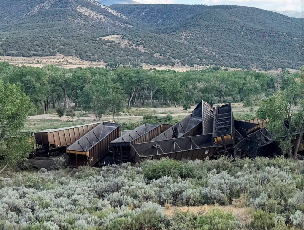
8.1.26, 6:15 p.m. – A train has derailed in the area of the mile marker 72 south of I-70. Highway 6 is not currently closed west of the 72, but County Road 300 by Una Bridge may be closed for incident management at times.
Out of caution, the boat ramp is currently closed to keep floaters from going down river.
Emergency crews are on scene to address the incident. Initial reports are that the derailed cars were empty.
July 24, 2026, 12:47 p.m. – I-70 westbound between Exit 105 (New Castle) and exit 97 (Silt) is now open! Thank you, Colorado Department of Transportation, for your hard work!
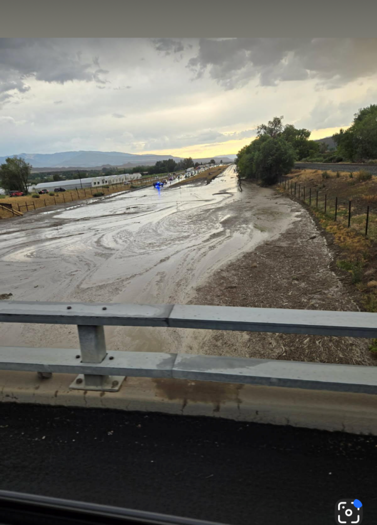
July 24, 2026 – I-70 Westbound at mile marker 100.5 (between New Castle and Silt) due to flooding/debris flow. Closed at New Castle Exit 105. No ETA of opening.
Garfield County Emergency Communications Authority
July 24, 2026, 6:44 a.m. – I-70 is closed between mile-markers 105 and 97 WB only, New Castle to Silt, due to flooding on the roadway. Detour on Hwy 6 in place. Eastbound remains open.
Garfield County Emergency Communications Authority
July 21, 2026, 3:19 p.m. – I-70 remains closed between mile-markers 97 and 105 both directions, Silt to New Castle, due to yesterday’s flooding. Westbound traffic is expected to be heavy this afternoon and evening with significant delays expected on the detour route. Please be patient and drive safely.
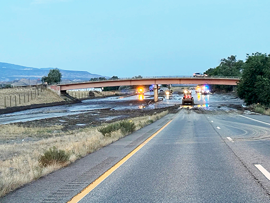
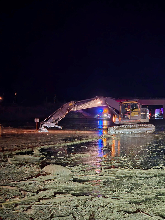
Colorado Department of Transportation maintenance personnel continue to work on Interstate 70 between New Castle, Mile Point 105, and Silt, MP 97, to remove tons of mud and debris covering the roadway. Detours are in place on U.S. 6.
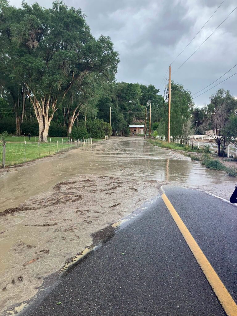
At approximately 7 p.m. on July 20, I-70 became impassable due to a debris flow. Torrential rain and hail flooded the area, pushing mud, logs, and rocks across the roadway and overwhelming local drainages.
“A very quick, very heavy rain and hail storm brought a lot of moisture and the dry ground was not able to absorb, which caused massive flooding and piles of debris to overwhelm the drainage system in this area,” said CDOT Regional Transportation Director Jason Smith. “Our maintenance crew reacted quickly and worked in conjunction with our State Patrol partners to get the roadway closed off and route vehicles onto detours.”
It’s estimated that the mud and debris has covered more than 300 yards of the highway and more than three feet deep in some areas.
“There is a lot of material for the crews to clear and water to drain,” said Smith. “We are working hard to get this cleared up to get this vital road back open as soon as possible.”
A debris flow is a fast-moving, gravity-driven slurry of water-saturated rock, soil, vegetation, and other organic materials that travels down slopes. Moving like a river of liquid mud and rock, these destructive landslides can exceed speeds of 35 mph and are frequently triggered by intense rainfall or rapid snowmelt, particularly in areas recently scarred by wildfires, but can also take place in extremely dry conditions.
Extended delays are expected. Commuters are encouraged to use the COtrip.org web or COtrip Planner App for roadway updates and detour information.
Garfield County Emergency Communications Authority
7.20.26, 11:24 pm – Highway 6 is open between mile markers 100-103 both directions, Silt and New Castle areas.
7.20.26, 9:03 pm – Highway 6 is closed between mile markers 100-103 both directions, between Silt and New Castle area, due to a land/mud slide. For the latest road conditions and a map of the detour, visit cotrip.org
Garfield County Sheriff’s Office
7.20.26, UPDATE as of 7:30 pm: I-70 now closed at exit 97 Silt, eastbound and exit 105, westbound New Castle.
ROAD CLOSURES / FLOODING ALERT
Flash flooding is impacting the Peach Valley area. County Road 214 (Peach Valley Road) is completely flooded at the intersection with County Road 262 (Mid Valley Lane). Both roads are closed due to swift moving water and multiple logs in the roadway.
On I-70 in the vicinity of mile markers 101–102, approximately one mile east of Coal Ridge High School between Silt and New Castle. There are some flood waters from Peach Valley moving onto the highway.
Please use caution in these areas, as it is backing up traffic in both the east and westbound lanes of I-70.
Between Exit 97: Silt (2 miles east of the Silt area) and Exit 105: New Castle (near New Castle) from Mile Point 101.5 to Mile Point 105. Road closed expect delays due to a mud slide.
Between Lyons Boulevard and Weare Lane (2 miles east of the Silt area) from Mile Point 100 to Mile Point 103. Road closed expect delays due to a mud slide.
I-70 eastbound both lanes open at mile marker 109 (Canyon Creek). One lane open westbound I-70 at Glenwood Springs. There is still a westbound closure at Dotsero.
Glenwood Springs Fire Department
UPDATE – 8:10 p.m. 6/9: I-70 eastbound is now open in both lanes.
I-70 westbound is opening in stages. Traffic at the Glenwood Springs exit, 116, is being released westbound through one open lane on I-70 in the first stage. Once that queue has been lessened, westbound traffic held at the Dotsero exit, 133, will be released.
Colorado Department of Transportation
I-70 both directions is CLOSED – 6:20 p.m. (6/8/2026)
I-70 remains closed in both directions from Chacra, Mile Point 109, to Dotsero, MP 133, due to an active fire. There is no estimated time for opening. Commuters are encouraged to use the norther detour route.
Westbound travelers:
> Take the Wolcott Exit, 159, north on CO 131, to US 40. Stay on US 40 past Craig, then take CO 13 southbound back to I-70 at Rifle.
Eastbound travelers:
> Take the Rifle Exit north on CO 13 to US 40. Take US 40 through Craig to CO 131. Take CO 131 south to Wolcott and back onto I-70.
For further updates, check COtrip.org or the COtrip Planner App.
Glenwood Springs Fire Department
UPDATE 7:30 pm – The aircraft has been released for the evening. Both eastbound lanes are expected to reopen shortly, along with one westbound lane.
UPDATE 6:42 pm – I-70 is expected to remain closed for an undetermined amount of time. We greatly appreciate everyone’s patience and understanding as crews continue their work.
With back-to-back Red Flag days and challenging wind conditions, we are especially grateful to have air support assisting with fire suppression efforts. The safety of our community and responders remains the top priority, and we will continue to provide updates as more information becomes available.
June 9, 2026, 4:40 p.m. – The fire size has been re-estimated at 8 – 10 acres in size.
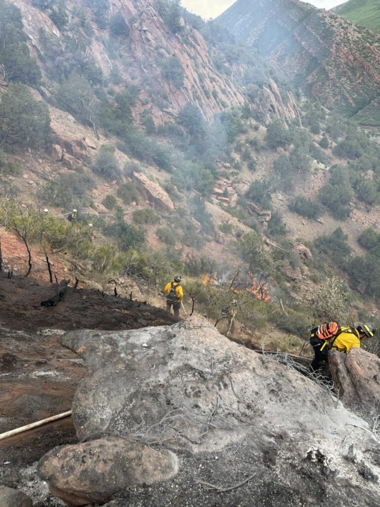
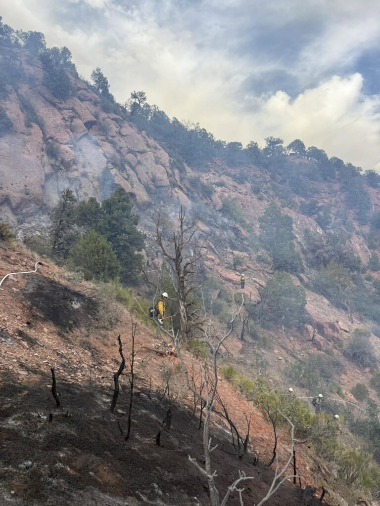
Approximately 44 firefighters are working to stop fire growth in steep and rocky terrain. Due to high winds in the area, fixed wing aircraft are unable to operate at this time.
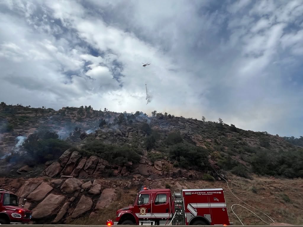
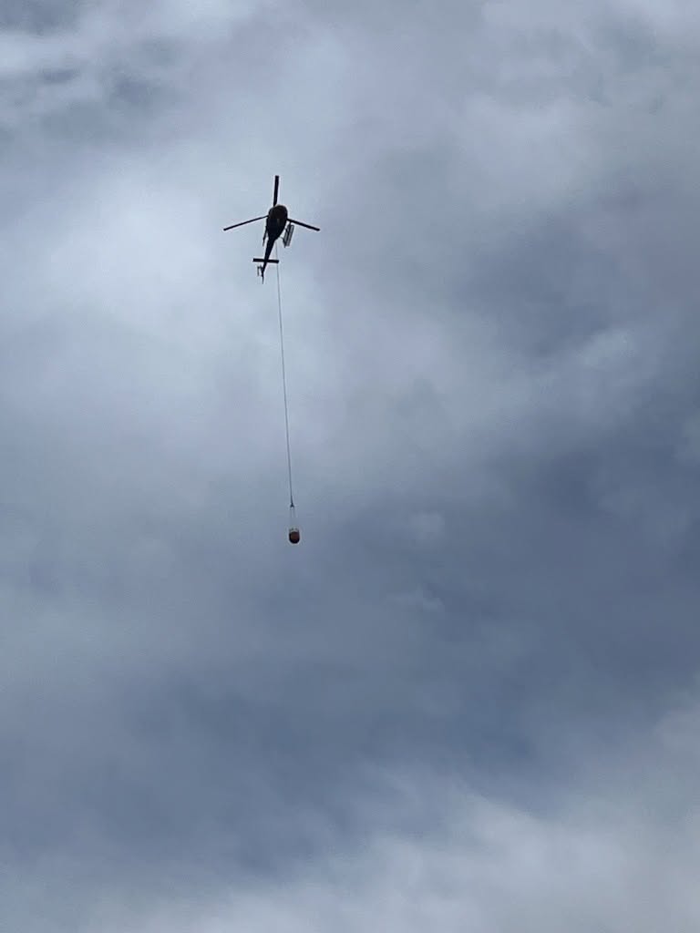
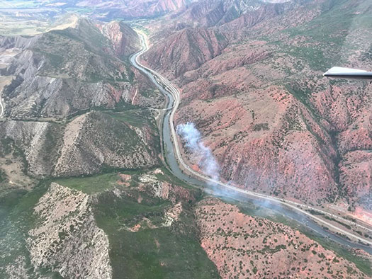
June 9, 2026, 4:07 p.m. – This fire has been named the Paradise Fire and is estimated at 20 acres. Two helicopters and two fixed-wing aircraft are en route to assist with suppression efforts. Aircraft will be refilling bucket drops from the Colorado River. I-70 will remain closed at this time. _____________________________
ACTUALIZACIÓN 4:40 p. m.
El tamaño del incendio ha sido reestimado entre 8 y 10 acres.
Aproximadamente 44 bomberos trabajan para detener el crecimiento del fuego en un terreno empinado y rocoso. Debido a los fuertes vientos en la zona, las aeronaves no pueden operar en este momento.
Las siguientes agencias están respondiendo a este incidente en un esfuerzo conjunto de ayuda mutua:
Upper Colorado River Interagency Fire Management Unit
Colorado Division of Fire Prevention and Control
Colorado River Fire Rescue
Garfield County Emergency Communications Authority
Garfield County Sheriff’s Office
Colorado Department of Transportation
Todas estas entidades colaboran en las labores de respuesta y control del incendio.
Este incendio ha sido nombrado Paradise Fire y se estima que abarca aproximadamente 20 acres.
Dos helicópteros y dos aeronaves están en camino para ayudar en las labores de supresión del incendio. Las aeronaves recargarán agua para las descargas con balde desde el río Colorado.
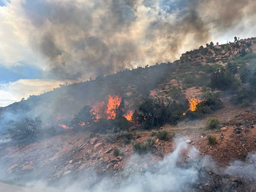
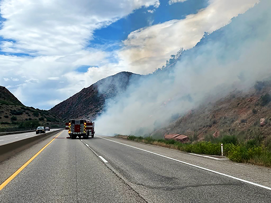
Estamos respondiendo a un incendio junto a la I-70 en dirección oeste, en el marcador de milla 112 en South Canyon. El Departamento de Bomberos y Rescate del Río Colorado está respondiendo en apoyo mutuo. La I-70 en dirección oeste está siendo cerrada en el marcador de milla 112.
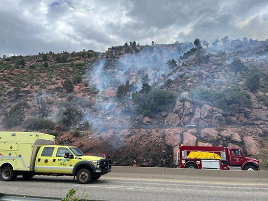
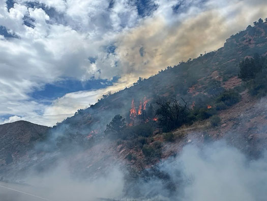
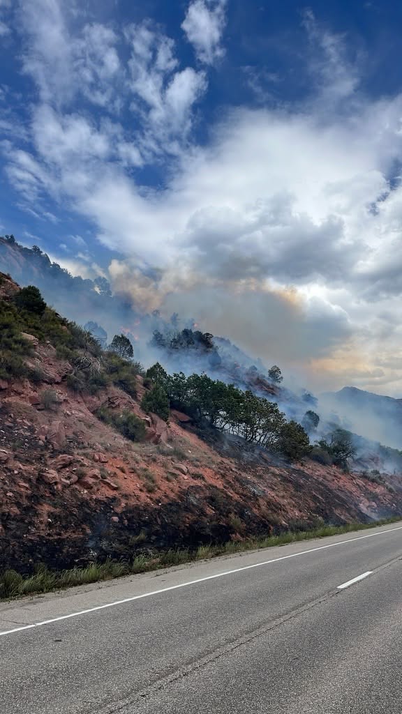
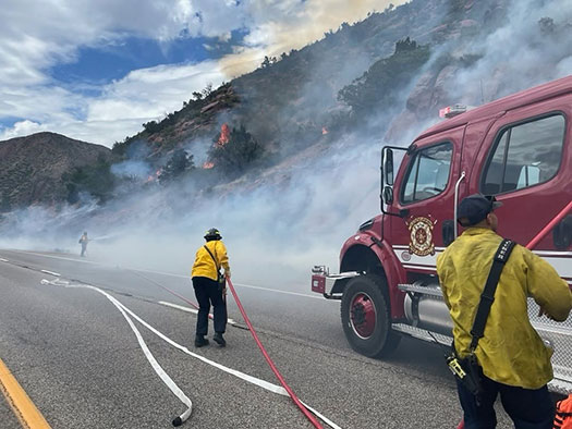
Photos courtesy of Glenwood Springs Fire Department
Garfield County Emergency Communications Authority
June 9, 2026, 3:15 p.m. – Both directions of I-70 are now closed at the 112 milepost.
Glenwood Springs Fire Department
June 9, 2026, 3:02 p.m. – Glenwood Springs Fire Department is responding to a brush fire on westbound I-70 at milepost 112 in South Canyon. Colorado River Fire Rescue is responding in mutual aid. I-70 westbound is being closed at milepost 112.
Garfield County Emergency Communications Authority
June 9, 2026, 3:06 p.m. – I-70 is closed at mile-marker 112 WB, South Canyon, due to a fire.
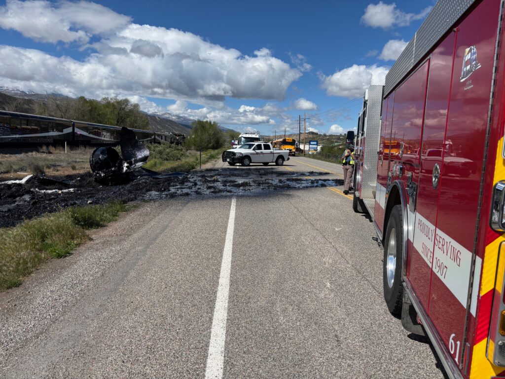
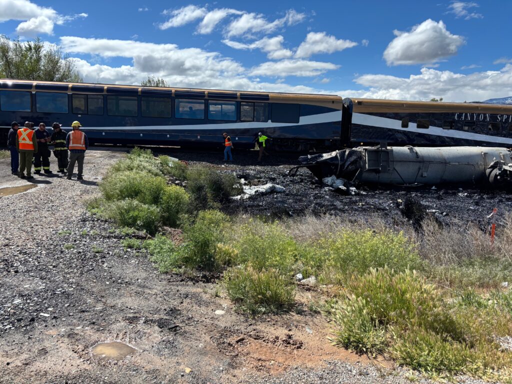
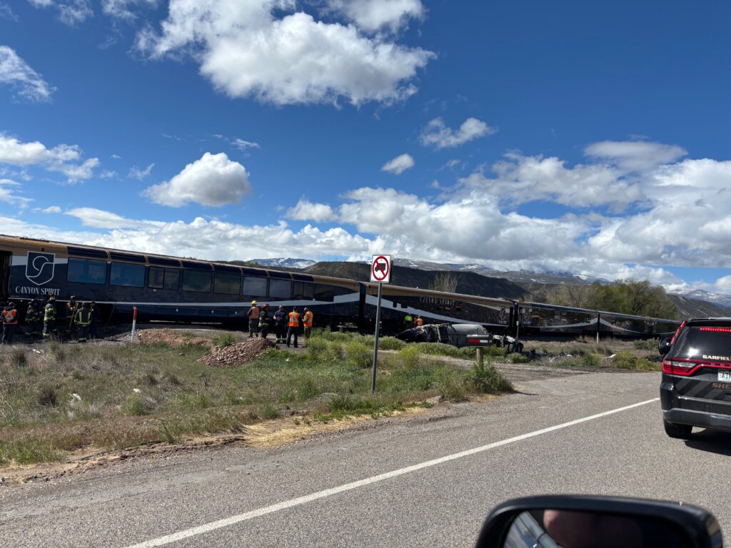
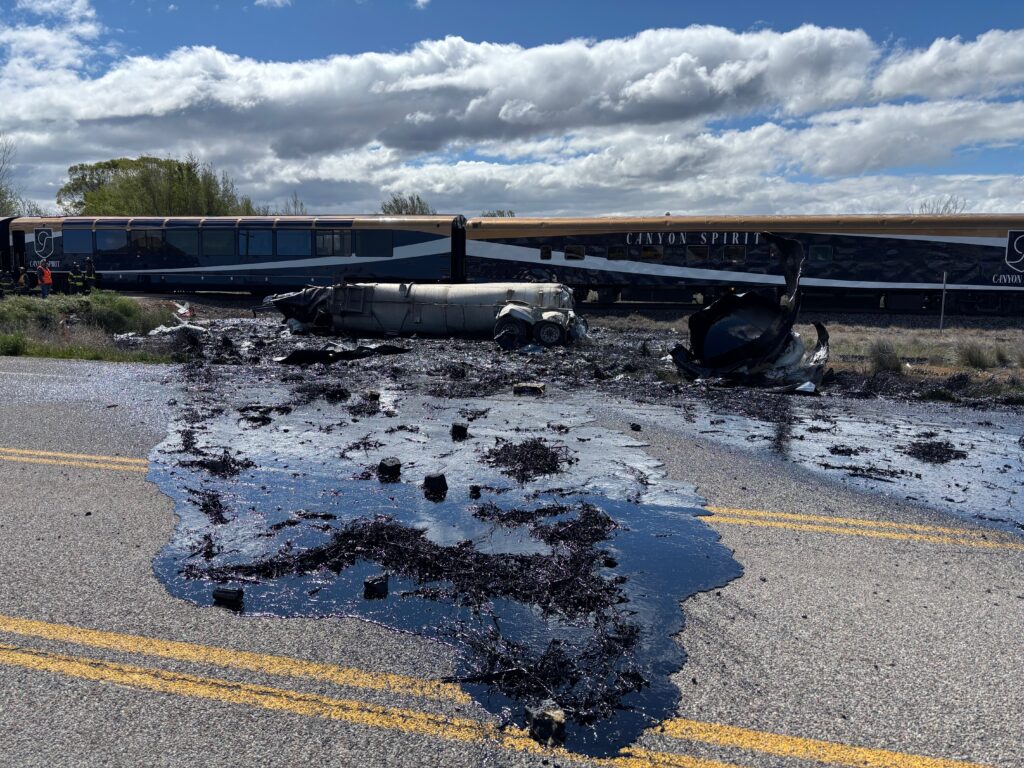
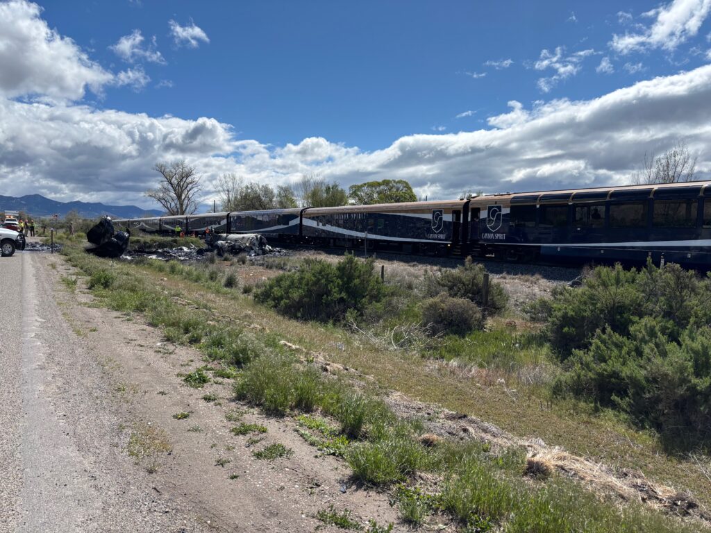
May 6, 2026, 12:12 p.m. – This morning, around 9:40 a.m., the Colorado State Patrol responded to the area of Highway 6 near Mile Pond Road (milepost 95) for a report of a passenger train that struck a semi-tanker truck on the train tracks.
The semi-tanker was split open due to the crash, spilling an estimated 6,000 gallons of road oil onto the ground. The driver of the semi-tanker was taken to an area hospital for minor injuries. Six passenger cars and two locomotives were derailed as a result of the crash, with the rail being damaged/split in areas. The rail line will be closed for an extended period of time for repairs. It is unknown at this time how many passengers were on the train; however, it is reported that no passengers suffered any injuries. Local buses will be transporting passengers to a safe location.
Highway 6 will be closed for an extended period of time. For road closure information, please visit COTrip.org for more information.
The Colorado State Patrol is the lead investigating agency for this incident. Any new information will be released in an update to this press release.