Hilltop Fire update

Upper Colorado River Type-3 Interagency Incident Management Team

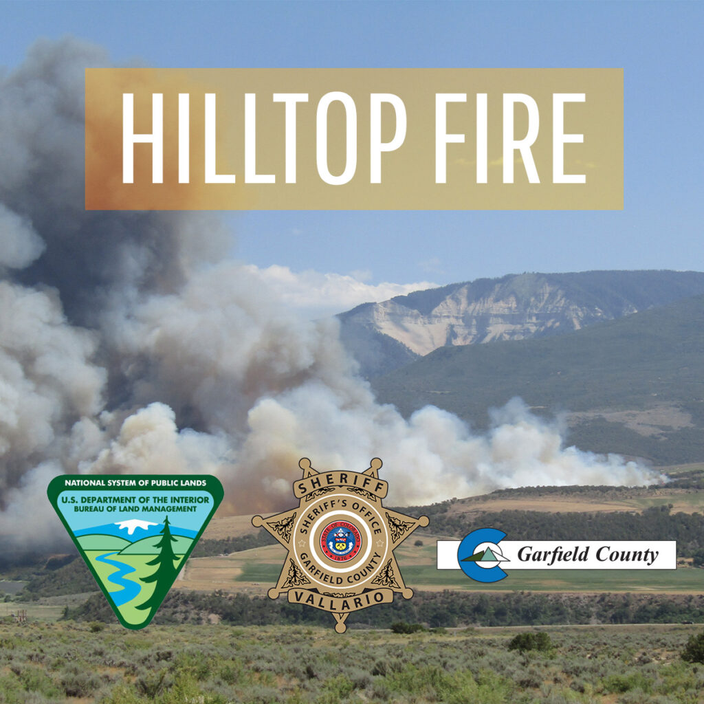
Hilltop fire photo with Bureau of Land Management, Garfield County Sheriff's Office and Garfield County logos

RULISON, CO – The Hilltop Fire has officially been declared contained as of 8 pm tonight. Tomorrow at 7 am, the incident will transition back to a Type 4 Incident Command structure. Remaining resources will continue to patrol, mop-up, and ensure that existing containment lines are secure. The Incident Commander estimates full control tomorrow, June 29th, at 8 pm.

According to Chris Bornholdt, Garfield County Emergency Operations Commander, “Evacuations were lifted last night, and residents were allowed to go back home. We appreciate everyone’s patience throughout this unfortunate event. We would like to thank the firefighters and support personnel from the countless agencies who’ve worked tirelessly to suppress this incident.â€

Please note that due to very high fire danger, Stage 1 fire restrictions are currently in effect in unincorporated Garfield County and on lands managed by the Bureau of Land Management and White River National Forest.

Hilltop Fire update

Interagency firefighters work diligently to stop spread of Hilltop Fire

Upper Colorado River Type-3 Interagency Incident Management Team

Bureau of Land Management, Garfield County Sheriff's Office and Garfield County logos

NEWS RELEASE
For Immediate Release
Media Contact:
Renelle Lott, Garfield County Communications Dept., 970.366.2275
June 27, 2025

RULISON, CO – Firefighters from multiple agencies continue fire suppression efforts to contain the Hilltop Fire located about 2 miles southeast of Rulison. More accurate mapping indicates the fire is currently at 326 acres and is 40% contained. Approximately 20-25 structures are at risk in the evacuation area.

A total of 153 personnel are currently on-scene. Resources include 13 engines, two type-2 initial attack crews, type-2 wildland fire module, type-2 suppression module, an interagency hot shot crew, smokejumpers, and support personnel.

Upper Colorado River Type-3 Interagency Incident Management Team assumed command this morning. Agencies providing support include Garfield County Sheriff’s Office, Grand Valley Fire Protection District, Colorado River Fire Rescue, Colorado Department of Fire Prevention and Control, Vail Fire Department, Colorado Springs Fire Department, Loveland Fire Department, and Adams County Fire Protection District.

Crews will continue working throughout the weekend to further containment efforts, suppress hot spots and perform mop-up operations. Safety is a priority for firefighters as they work around burned areas and debris, hot spots, and steep slopes.

Evacuations remain in effect for residents located within one mile of County Roads 320 and 309; pre-evacuation continues for residents more than one mile and within two miles of CR 320 and CR 309. Garfield County Sheriff’s Office is helping evacuees access their homes when safely possible.

Power companies are working to restore damaged poles and wires.

The fire investigator determined that this fire was human-caused and preventable. As a reminder, stage 1 fire restrictions are in effect in Garfield County and on lands managed by the Bureau of Land Management and the White River National Forest. The weather is expected to remain hot and dry, with high temps and no moisture throughout the weekend.

We appreciate the support from the community and our partners. In the interest of public and emergency responder safety, please avoid the area.

We will share more information as it becomes available.

For fire updates and multimedia, visit garfieldcounty.net.

UPDATE: Saturday morning, June 28, 2025, it was announced that evacuations are lifted and displaced residents have returned to their homes. Garfield County is assisting with re-entry and recovery.

Interagency firefighters work diligently to stop spread of Hilltop Fire

City of Glenwood: Evacuations of Altitude Apartment buildings rescinded – brush fire east of Palmer Ave between 23rd and 27th Street

Glenwood Springs Fire Department and Glenwood Springs Police Department

UPDATE 8:43 PM
Evacuations have been rescinded, and evacuees are being allowed back into their homes.
_____________________________________________________________________________________________________________

UPDATE 8:25 PM
We are grateful for the support from the helicopter, whose work helped to slow the growth of the fire! The helicopter has been released. We will continue to work into the night with crews from Roaring Fork Fire Rescue, and Carbondale & Rural Fire Protection District, to build handline around the fire.
_______________________________________________________________________________________________________________

UPDATE 7:40 PM
All Altitude Apartment buildings are actively being evacuated now.


UPDATE 7:37
Helicopter support is en route, approximately 8 minutes out.
Building C of the Altitude apartments is currently being evacuated.
__
We are responding to an active brush fire east of Palmer Avenue between 23rd and 27th Street. The fire is estimated to be approximately a quarter acre in size. Carbondale & Rural Fire Protection District is responding in mutual aid to support during this incident. Glenwood Springs Police Dept is also responding to this incident. Please avoid the area so first responders can work safely.


ACTUALIZACIÓN 7:40 PM
Todos los edificios de los apartamentos Altitude están siendo evacuados en este momento.


ACTUALIZACIÓN 7:37 PM
Apoyo aéreo en helicóptero está en camino, a aproximadamente 8 minutos de distancia.
El Edificio C de los apartamentos Altitude está siendo evacuado actualmente.


Estamos respondiendo a un incendio activo de maleza al este de la Avenida Palmer, entre las calles 23 y 27.
Se estima que el incendio abarca aproximadamente un cuarto de acre.
El Distrito de Protección Contra Incendios de Carbondale y Rural está prestando ayuda mutua en respuesta a este incidente.

El Departamento de Policía de Glenwood Springs también está respondiendo.
Por favor, evite el área para que los socorristas puedan trabajar de manera segura.

City of Glenwood Springs

6.26.25, 7:29 p.m. – Glenwood Spring Fire is responding to an active brush fire east of Palmer Avenue between 23rd and 27th Street. The fire is estimated to be approximately a quarter acre in size. Carbondale & Rural Fire Protection District is responding in mutual aid to support during this incident.  Glenwood Springs Police Department is also responding to this incident.  Please avoid the area so first responders can work safely. Updates will be shared via Glenwood Springs Fire Department Facebook Page: facebook.com/GlenwoodSpringsFireDepartment.

Estamos respondiendo a un incendio en matorral activo al este de Palmer Avenue, entre la 23.ª y la 27.ª calle de Glenwood Springs , con un tamaño estimado de aproximadamente ¼ de acre. 

El Carbondale & Rural Fire Protection District está brindando apoyo mutuo en este incidente, y también está respondiendo el Departamento de Policía de Glenwood Springs, para asegurar una respuesta eficiente.

Por favor, eviten la zona para permitir que los primeros respondedores trabajen con seguridad.

City of Glenwood: Evacuations of Altitude Apartment buildings rescinded – brush fire east of Palmer Ave between 23rd and 27th Street

Garfield County Sheriff’s Office: Evacuation lifted and I-70 open in Rulison area between Parachute and Rifle

Garfield County Emergency Communications Authority

6.20.25, 10:20 p.m. – Road open – I-70 is open between mile markers 75 to 87 both directions, between Parachute and west Rifle.

6.20.25, 8:08 p.m. – Evacuation lifted – Rulison area evacuation has been lifted.

6.20.25, 8:03 p.m. – Road open – Highway 6 is open between mile markers 75-87 both directions, from Parachute to west Rifle. I-70 remains closed at this time.

Autoridad de Comunicaciones de Emergencia del Condado de Garfield

6.20.25, 10:20 pm – Camino abierto – La I-70 está abierta entre los marcadores de millas 75 a 87 en ambas direcciones, entre Parachute y el oeste de Rifle.

6.20.25, 8:08 pm – Se levanta la evacuación – Se ha levantado la evacuación del área de Rulison.

6.20.25, 8:03 p. m. â€“ Carretera abierta. La autopista 6 está abierta entre los marcadores de millas 75 y 87 en ambas direcciones, desde Parachute hasta el oeste de Rifle. La I-70 permanece cerrada en este momento.

Garfield County Sheriff’s Office

Evacuation has been ordered for Rulison area

6.20.25, 6:23 p.m. – Evacuations ordered for Rulison area: one mile east of the 81 and one mile west of the 81 evacuate to the Garfield County Fairgrounds.

Garfield County Emergency Communications Authority

6.20.25, 6:05 p.m. – EVACUATE IMMEDIATELY IN AREA OF FIRE: Rulison Area: Due to the fire, evacuate the area immediately. All people and small animals (as well as large animals) should go to the Garfield County Fairgrounds.

I-70 is closed between mile markers 75 and 87 westbound, from Parachute to West Rifle, due to a fire.

Oficina del Sheriff del Condado de Garfield

Se ha ordenado la evacuación del área de Rulison.

6.20.25, 6:23 pm – Se ordenaron evacuaciones para el área de Rulison: una milla al este de la 81 y una milla al oeste de la 81, evacuen al recinto ferial del condado de Garfield.

Garco911/CDOT: I-70 en dirección oeste cerrada entre Parachute y el oeste de Rifle

EVACUAR INMEDIATAMENTE – Ãrea de Rulison: Debido al incendio, evacue el área inmediatamente. Todas las personas y animales pequeños (así como los animales grandes) deben dirigirse al recinto ferial de Rifle.

La I-70 está cerrada entre los marcadores de millas 75 y 87 en dirección oeste, desde Parachute hasta West Rifle, debido a un incendio.

Garfield County Sheriff’s Office: Evacuation lifted and I-70 open in Rulison area between Parachute and Rifle

Garco911/CDOT: I-70 westbound closed between Parachute and west Rifle

Colorado Department of Transportation

6.20.25, 5:47 p.m. – Between Exit 90: CO 13; Rifle (Rifle) and Exit 75: Parachute (Parachute) from mile point 87 to mile point 75. Road closed, expect delays due to safety concerns.

Comment: Large brush fire near interstate, both lanes closed for safety. US-6 is also closed.

Please plan for delays and use EXTREME CAUTION as conditions change rapidly.

Garfield County Emergency Communications Authority

6.20.25, 5:34 p.m. – I-70 is closed between mile markers 75 and 87 westbound, from Parachute to West Rifle, due to a fire.

Garco911/CDOT: I-70 westbound closed between Parachute and west Rifle

NWS: Gusty winds, low humidity and dry fuels trigger red flag warnings and fire weather watches

National Weather Service

Fire Weather Watch

URGENT – FIRE WEATHER MESSAGE
National Weather Service Grand Junction CO
244 PM MDT Thu Apr 24 2025

Lower Colorado River-Colorado River Headwaters-
244 PM MDT Thu Apr 24 2025

…RED FLAG WARNING REMAINS IN EFFECT FROM NOON TO 8 PM MDT FRIDAY FOR GUSTY WINDS, LOW RELATIVE HUMIDITY AND DRY FUELS FOR FIRE WEATHER ZONES 203 AND 205 BELOW 7000 FEET…FIRE WEATHER WATCH REMAINS IN EFFECT FROM SATURDAY AFTERNOON THROUGH SATURDAY EVENING FOR GUSTY WINDS, LOW RELATIVE HUMIDITY AND DRY FUELS FOR FIRE WEATHER ZONES 203 AND 205 BELOW 7000 FEET…
…FIRE WEATHER WATCH IN EFFECT FROM SUNDAY AFTERNOON THROUGH SUNDAY EVENING FOR GUSTY WINDS, LOW RELATIVE HUMIDITY AND DRY FUELS FOR FIRE WEATHER ZONES 203 AND 205 BELOW 7000 FEET…

The National Weather Service in Grand Junction has issued a Fire Weather Watch for gusty winds, low relative humidity and dry fuels, which is in effect from Sunday afternoon through Sunday evening. A Red Flag Warning remains in effect from noon to 8 PM Friday and a Fire Weather Watch remains in effect Saturday afternoon through Saturday evening.

* AFFECTED AREA…In Colorado, Fire Weather Zone 203 Lower Colorado River and Fire Weather Zone 205 Colorado River Headwaters below 7000 feet.

* TIMING…For the Red Flag Warning, from noon to 8 PM MDT Friday. For the first Fire Weather Watch, from Saturday afternoon through Saturday evening. For the second Fire Weather Watch, from Sunday afternoon through Sunday evening.

* WINDS…For Friday and Saturday, south 15 to 20 mph with gusts to 40 mph. For Sunday south 20 to 30 mph with gusts up to 45 mph.

* RELATIVE HUMIDITY…8 to 13 percent.

* IMPACTS…Fires will catch and spread quickly. Exercise extreme caution with any outdoor burning.

PRECAUTIONARY/PREPAREDNESS ACTIONS…

A Red Flag Warning means that critical fire weather conditions are either occurring now, or will shortly. A combination of strong winds, low relative humidity, and warm temperatures can contribute to extreme fire behavior.

A Fire Weather Watch means that critical fire weather conditions are forecast to occur. Listen for later forecasts and possible Red Flag Warnings.

Hazardous Weather Outlook

National Weather Service Grand Junction CO
248 AM MDT Thu Apr 24 2025

Lower Yampa River Basin-Central Yampa River Basin-
Roan and Tavaputs Plateaus-Elkhead and Park Mountains-
Upper Yampa River Basin-Grand Valley-Debeque to Silt Corridor-
Central Colorado River Basin-Grand and Battlement Mesas-
Gore and Elk Mountains/Central Mountain Valleys-
Central Gunnison and Uncompahgre River Basin-
West Elk and Sawatch Mountains-Flat Tops-Upper Gunnison River Valley-
Uncompahgre Plateau and Dallas Divide-Northwest San Juan Mountains-
Southwest San Juan Mountains-Paradox Valley/Lower Dolores River-
Four Corners/Upper Dolores River-Animas River Basin-
San Juan River Basin-Southeast Utah-Eastern Uinta Mountains-
Eastern Uinta Basin-Tavaputs Plateau-Arches/Grand Flat-
La Sal and Abajo Mountains-Canyonlands/Natural Bridges-
248 AM MDT Thu Apr 24 2025

This Hazardous Weather Outlook is for northwest Colorado, southwest Colorado, west central Colorado, east central Utah, northeast Utah and southeast Utah.

.DAY ONE…Today and tonight.

A weak disturbance will cause scattered showers and a few thunderstorms to fire this afternoon. Northeast Utah and Northwest Colorado will have the best chances to see this convection. Gusty outflow winds will be the main concern.

.DAYS TWO THROUGH SEVEN…Friday through Wednesday.

Gusty surface winds of 25 to 35 mph, if not higher at times, are expected each afternoon from Friday through the weekend. Low afternoon relative humidities and dry fuels will allow critical fire weather conditions to occur Friday afternoon. Red Flag Warnings have been issued for those fire zones where these conditions will be met.

Similar conditions are possible Saturday. Fire Weather Watches have been issued to account for this possibility.

SPOTTER INFORMATION STATEMENT…

Spotter activation is not expected today or tonight, however spotters are encouraged to report excessive wind or any observed wind related damage to the National Weather Service in Grand Junction.
NWS: Gusty winds, low humidity and dry fuels trigger red flag warnings and fire weather watches

Garco911 and CDOT: I-70 eastbound partially open at Glenwood Springs

Garfield County Emergency Communications Authority

10.11.24, 1:03 p.m. – I-70 is open at mile-marker 114 EB, West Glenwood Springs. Right lane at mile marker 116 EB, Glenwood Springs is still closed.

Colorado Department of Transportation

10.11.24, 6:09 a.m. – I-70 eastbound: Road closed. Between Exit 111: South Canyon and Exit 114: West Glenwood (Glenwood Springs) at Mile Point 114. Road closed expect delays due to a crash. Slower speeds are advised.

Garfield County Emergency Communications Authority

10.11.24, 4:40 a.m. – I-70 is closed at mile-marker 114 EB, West Glenwood Springs, due to an accident.

Garco911 and CDOT: I-70 eastbound partially open at Glenwood Springs