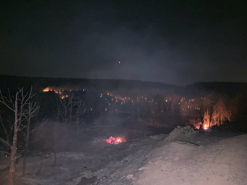
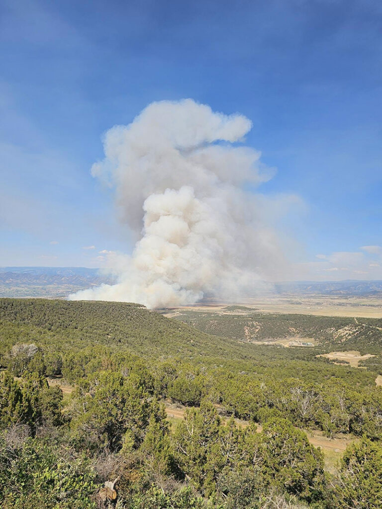
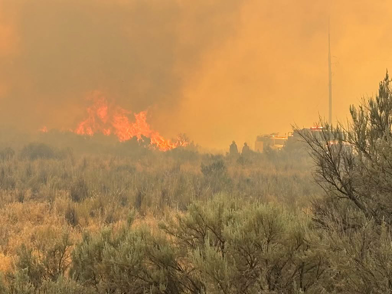
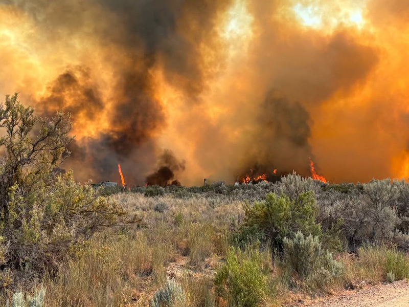
As of this morning, the Dry Creek Fire south of Rifle is estimated at 315 acres.
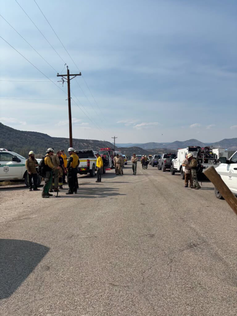
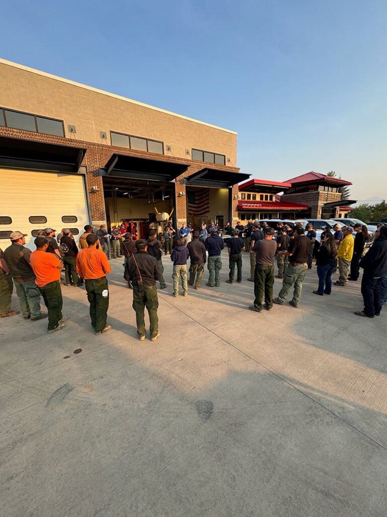
At 7:00 a.m. today, management of the fire transitioned to the Upper Colorado River Interagency Fire Management Unit Type 3 team. During this morning’s briefing, crews reviewed current fire conditions and operational objectives before heading into the field.
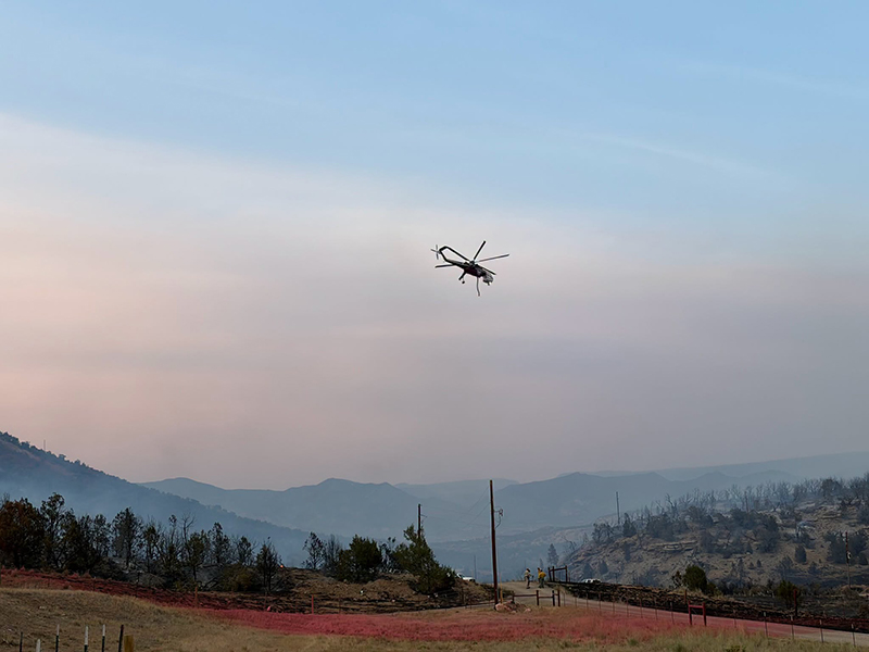
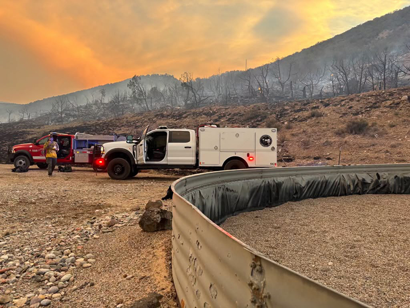
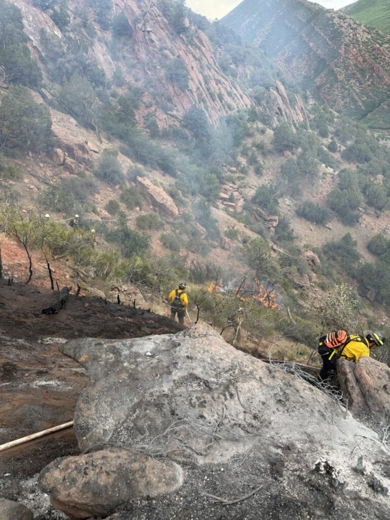
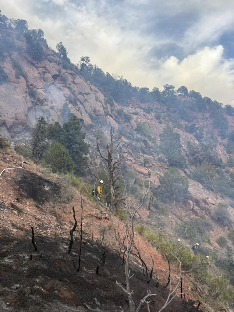
Firefighter and public safety remain the top priority. Crews are utilizing a full suppression strategy with direct and indirect tactics to slow the fire’s spread and construct containment lines around the fire.
Evacuation orders remain in effect for affected areas and are expected to remain in place throughout the day due to extreme fire behavior conditions and the forecasted winds are expected to test the fire line this afternoon. Residents are encouraged to stay informed by monitoring the latest evacuation information and updates at https://www.garfieldcounty.net/
Fire personnel are working closely with Xcel Energy to inspect power lines and infrastructure so that power can be safely restored when conditions allow.
June 23, 2026, 5:47 p.m. – Please follow garfieldcounty.net for evacuation updates.
All evacuees can go to the Garfield County Fairgrounds in Rifle.
For power outage information, please go to the Xcel Energy outage map.
Acreage has been updated to 287.8 acres.
Pre-evacuation notice
June 23, 2026, 4:26 p.m – Grass Mesa, south of Rodeo Drive and Coyote Trail: due to fire, please prepare for possible evacuation orders issued by Colorado River Fire Rescue. You will receive another message if evacuations are ordered.
I-70 eastbound both lanes open at mile marker 109 (Canyon Creek). One lane open westbound I-70 at Glenwood Springs. There is still a westbound closure at Dotsero.
Glenwood Springs Fire Department
UPDATE – 8:10 p.m. 6/9: I-70 eastbound is now open in both lanes.
I-70 westbound is opening in stages. Traffic at the Glenwood Springs exit, 116, is being released westbound through one open lane on I-70 in the first stage. Once that queue has been lessened, westbound traffic held at the Dotsero exit, 133, will be released.
Colorado Department of Transportation
I-70 both directions is CLOSED – 6:20 p.m. (6/8/2026)
I-70 remains closed in both directions from Chacra, Mile Point 109, to Dotsero, MP 133, due to an active fire. There is no estimated time for opening. Commuters are encouraged to use the norther detour route.
Westbound travelers:
> Take the Wolcott Exit, 159, north on CO 131, to US 40. Stay on US 40 past Craig, then take CO 13 southbound back to I-70 at Rifle.
Eastbound travelers:
> Take the Rifle Exit north on CO 13 to US 40. Take US 40 through Craig to CO 131. Take CO 131 south to Wolcott and back onto I-70.
For further updates, check COtrip.org or the COtrip Planner App.
Glenwood Springs Fire Department
UPDATE 7:30 pm – The aircraft has been released for the evening. Both eastbound lanes are expected to reopen shortly, along with one westbound lane.
UPDATE 6:42 pm – I-70 is expected to remain closed for an undetermined amount of time. We greatly appreciate everyone’s patience and understanding as crews continue their work.
With back-to-back Red Flag days and challenging wind conditions, we are especially grateful to have air support assisting with fire suppression efforts. The safety of our community and responders remains the top priority, and we will continue to provide updates as more information becomes available.
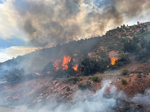
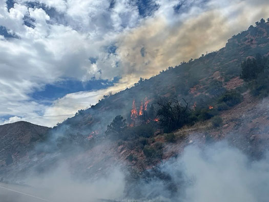
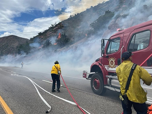
June 9, 2026, 4:40 p.m. – The fire size has been re-estimated at 8 – 10 acres in size.
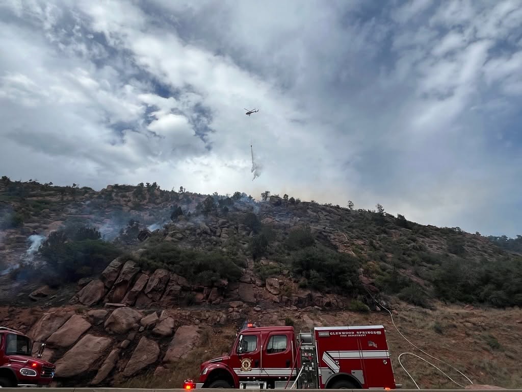
Approximately 44 firefighters are working to stop fire growth in steep and rocky terrain. Due to high winds in the area, fixed wing aircraft are unable to operate at this time.
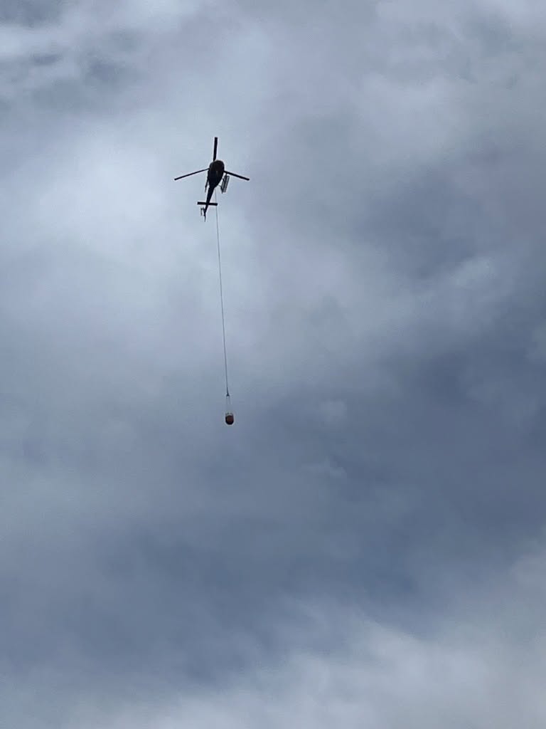
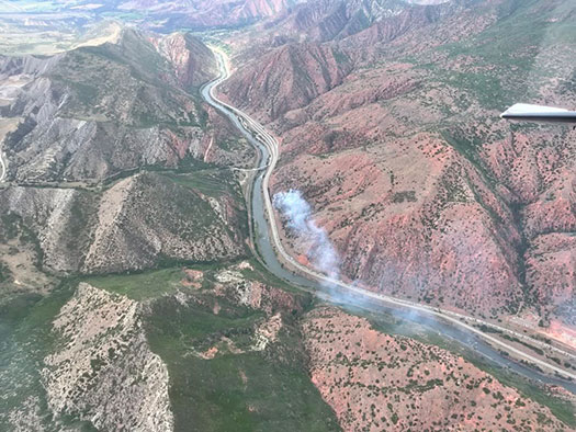
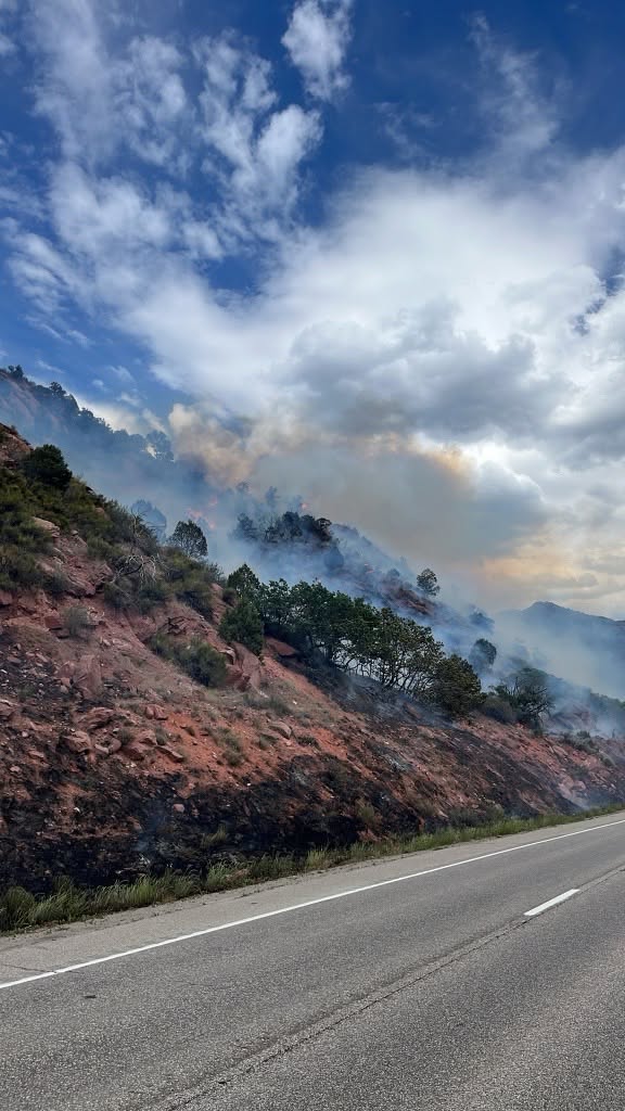
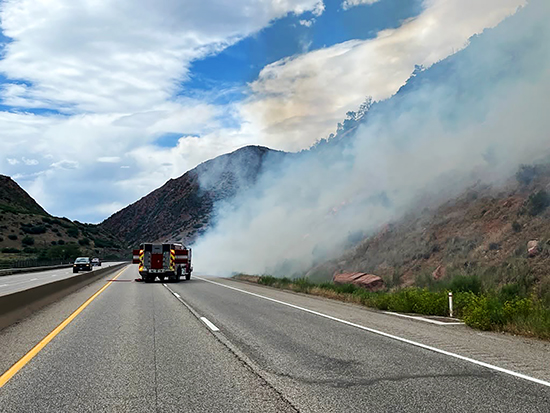
June 9, 2026, 4:07 p.m. – This fire has been named the Paradise Fire and is estimated at 20 acres. Two helicopters and two fixed-wing aircraft are en route to assist with suppression efforts. Aircraft will be refilling bucket drops from the Colorado River. I-70 will remain closed at this time. _____________________________
ACTUALIZACIÓN 4:40 p. m.
El tamaño del incendio ha sido reestimado entre 8 y 10 acres.
Aproximadamente 44 bomberos trabajan para detener el crecimiento del fuego en un terreno empinado y rocoso. Debido a los fuertes vientos en la zona, las aeronaves no pueden operar en este momento.
Las siguientes agencias están respondiendo a este incidente en un esfuerzo conjunto de ayuda mutua:
Upper Colorado River Interagency Fire Management Unit
Colorado Division of Fire Prevention and Control
Colorado River Fire Rescue
Garfield County Emergency Communications Authority
Garfield County Sheriff’s Office
Colorado Department of Transportation
Todas estas entidades colaboran en las labores de respuesta y control del incendio.
Este incendio ha sido nombrado Paradise Fire y se estima que abarca aproximadamente 20 acres.
Dos helicópteros y dos aeronaves están en camino para ayudar en las labores de supresión del incendio. Las aeronaves recargarán agua para las descargas con balde desde el río Colorado.
Estamos respondiendo a un incendio junto a la I-70 en dirección oeste, en el marcador de milla 112 en South Canyon. El Departamento de Bomberos y Rescate del Río Colorado está respondiendo en apoyo mutuo. La I-70 en dirección oeste está siendo cerrada en el marcador de milla 112.
Photos courtesy of Glenwood Springs Fire Department
Garfield County Emergency Communications Authority
June 9, 2026, 3:15 p.m. – Both directions of I-70 are now closed at the 112 milepost.
Glenwood Springs Fire Department
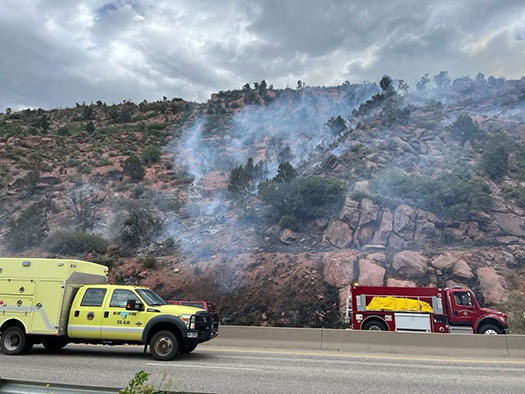
June 9, 2026, 3:02 p.m. – Glenwood Springs Fire Department is responding to a brush fire on westbound I-70 at milepost 112 in South Canyon. Colorado River Fire Rescue is responding in mutual aid. I-70 westbound is being closed at milepost 112.
Garfield County Emergency Communications Authority
June 9, 2026, 3:06 p.m. – I-70 is closed at mile-marker 112 WB, South Canyon, due to a fire.
Glenwood Springs Police Department and Garfield County Emergency Communications Authority
5.21.26, 7:20 p.m. – 7th Street & Bennett Avenue: The area is now clear. There’s no ongoing threat. Residents can resume normal activity.
Departamento de Policía de Glenwood Springs y Autoridad de Comunicaciones de Emergencia del Condado de Garfield
5.21.26, 7:20 p.m.– Calle 7 y Avenida Bennett: La zona ya está despejada. No existe ninguna amenaza. Los residentes pueden retomar sus actividades normales.
Glenwood Springs Police Department and Garfield County Emergency Communications Authority
5.21.26, 6:40 p.m. – 7th Street and Bennett Avenue – Glenwood Springs: There is a law enforcement presence in the area. Please stay inside, lock doors and windows or avoid the area.
5.21.26, 6:40 p.m. – 7th St y Bennett Ave, Glenwood Springs: Hay presencia policial. Por favor, permanezca adentro, cierre con llave las puertas y ventanas, y evite el área.
1.23.26, 9:35 p.m. – Between exit 116 – Glenwood Springs/Aspen and exit 119 – No Name at mile point 118.5 the roadway is reopened to traffic.
1.23.26, 8:30 p.m. – Crash on eastbound I-70 between exit 116 – Glenwood Springs/Aspen, and exit 119 – No Name, at mile point 118.5. Road closed, expect delays due to a crash.
Garfield County Emergency Communications Authority
1.23.26, 8:21 p.m. – I-70 is closed at mile marker 116 eastbound, Glenwood Springs exit, due to a multi-vehicle accident.