
GarCo911: Highway 6 open near Parachute after mudslide

Garfield County Emergency Communications Authority

10.15.26, 5:30 p.m. – Highway 6 is open at mile marker 73.5, Parachute Park Boulevard, both directions, Parachute.

10.14.26, 4:42 p.m. – Highway 6 is closed from Parachute Park Boulevard to Exit 72 in both directions due to a land/mud slide.

GARFIELD COUNTY EMERGENCY COMMUNICATIONS AUTHORITY
REGISTER for alerts – garco911.com | Reachwell mobile app
GarCo911: Highway 6 open near Parachute after mudslide

CDOT: Highway 6 closed near Parachute due to flooding

Colorado Department of Transportation

October 14, 2026, 2:22 p.m.: Highway 6 is closed (near Parachute) from Mile Point 73 to Mile Point 74.5. Road closed, expect delays because of flooding.

National Weather Service

Oct. 14, 2026, 12:37 p.m.: Flood advisory in effect for Garfield County until 1:30 p.m.

  • WHAT: Flooding caused by excessive rainfall is expected.
  • WHERE: South Central Garfield County in west central Colorado. Northeastern Mesa County in west central Colorado.
  • WHEN: Until 1:30 p.m. MDT.
  • IMPACTS: Minor flooding in low-lying and poor drainage areas. Water over roadways.

    ADDITIONAL DETAILS
  • At 12:35 p.m. MDT, NWS employee reported heavy rain in the advisory area, with standing water on I-70. Overflowing poor drainage areas have already caused minor flooding in the advisory area.
  • Some locations that will experience flooding including Parachute and Battlement Mesa.
  • http://www.weather.gov/safety/flood

PRECAUTIONARY/PREPAREDNESS ACTIONS…

Turn around, don’t drown when encountering flooded roads. Most flood deaths occur in vehicles.

CDOT: Highway 6 closed near Parachute due to flooding

CDOT: TRAVEL ALERT | Hanging Lake Tunnel Maintenance Westbound I-70 in Glenwood Canyon – 9:30 a.m. (9/15/26)

Colorado Department of Transportation

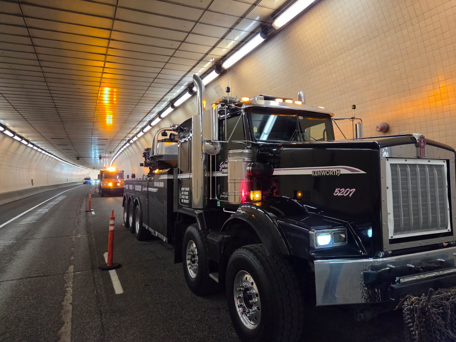
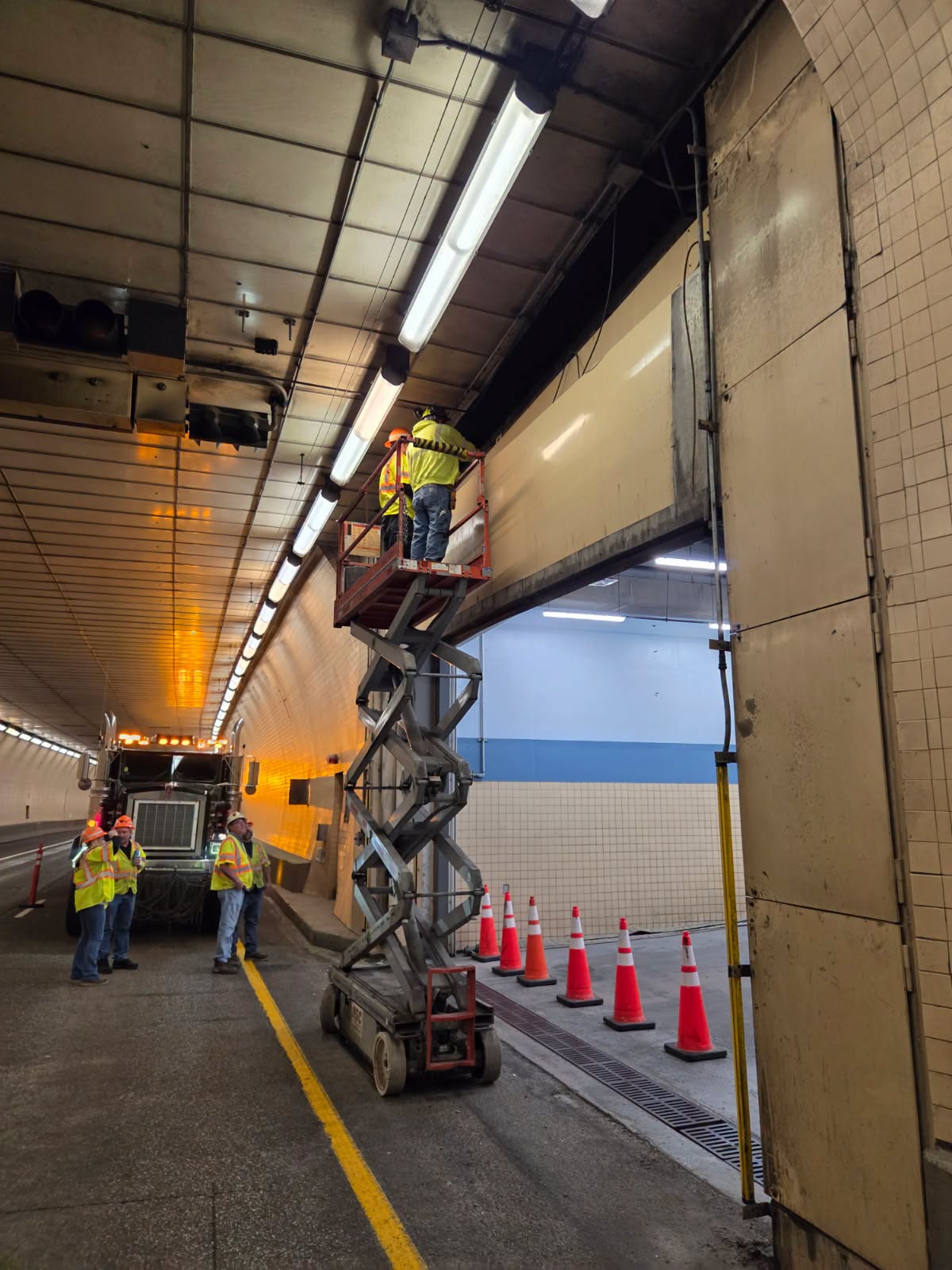
September 15, 2026, 9:35 a.m. – Westbound Interstate 70 at Dotsero (Exit 133) will experience intermittent closures starting at 9:30 a.m. this morning (9/15/26) This is for emergency maintenance on essential doors at the Hanging Lake Tunnel Complex in Glenwood Canyon.

For the most up to date information, visit COtrip Planner App and COtrip.org.

truck in closed lane of hanging lake tunnel on I70

workers in closed lane of hanging lake tunnel on I70

COLORADO DEPARTMENT OF TRANSPORTATION
COtrip travel alerts | facebook @coloradodot

CDOT: TRAVEL ALERT | Hanging Lake Tunnel Maintenance Westbound I-70 in Glenwood Canyon – 9:30 a.m. (9/15/26)

GarCo911: Highway 133 reopened at mile marker 66.5 after downed power line

Garfield County Emergency Communications Authority

September 14, 2026, 11:48 a.m. – Highway 133 is open at mile marker 66.5 in both directions, south of Roaring Fork High School.

September 14, 2026, 11:28 a.m. – Highway 133 is closed at mile marker 66.5 in both directions, south of Roaring Fork High School, due to a downed power line.

GARCO911 – GARFIELD COUNTY EMERGENCY COMMUNICATIONS AUTHORITY
REGISTER FOR ALERTS – garco911.com | Reachwell mobile app

GarCo911: Highway 133 reopened at mile marker 66.5 after downed power line

Garco911: County Road 311 south of Silt reopened

Garfield County Emergency Communications Authority

8.29.26, 7:23 p.m. County Road 311 is open at the intersection of County Road 331 and County Road 311 eastbound, south of Silt.

8.29.26, 6:40 p.m. – County Road 311 is closed at the intersection of County Road 331 and County road 311 eastbound, south of Silt, due to a fire.

GARFIELD COUNTY EMERGENCY COMMUNICATIONS AUTHORITY
REGISTER for alerts – garco911.com | Reachwell mobile app

Garco911: County Road 311 south of Silt reopened

Garco911: I-70 eastbound reopened at New Castle

Garfield County Emergency Communications Authority

8.28.26, 8:31 a.m. – I-70 is open at mile-marker 105 EB, New Castle.

8.28.26, 7:54 a.m. – I-70 is closed at mile marker 105 eastbound, New Castle, due to an accident.

GARFIELD COUNTY EMERGENCY COMMUNICATIONS AUTHORITY
REGISTER for alerts – garco911.com | Reachwell mobile app

Garco911: I-70 eastbound reopened at New Castle

Garco911: I-70 reopened between South Canyon and Canyon Creek

Garfield County Emergency Communications Authority

8.23.26, 2:29 p.m. – I-70 is open between mile markers 111 to the 109 westbound, South Canyon to Canyon Creek.

8.23.26, 1:23 p.m. – I-70 is closed between mile markers 111 to the 109 westbound, South Canyon to Canyon Creek, west of Glenwood Springs, due to an accident.

Garco911: I-70 reopened between South Canyon and Canyon Creek

Garco911: Highway 82 reopened in Carbondale area

Garfield County Emergency Communications Authority

8.2.26, 5:43 p.m. – Highway 82 is open between mile markers 11.5 and 15.5 both directions, from Carbondale to Catherine’s Store.

8.2.26, 12:45 p.m. – Highway 82 is closed between mile markers 11.5 and 15.7 both directions, from the Carbondale light to Catherine’s store, due to an accident.

Garco911: Highway 82 reopened in Carbondale area