Location: 11 miles south of Meeker, Colorado Start Date: 08/02/2025 Cause: Lightning Size: Lee Fire: 138,844 acres Containment: Lee Fire: 90%
208 Total Personnel; 1 Helicopter; 10 Engines; 1 Hand Crew; 1 Water Tender; 2 Dozers
KEY MESSAGE
Today, crews are continuing repair work in areas affected by suppression activities, following agency standards and working closely with Resource Advisors. These efforts aim to reduce the impacts of firefighting operations while protecting important natural and cultural resources. Fireline is being restored to local and agency standards, and patrols are underway to ensure the fire remains secure within its current footprint. Suppression repair operations will continue under the approved Suppression Repair Plan, minimizing impacts and supporting progress toward full containment
CURRENT STATUS
Yesterday, the FDNY Incident Management Team formally assumed command of the Lee Fire. Updated acreage was reported following the most recent infrared flight, which was completed after several earlier cancellations due to unfavorable weather conditions. This flight provided a clearer picture of current fire activity and perimeter status. Across all divisions, crews continued suppression repair, and debris removal, working closely with Resource Advisors to mitigate impacts and restore affected areas. These efforts remain a priority as containment objectives progress and conditions allow.
WEATHER AND FIRE BEHAVIOR
The monsoonal pattern remains firmly in place, with rainfall probabilities near 100% over the coming days. Widespread cloud cover with embedded showers is moving across the area. Should clearing occur by midday, stronger thunderstorms are likely to develop, increasing the potential for flash flooding. If cloud cover persists, conditions remain limited to lighter, intermittent rain with minimal lightning or heavy downpours.
CLOSURES AND SPECIAL MESSAGES
For accurate up-to-date information on evacuations and road closures for Rio Blanco County go to the
Northern Rockies Complex Incident Management Team 3
Derby Fire Quick Facts: Tuesday, August 26, 2025 Total acreage: 5,346 acres 0% containment 844 personnel
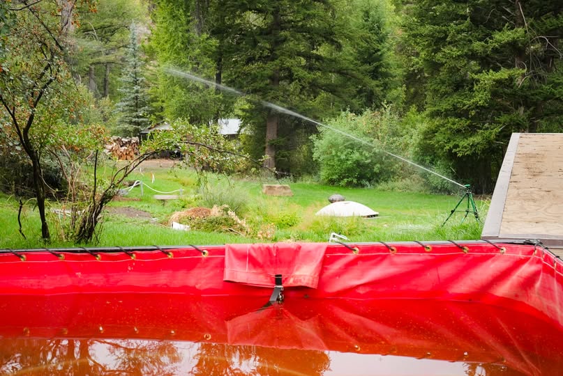
Firefighters tested structure protection systems yesterday in the Sweetwater Canyon area. In this photo, a sprinkler wets down the lawn of a resident, drawing water from a foldable water tank. The water tanks are filled by fire engines or water tenders.
Pumps push the water from the water tank through hose lays to the sprinkler systems. Photo by Stephen Rawding/Derby Fire.
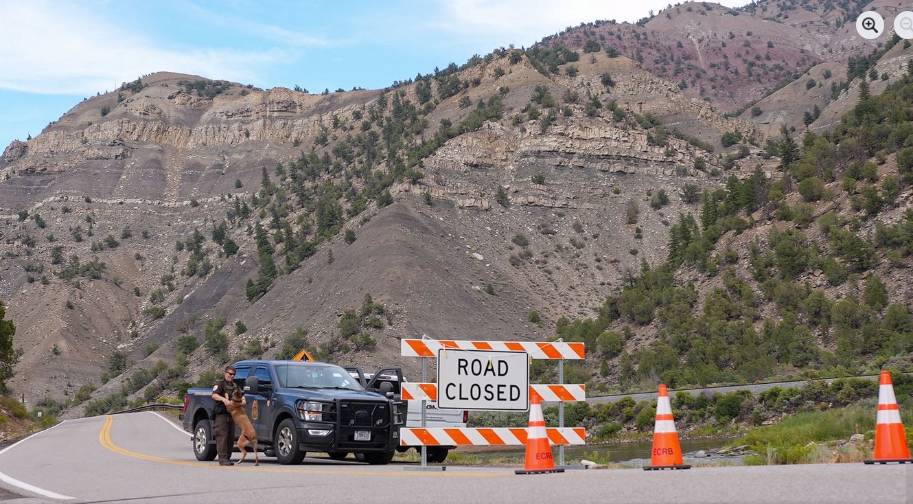
The Eagle County Sheriff’s Office has made a change to the Colorado River Road closure near Dotsero, CO, moving the closure from north of the Dotsero roundabout to just north of the intersection of Colorado River and Coffee Pot roads. Coffee Pot Road is now open to non-local traffic. Colorado River Road remains closed to all non-local residents and non-emergency traffic north of this intersection. A security checkpoint is in place at this point.
A strong thunderstorm will impact south central Garfield County through 2:15 p.m. MDT
At 1:51 p.m. MDT, Doppler radar was tracking a strong thunderstorm 18 miles northwest of De Beque, or 28 miles north of Grand Junction, moving east at 10 mph.
HAZARD Wind gusts up to 40 mph and penny size hail.
SOURCE Radar indicated.
IMPACT Gusty winds could knock down tree limbs and blow around unsecured objects. Minor hail damage to vegetation and outdoor objects is possible.
This storm will remain over mainly rural areas of south central Garfield County.
PRECAUTIONARY/PREPAREDNESS ACTIONS
If outdoors, consider seeking shelter inside a building.
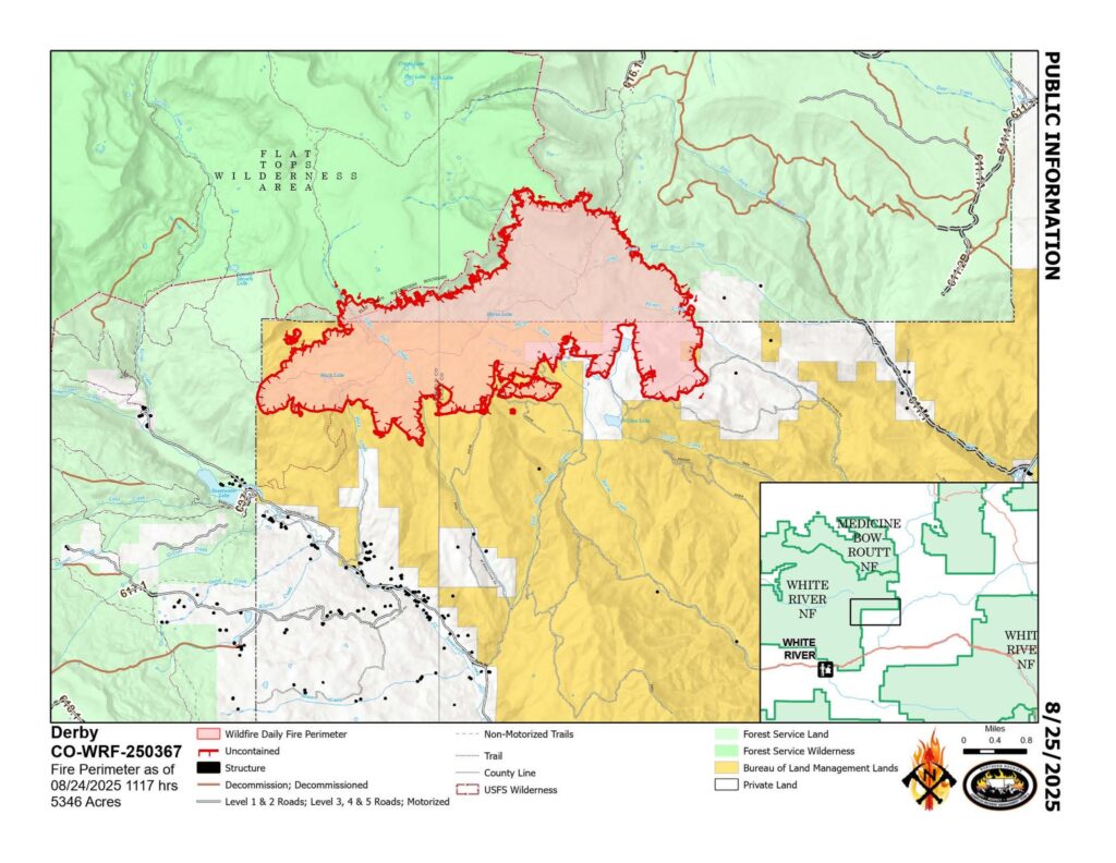
Location: 13 miles north of Dotsero, CO Start Date: 8/16/2025; Cause: Lightning Size: Est. 5346 acres Completion/Containment: 0% 648 total personnel
Key Message:
A Community Meeting will be held Monday, Aug. 25, 6:30 PM at the Gypsum Town Hall. It will be live streamed on the Derby Fire Facebook page and simulcast in Spanish on https://www.youtube.com/@DerbyFireInformation.
The Garfield County and Eagle County Sheriff’s Offices have changed the evacuation status for Sweetwater Valley and Sheep Creek to pre-evacuation (SET) status.
Current Status:
About three quarters of the recent growth on the fire’s southeast flank has been halted with new control lines.
The fire is growing slowly on other parts of its south perimeter, where firefighters are constructing control lines from a network of roads, dozer line, and hand line. On Sunday they worked to strengthen and widen those fire lines and will continue through the next several days as weather and conditions permit. Structure protection crews are working along Red Dirt Creek Road. Across the fire they have prepared over 500 structures by positioning sprinkler kits and removing surrounding fuels. Air support assisted by dropping flame retardant and water on the fire’s southeast flank.
Weather and Fire Behavior:
On Sunday, light but wetting rains fell on the Derby Fire, and the chance for monsoonal rain possibly accompanied by lighting will continue through most of the week. Daytime smoke and nighttime fire glows may be visible.
Closures and Special Messages:
Garfield and Eagle Counties have changed the evacuation status for Sweetwater Valley and Sheep Creek to pre-evacuation (SET). Zones GYF-263, 266-A, 267, 300, 366, and 369 are in pre-evacuation status. More evacuation information is available at https://arcg.is/S0u4G and www.ecemergency.org, including where to shelter and resources for pets and livestock.
The Colorado River Rd remains closed to non-residents and unapproved traffic at the roundabout north of Dotsero to Red Dirt Rd. Note that Coffeepot Rd. cannot be accessed from its intersection with Colorado River Rd.
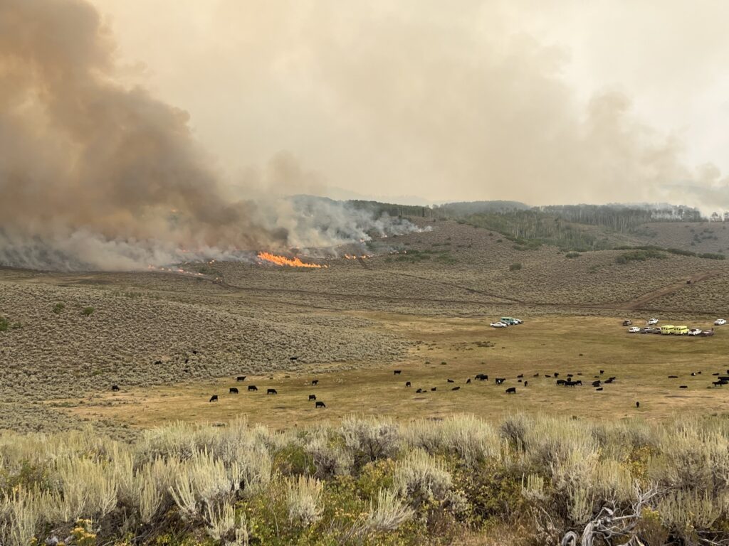
Cows grazing in the foreground with staged fire engines while the Derby Fire burns across the foothills in the background. Photo by Matt Butler/Derby Fire.
Equipo 3 de Gestión de Incidentes Complejos de las Montañas Rocosas del Norte,
Comandante de Incidente Mike Behrens
Ubicación: 13 millas al oeste de Dotsero, CO Fecha de inicio: 08/16/2025; Causa: Rayos Tamaño: Est. 5346 acres Finalización/Contención: 0% 648 Personal total
Mensaje clave:
Habrá una reunióncomunitaria el lunes, el 25 de agosto a las 6:30pm en el Gypsum Town Hall. Se transmitirá en vivo por la página de Facebook de Derby Fire y simultáneamente en español en https://www.youtube.com/@DerbyFireInformation. Las Oficinas del Condado de Eagle y del Sheriff del Condado de Garfield han cambiado el estado de evacuación de Sweetwater Valley y Sheep Creek a “LISTOS”, la etapa 2 del proceso de evacuaciones que significa “prepárese y esté alerta”.
Estado actual:
Aproximadamente tres cuartas partes del reciente crecimiento en el flanco sureste del incendio se han detenido con nuevas líneas de control. El incendio crece lentamente en otras partes de su perímetro sur, donde los bomberos están construyendo líneas de control a partir de una red de carreteras, una línea de excavadoras y una línea de mano. El domingo, trabajaron para reforzar y ampliar estas líneas de control y continuarán durante los próximos días si el clima y las condiciones lo permiten. Los equipos de protección de estructuras trabajan a lo largo de Red Dirt Creek Road. Al otro lado del incendio, han preparado más de 500 estructuras mediante la instalación de equipos de rociadores y la retirada de los combustibles circundantes. Se brindó apoyo aéreo con el lanzamiento de retardante de llama y agua en el flanco sureste del incendio.
Comportamiento del clima y el fuego
El domingo, cayeron lluvias sobre el incendio de Derby, y la probabilidad de lluvias monzónicas, posiblemente acompañadas de rayos, continuará durante la mayor parte de la semana. Podría verse humo diurno y resplandores de incendios nocturnos.
Cierres y mensajes especiales
Los condados Eagle y Garfield han cambiado el estado de evacuación para los residentes de Sweetwater Valley y Sheep Creek a “SET”, la etapa 2 del proceso de evacuaciones que significa “prepárese y esté alerta”. Las zonas GYF-263, 266-A, 267, 300, 366 y 369 están en estado previo a la evacuación. Para más información, incluido dónde refugiarse y recursos para mascotas y ganado, visite https://sites.google.com/eaglecounty.us/ecemergencyespanol/inicio.
El Colorado River Road permanece cerrado para todos aquellos que no sean residentes y el tráfico no autorizado en la rotonda al norte de Dotsero hasta Red Dirt Road. Tenga en cuenta que no se puede acceder a Coffeepot Road desde su intersección con Colorado River Road.
Northern Rockies Complex Incident Management Team 3
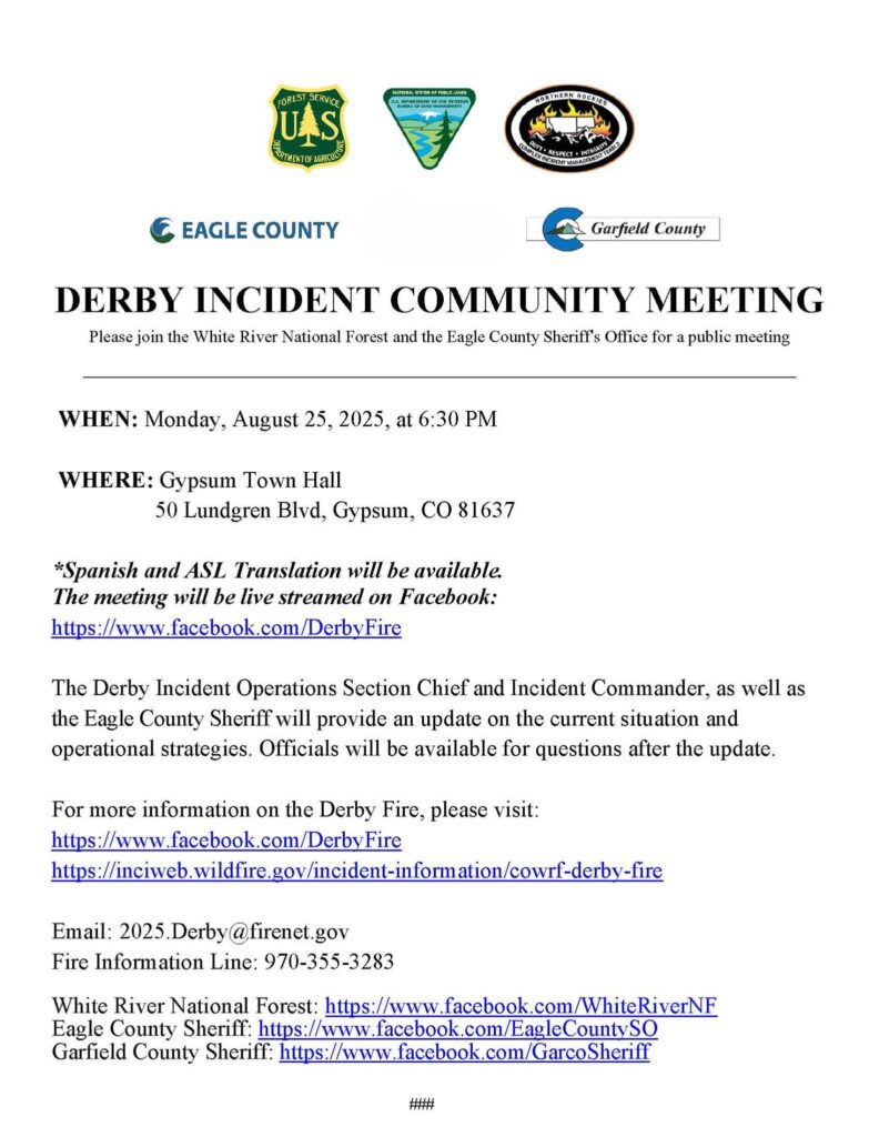
Please join us for a community meeting tonight, Monday, August 25, 2025 at 6:30 pm at the Gypsum Town Hall, 50 Lundgren Blvd., Gypsum, CO 81637.
The community meeting will be live-streamed on the Derby Fire Colorado Facebook page, https://www.facebook.com/DerbyFire. A Spanish dubbed version will be live-streamed on the Derby Fire Incident YouTube page, https://www.youtube.com/@DerbyFireInformation The Derby Incident Operations Section Chief and Incident Commander, as well as the Eagle County Sheriff, will provide an update on the current situation and operational strategies. Officials will be available for questions after the update.
The image below captures a flyer advertising the Derby Incident Community Meeting on Monday, August 25, 2025. This information is described in the post above.
Location: 11 miles south of Meeker, Colorado Start Date: 08/02/2025 Cause: Lightning Size: Lee Fire: 137,758 acres Containment: Lee Fire: 90% 266 Total Personnel; 1 Helicopter; 9 Engines; 3 Hand Crews; 2 Water Tenders; 2 Dozers
KEY MESSAGE
Today at 0600, the FDNY Incident Management Team assumed command of the Lee fire. We extend our appreciation to the Northern Rockies IMT for their dedicated efforts and smooth transition. On the southwest flank, crews will continue patrolling and working to secure the fire’s perimeter. Suppression repair and debris removal will be ongoing across all divisions, conducted in coordination with resource advisors.
CURRENT STATUS
Yesterday, fire activity remained minimal, with only isolated creeping and smoldering observed within the perimeter. Crews concentrated on securing constructed line, conducting patrol and mop-up along existing containment, and advancing suppression repair in coordination with Resource Advisors. Continued rainfall is expected to elevate the risk of flash flooding and debris flows within burned and surrounding areas.
WEATHER AND FIRE BEHAVIOR
Showers and thunderstorms are expected to develop again today, with skies clearing during the late morning before storms build in the afternoon. Daytime heating will drive thunderstorm development, with cumulus buildups after 11:00 signaling activity. A wet pattern will continue through the week, with a 90–100% chance of daily rainfall through Thursday. Storms may bring periods of heavy rain, frequent lightning, gusty outflow winds, and small hail.
Northern Rockies Complex Incident Management Team 3
Derby Fire Weather update 8-25-2025.
Incident Meterologist, Ryan Fleihman, discusses yesterday’s weather patterns, expected conditions this morning, and over the next few days. The fire footprint received gradual afternoon rain, ranging between 1/10 inch to 1/2 inch. A cluster of storms to the west of the fire will bring light rain and lightning this morning, followed by gradual clearing of clouds, with more rain predicted in the afternoon and evening. Showers could continue overnight. Largest concern today is the potential for localized flash flooding and debris flows, especially in burn scars. Please tune in to the Grand Junction National Weather Service station for flash flood warnings.