Bureau of Land Management Colorado, Upper Colorado River District, Grand Junction Field Office
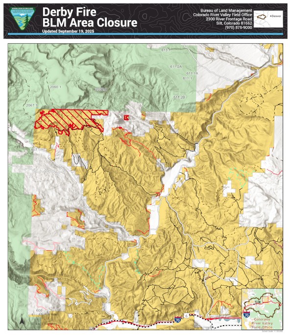
The Bureau of Land Management has reopened more public lands in Garfield and Eagle counties that were previously closed due to the Derby Fire. The updated closure order takes effect immediately.
Some areas inside the burned perimeter remain closed because they’re not safe. There are hazards like burned trees and ongoing work to repair damage from fighting the fire. See below and attached map for details. The closure order and map are also available on the BLM website.
This closure affects: BLM lands north and west of the town of Gypsum, Colorado, that are north of Sweetwater Road; west of the Colorado River; east of the White River National Forest boundary; and south of Derby Creek.
BLM issued the emergency closure Aug. 20 to ensure public and firefighter safety during fire suppression efforts and to reduce exposure to hazardous situations because of fire behavior of the Derby Fire.
This order will remain in effect until fire BLM rescinds the order. The public is to remain clear of the areas still closed. Please use caution and watch for firefighters when traveling in the area. Violations of this emergency order may lead to prosecution, with fines and possible imprisonment.
Thank you for your understanding as we focus on public safety and protecting natural resources.
Derby Fire Update – September 1, 2025 Rocky Mountain Area Complex Incident Management Team 3 Casey Cheesbrough, Jay Miller, Ben Sanders Incident Commanders Fire Information: 970-355-3283
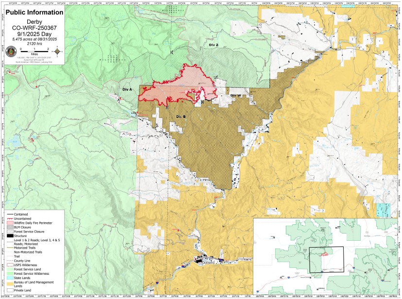
Size: 5,475 acres Containment: 6% Total personnel: 578 Cause: Lightning Resources: 4 aircraft, 9 hand crews, 27 engines, 12 heavy equipment
Current situation:
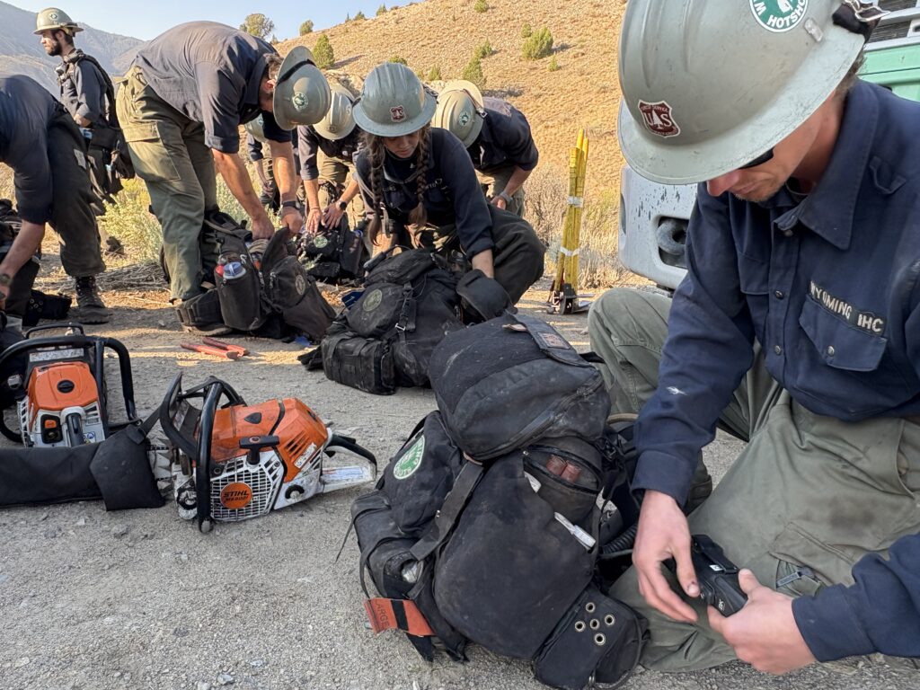
A spike camp is located near West Fork Red Dirt Creek, east of the fire edge, allowing hotshot crews to reduce travel time to where they are building direct line on the fire’s edge. The hotshots are working south to eventually meet crews working up from Poison Creek on the southeast corner. This assignment may take several days to complete.
A combined group of 30 hotshots and highly skilled medical personnel will return by helicopter to the Hack Lake area to continue their work on the western perimeter. Being transported by helicopter allows the crew to save time and conserve energy for the day’s task, rather than making an arduous hike to the fireline. An Unmanned Aerial System (UAS) will scout for areas of heat in spots outside the perimeter in the northwest portion of the fire and south of the Flat Top Wilderness area. UAS reconnaissance flights identify areas of heat providing crews with coordinates to effectively locate them.
Firefighters continue backhauling excess structure protection equipment from areas where it is no longer needed. Crews continue to patrol and monitor the southern portion of the fire, searching out areas of heat and extinguishing them as they work towards containment. Crews will also monitor and maintain structure protection systems that remain along the Sweetwater, Sheep Creek, and Red Dirt Creek roads.
Weather and fire behavior:
Smoke levels are expected to be more noticeable than in previous days as the drying trend continues. Starting Monday, fire activity will increase with rising temperatures and lowering humidity, as seasonal warm and dry pattern returns to Western Colorado this week. Temperatures will stay in the low seventies with a mild 10 miles per hour wind.
Evacuations and closures: Fire restrictions and closures remain in place for lands within the Bureau of Land Management – Colorado River Valley Field Office areas, https://www.blm.gov/ucr-fire-restrictions. Restrictions and closures remain in the White River National Forest. See Critical and Fire Restriction Forest Alerts at https://www.fs.usda.gov/r02/whiteriver/alerts/ .
The Colorado River, Sweetwater, and Red Dirt Creek roads have all been reopened, and the Garfield County and Eagle County Sheriff’s Offices have changed the evacuation status for Sweetwater Valley, Sheep Creek and Red Dirt Creek areas to pre-evacuation (READY) status: https://arcg.is/S0u4G and www.ecemergency.org.
A Temporary Flight Restriction (TFR) is in place over the Derby Fire. All unauthorized aircraft (including drones) are prohibited from flying near the fire, as they can interfere with authorized air support operations. For more information, visit https://tfr.faa.gov.
Derby Fire information Phone: 970-355-3283 (8:00 a.m. to 8:00 p.m.) Email:2025.Derby@firenet.gov
Actualización Diaria para el Incendio Derby – el 1 de septiembre de 2025
Equipo 3 del Manejo de Incidentes Complejos del Área de las Montañas Rocosas
Comandantes del Incidente: Casey Cheesbrough, Jay Miller, Ben Sanders Información del incendio: 970-355-3283
Un campamento secundario se encuentra cerca de West Fork Red Dirt Creek, al este del borde del incendio, lo que permite a los equipos de bomberos “hotshot” (bomberos forestales altamente capacitados y especializados) reducir el tiempo de viaje hasta donde construyen una línea directa en el borde del incendio. Los bomberos trabajan hacia el sur para reunirse con los equipos que trabajan desde Poison Creek en la esquina sureste. Esta tarea podría tardar varios días.
Un grupo combinado de 30 bomberos “hotshot” y personal médico altamente capacitado regresará en helicóptero a la zona de Hack Lake para continuar su trabajo en el perímetro oeste. El transporte en helicóptero permite al equipo ahorrar tiempo y energía para la tarea del día, en lugar de realizar una ardua caminata hasta la línea de fuego. Un Sistema Aéreo No Tripulado (UAS por sus siglas en inglés, o dron) buscará cualquier foco secundario de calor fuera del perímetro, en la parte noroeste del incendio y al sur de la zona silvestre Flat Top Wilderness. Los vuelos de reconocimiento del UAS identifican las zonas de calor, proporcionando a los equipos las coordenadas para localizarlas eficazmente.
Los bomberos continúan retirando el exceso de equipo de protección estructural de las zonas donde ya no se necesita. Los equipos continúan patrullando y monitoreando la zona sur del incendio, buscando áreas de calor y extinguiéndolas mientras trabajan para contenerlo. También monitorearán y darán mantenimiento a los sistemas de protección de estructuras que permanecen a lo largo de las carreteras de Sweetwater, Sheep Creek y Red Dirt Creek.
Clima y el comportamiento del fuego:
Se espera que los niveles de humo sean más visibles que en días anteriores a medida que continúa la tendencia a la sequía. A partir del lunes, la actividad de los incendios aumentará con el aumento de las temperaturas y la disminución de la humedad, ya que el patrón estacional cálido y seco regresa al oeste de Colorado esta semana. Las temperaturas se mantendrán alrededor de los 70°F con vientos suaves de 10mph.
Evacuaciones y cierres: Las restricciones y cierres por incendios se permanecen vigentes en los terrenos bajo la administración de la Oficina de Administración de Tierras del Valle del Río Colorado: https://www.blm.gov/ucr-fire-restrictions. Las restricciones y cierres por incendios se permanecen vigentes en Bosque Nacional White River. Consulte las alertas forestales críticas y de restricciones por incendios en https://www.fs.usda.gov/r02/whiteriver/alerts/.
Se han reabierto los caminos Colorado River Road, Sweetwater Road y Red Dirt Creek. Los condados Eagle y Garfield han cambiado el estado de evacuación para los residentes de Sweetwater Valley, Sheep Creek, y Red Dirt Creek a “LISTOS”, la etapa 1 del proceso de evacuaciones que significa que “esté preparados”: https://arcg.is/S0u4G o https://sites.google.com/eaglecounty.us/ecemergencyespanol/inicio.
Se ha establecido una Restricción Temporal de Vuelo (TFR) sobre el incendio Derby. Se prohíbe a todas las aeronaves no autorizadas (incluidos los drones) volar cerca del incendio, ya que pueden interferir con las operaciones de apoyo aéreo autorizadas. Para más información, visite https://tfr.faa.gov.
Información sobre el Incendio Derby
Teléfono: 970-355-3283 (de 8:00 a. m. a 8:00 p. m.) Correo electrónico: 2025.Derby@firenet.gov
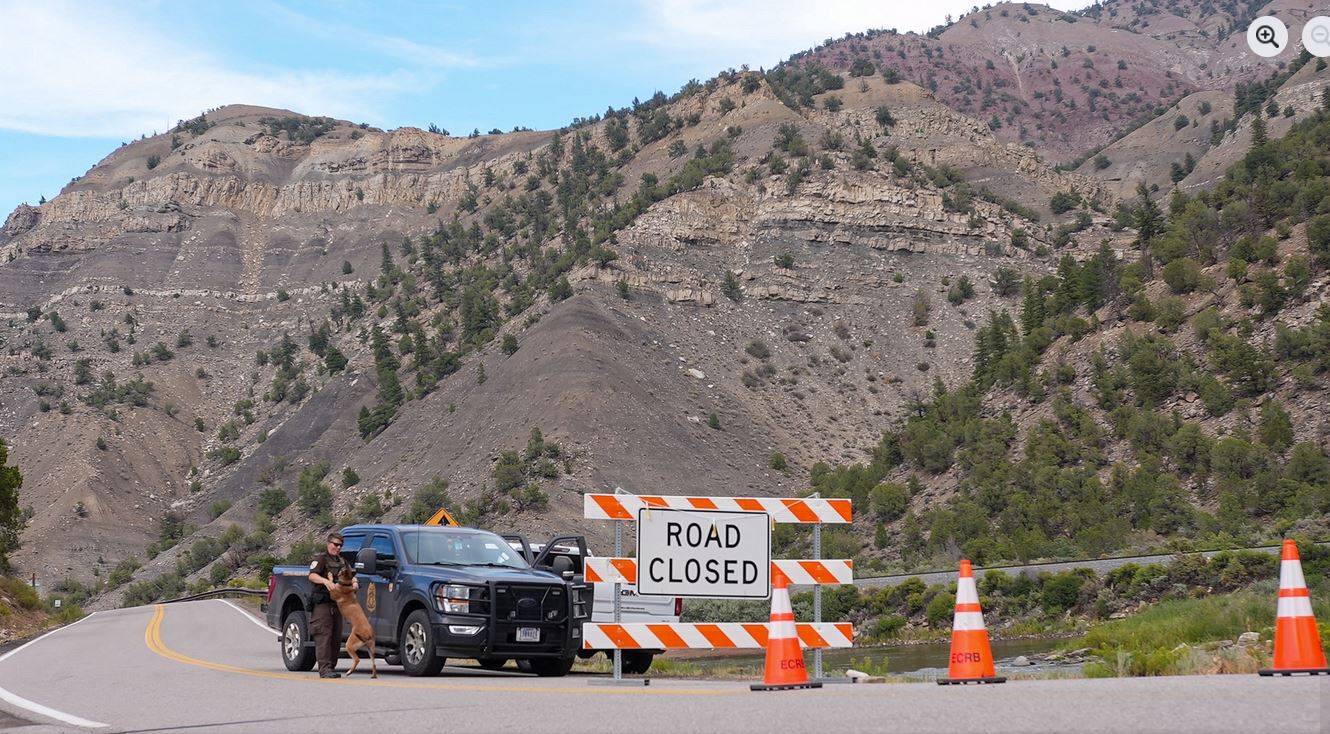
The Eagle County Sheriff’s Office has made a change to the Colorado River Road closure near Dotsero, CO, moving the closure from north of the Dotsero roundabout to just north of the intersection of Colorado River and Coffee Pot roads. Coffee Pot Road is now open to non-local traffic. Colorado River Road remains closed to all non-local residents and non-emergency traffic north of this intersection. A security checkpoint is in place at this point.
Colorado River Road closure for the Derby Fire has been extended south, starting from the north side of the Dotsero roundabout to Red Dirt Rd. This closure is for all non-residents and non-emergency traffic.
While we understand the impact of road closures, safeguarding and the life safety of people is always our highest priority. This precaution allows emergency crews to focus fully on protecting residents and responders in the area.
Out of respect for your safety and the safety of our dedicated first responders, we ask that you avoid the area unless you’re part of the emergency response team. Every moment and movement matters right now.
***EN ESPAÑOL***
El cierre de la carretera Colorado River por el incendio Derby se ha ampliado hacia el sur, desde el lado norte de la glorieta de Dotsero hasta la calle Red Dirt. Este cierre está para todos los que no son residentes y el tráfico que no sea de emergencia.
Aunque entendemos el impacto que tienen los cierres de carreteras, nuestra prioridad siempre es proteger la vida de las personas. Esta precaución permite que los equipos de emergencia se concentren en proteger a los residentes y a los socorristas de la zona.
Por respeto a su seguridad y a la de nuestros dedicados equipos de emergencia, le pedimos que evite la zona a menos que forme parte del equipo de emergencia. En estos momentos, cada momento y cada movimiento cuentan.
Northern Rockies Complex Incident Management Team 3
Please join us for a community meeting Friday, August 22, 2025 at 6:30 pm at the Gypsum Town Hall, 50 Lundgren Blvd, Gypsum, CO. Spanish language translation will be available. We will try again with live streaming.
The Derby Incident Operations Section Chief and Incident Commander, as well as the Eagle County Sheriff, will provide an update on the current situation and operational strategies. Officials will be available for questions after the update.