December 2, 2025, 11:15 a.m. – I-70 is now open at mile marker 105, New Castle.
December 2, 2025, 9:27 a.m. – Eastbound Interstate 70 is closed at mile marker 105, just before the New Castle exit, due to an accident. Traffic is being diverted at Silt.
Garfield County Emergency Communications Authority
9.27.25, 12:40 am – I-70 is open at mile marker 130 westbound, Dotsero.
Colorado Department of Transportation
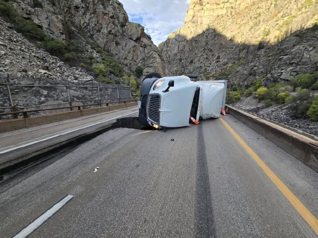
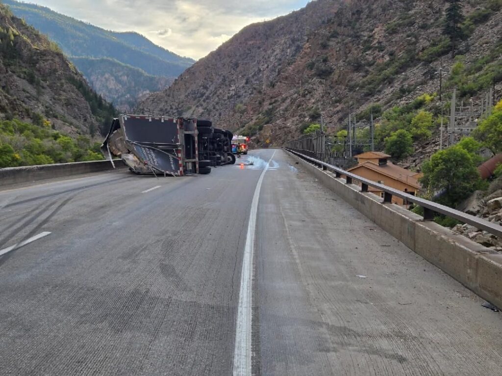
9.26.25, 9:03 pm – Westbound I-70 is closed to through traffic at Wolcott, Exit 157, due to a rolled over CMV crash that took place in Glenwood Canyon at around 6 p.m. this evening. CDOT and its partners worked tirelessly to avoid putting a detour in place — estimated to add four hours of travel time — but unfortunately, I-70 through Glenwood Canyon is an extremely challenging section of road with limited space for operations. There is no estimated time of re-opening.
The detour that is in place directs commuters onto US 6 via exit 157, Wolcott, north on HWY 131 toward Steamboat, west on US 40 towards Craig, south on HWY 13, and back on I-70 near Rifle.
Check COtrip.org or the #COtrip Planner app for more information and road updates.