CRFR: Dry Creek Fire updates

Colorado River Fire Rescue

Dry Creek Fire Update – June 24, 2026

As of this morning, the Dry Creek Fire south of Rifle is estimated at 315 acres.

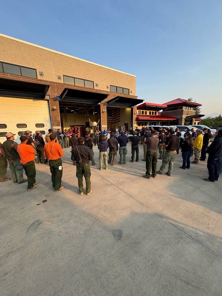
At 7:00 a.m. today, management of the fire transitioned to the Upper Colorado River Interagency Fire Management Unit Type 3 team. During this morning’s briefing, crews reviewed current fire conditions and operational objectives before heading into the field.

Firefighter and public safety remain the top priority. Crews are utilizing a full suppression strategy with direct and indirect tactics to slow the fire’s spread and construct containment lines around the fire.

Evacuation orders remain in effect for affected areas and are expected to remain in place throughout the day due to extreme fire behavior conditions and the forecasted winds are expected to test the fire line this afternoon. Residents are encouraged to stay informed by monitoring the latest evacuation information and updates at https://www.garfieldcounty.net/

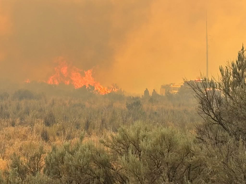
Emergency services respond to the dry creek fire at night

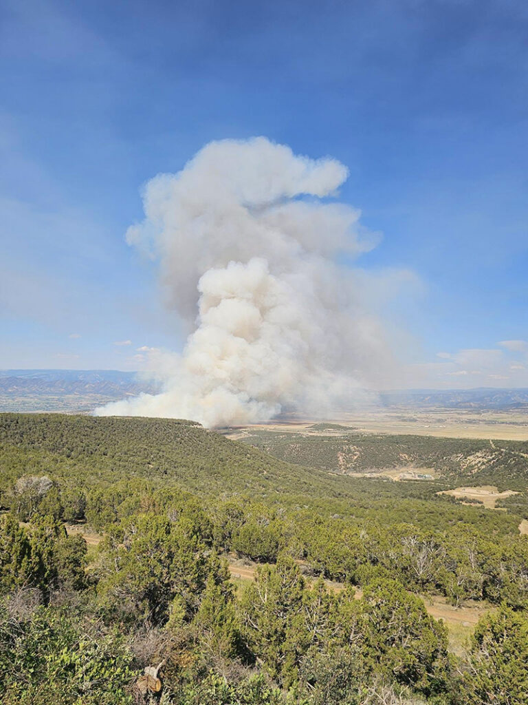
plume of smoke from Dry Creek Fire

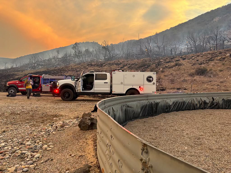
Emergency services respond to the dry creek fire

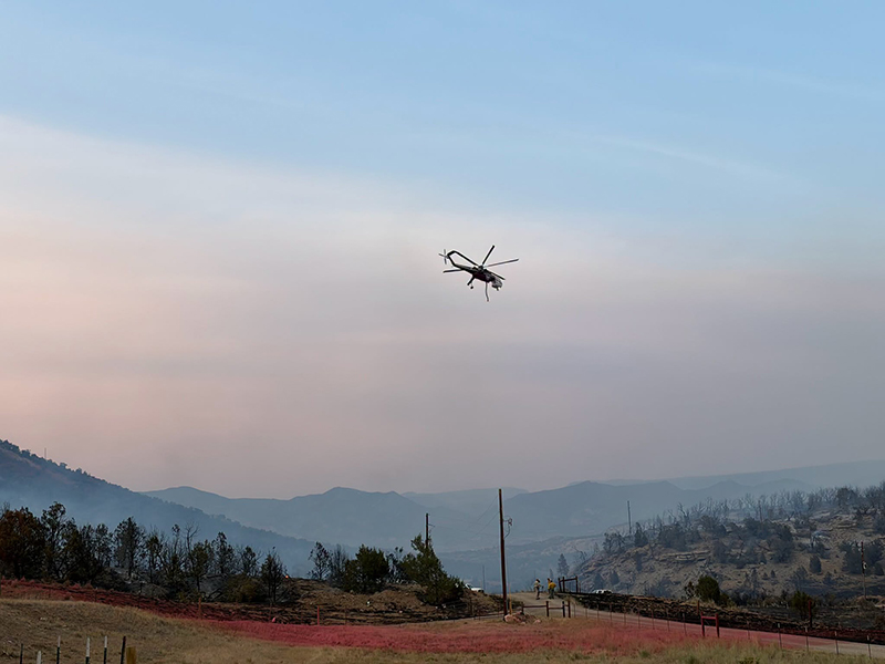
Aerial emergency services respond to the dry creek fire

Emergency services respond to the dry creek fire

Emergency services respond to the dry creek fire

Emergency services respond to the dry creek fire

Emergency services respond to the dry creek fire

Customers impacted by power outages can find current outage updates through Xcel Energy at https://co.my.xcelenergy.com/s/outage-safety/outage-map

Fire personnel are working closely with Xcel Energy to inspect power lines and infrastructure so that power can be safely restored when conditions allow.

Colorado River Fire Rescue
CRFR website | facebook: #ColoradoRiverFireRescue

CRFR: Dry Creek Fire updates

Dry Creek Fire – Colorado River Fire Rescue responds to wind-driven wildland fire near Rifle

Colorado River Fire Rescue


6.23.26, 10:55 p.m. – RIFLE, Colo. — June 23, 2026 – At approximately 3:20 p.m. today, Colorado River Fire Rescue was dispatched to a reported structure fire at 899 Gage Road near Rifle. While responding, updated information indicated that brush was burning and spreading toward a structure.

Responding units observed a significant smoke column en route and requested mutual aid from Upper Colorado River Interagency Fire Management Unit, Glenwood Springs Fire Department and the Grand Valley Fire Protection District. Upon arrival, firefighters found a rapidly spreading wildland fire being driven by strong winds to the east and southeast.

All evacuations will remain in place overnight.

Due to the fire’s growth and the threat to infrastructure, the Mountain Area Mutual Aid (MAMA) system was activated, bringing additional resources from Eagle and Pitkin counties to assist with suppression efforts.

As of this evening, the fire has burned approximately 288 acres. One residence and one outbuilding have been confirmed lost. Fire crews continue to work through the night to contain the fire and protect threatened structures and critical infrastructure.

The Upper Colorado River (UCR) Type III Incident Management Team has been ordered and will assume command of the incident at 7:00 a.m. tomorrow. The cause of the fire remains under investigation.

Colorado River Fire Rescue would like to remind residents that Garfield County is moving into Stage II Burn Restrictions on Friday, June 25, 2026. Current conditions are extremely dry, and any spark could start a fast-moving wildfire. Residents and visitors are urged to exercise extreme caution in all outdoor activities and strictly comply with burn restrictions.

Colorado River Fire Rescue thanks our mutual aid partners and cooperating agencies for their assistance and continued support during this incident. We appreciate Garfield County Emergency Communications Authority for support during this incident.

For additional information and updates, please follow the official Colorado River Fire Rescue communication channels.

Leif Sackett
Fire Chief
Colorado River Fire Rescue

Colorado River Fire Rescue
CRFR website | facebook: #ColoradoRiverFireRescue

Dry Creek Fire – Colorado River Fire Rescue responds to wind-driven wildland fire near Rifle

CRFR: Dry Creek Fire updates

Colorado River Fire Rescue

June 23, 2026, 5:47 p.m. – Please follow garfieldcounty.net for evacuation updates.

All evacuees can go to the Garfield County Fairgrounds in Rifle.

For power outage information, please go to the Xcel Energy outage map.

Acreage has been updated to 287.8 acres.

Pre-evacuation notice

June 23, 2026, 4:26 p.m – Grass Mesa, south of Rodeo Drive and Coyote Trail: due to fire, please prepare for possible evacuation orders issued by Colorado River Fire Rescue. You will receive another message if evacuations are ordered.

Colorado River Fire Rescue
CRFR website | facebook: #ColoradoRiverFireRescue

CRFR: Dry Creek Fire updates

CRFR: Structure/wildfire response south of Rifle – evacuations in progress for Gage Road

Colorado River Fire Rescue

June 23, 2026, 4:34 p.m. – The UCR Type 3 Incident Management Team has been ordered. ICP Location is being established. Additional air resources have been ordered including, two large air tankers, two helicopters, and Air Attack.

June 23, 2026, 4:27 p.m. – The fire has jumped County Road 319. Additional mutual aid resources have been requested by Incident Command.

June 23, 2026, 4 p.m. – Evacuation updates:

  • Grass Mesa Rd. north of Gage Rd.
  • Sunset Lane
  • Gage Rd north of mile marker 1
  • ALL evacuees can go to the Garfield County Fairgrounds in Rifle.
  • Additional air tankers and two IA crews have been ordered.

June 23, 2026, 3:27 p.m. – Crews are responding to a reported structure fire south of Rifle on Gage Road. Additional structures and gas infrastructures are threatened. Air resources, mutual aid, and interagency resources have also been ordered.

Please avoid the area and give emergency responders room to work. Use caution if traveling nearby and watch for emergency vehicles.

More information will be shared as it becomes available.

Colorado River Fire Rescue
CRFR website | facebook: #ColoradoRiverFireRescue

Garfield County Sheriff’s Office

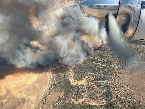
Aerial view of the Dry Creek Fire.

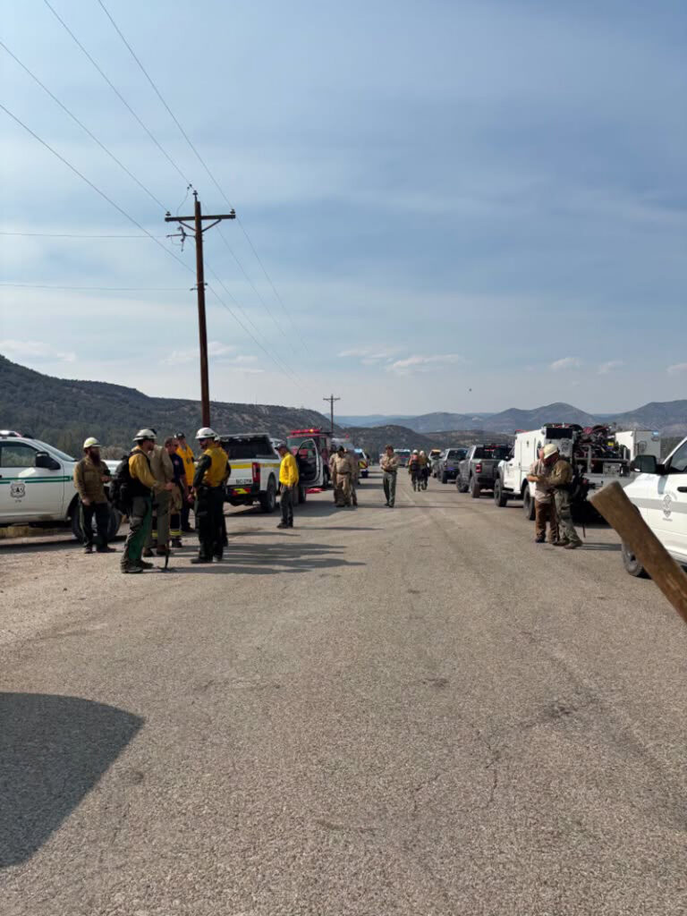
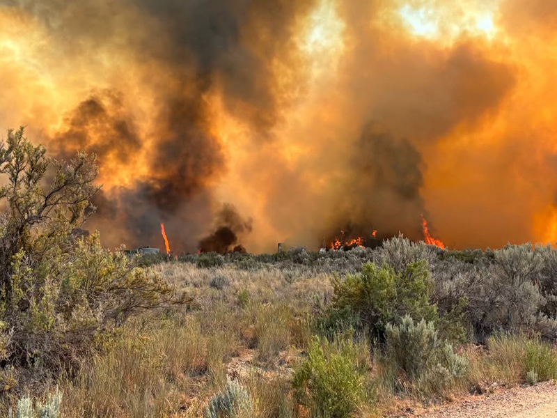
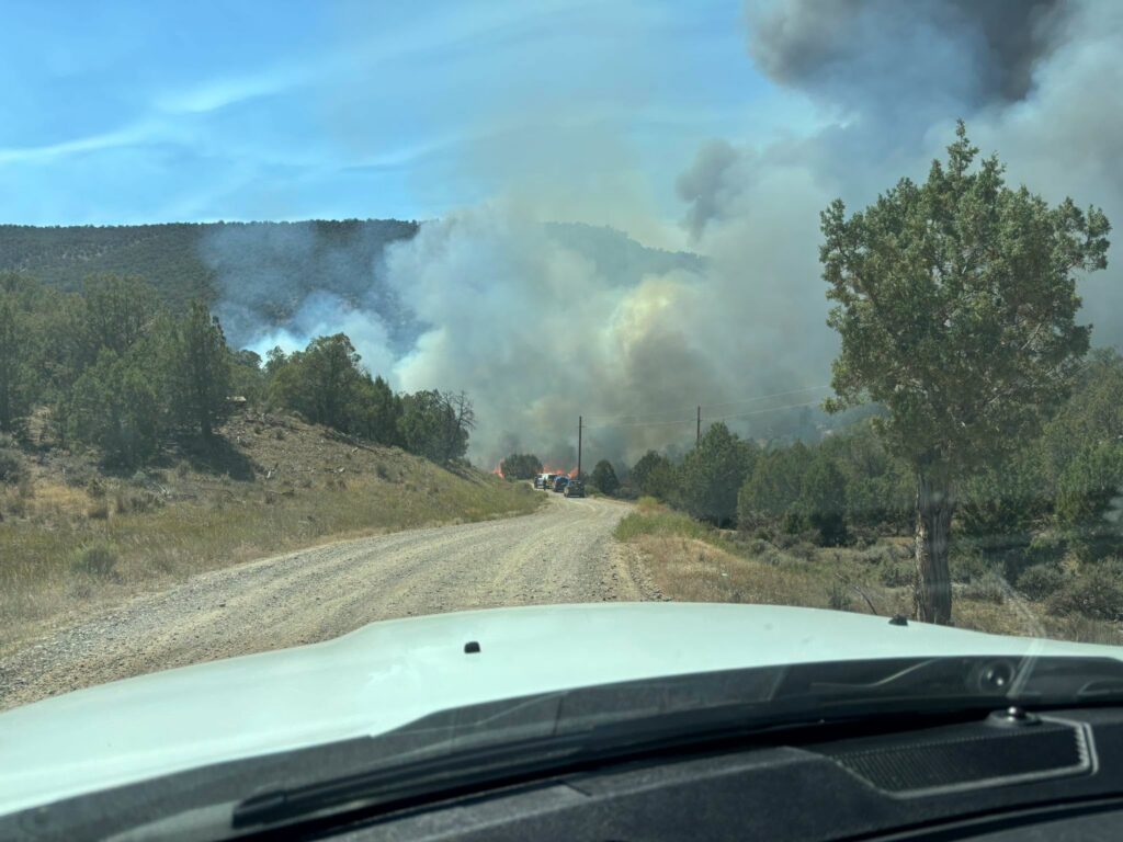
Dry Creek Fire from a gravel road.

June 23, 2026, 3:48 p.m. – Fire in the Grass Mesa area on Gage Road in Rifle. Some neighborhoods are being evacuated. Please stay clear of the area.

CRFR: Structure/wildfire response south of Rifle – evacuations in progress for Gage Road

CRFR: Lift-Up is at the Rifle Fairgrounds until 1:00 PM today

Colorado River Fire Rescue

Lift-Up is at the Rifle Fairgrounds until 1:00 PM today to support families displaced by yesterday’s fire.

If you or someone you know has been affected and is in need of food, supplies, or other essential items, please stop by. Help us spread the word so that everyone who needs assistance can access these resources.

Rifle Fairgrounds

Until 1:00 PM today

Please share with anyone who may have been impacted.

CRFR: Lift-Up is at the Rifle Fairgrounds until 1:00 PM today

Derby Fire: Evacuations lifted by the Garfield County Sheriff’s Office

Garfield County Sheriff’s Office

The two Garfield County ready (green) evacuation zones for the Derby Fire are lifted due to successful suppression efforts and moist weather conditions.

Zone 265 and zone 268 in Garfield County west and south of the Derby Fire containment lines are no longer in any evacuation preparation status. Stage 1 fire restrictions still apply in these areas, including in the White River National Forest.

As fire complexity decreases and assigned resources are scaled appropriately, crews remain on scene to continue suppression efforts with a goal of full containment. While fire suppression efforts continue, smoke is expected to remain visible throughout the season, likely until snowfall arrives.

Evacuation zones for the Lee Fire were lifted August 26, so no further zone statuses are in effect in Garfield County on either the Lee or Derby fires.

The Garfield County Sheriff’s Office offers a sincere thank you to our residents for preparing to evacuate and monitoring fire spread and official status updates in the Ready-Set-Go model during both the Lee and Derby fires. Garfield County Emergency Management will continue using this model for future evacuation updates to alert the community during incident management.

Garfield County Sheriff’s Office and staff, Garfield County Emergency Management, and Garfield County leadership and staff extend our deepest gratitude to Rocky Mountain Complex Incident Management Team 3, the Northern Rockies Complex Incident Management Teams 1 and 3, FDNY Incident Management Team, and the incoming Derby Fire Type 3 incident management team for their excellence in fire strategy and suppression on behalf of public safety for our residents.

INTERACTIVE EVACUATION MAP: https://arcg.is/S0u4G

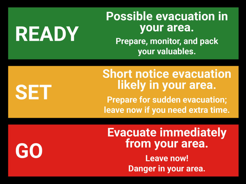
READY – SET – GO evacuation status chart

Ready - Set - Go graphic for evacuation status

GO (red) = Evacuate immediately from your area. Leave now – danger in your area.

SET (yellow) = Short notice evacuation likely in your area. Prepare for sudden evacuations. Leave now if you need extra time.

READY (green) = Possible evacuation in your area. Prepare, monitor, and pack your valuables.

Garfield County: 
REGISTER FOR ALERTS – garco911.com
FACEBOOK – facebook.com/garcosheriff
INCIDENT UPDATES/SUBSCRIBE – garfieldcounty.net
Derby Fire information page: https://www.facebook.com/DerbyFire/

Derby Fire: Evacuations lifted by the Garfield County Sheriff’s Office

Lee Fire: Zone downgrades for Garfield County

Garfield County Sheriff’s Office

EVACUATION update from Garfield County Sheriff’s Office:

LEE FIRE

8.22.25, noon: Two zones in Garfield County are downgrading status now due to decreased fire activity and successful suppression efforts.

Zone 80 is in READY (GREEN) West of Highway 13 in north Garfield County
Zone 81 is in READY (GREEN) West and south of Zone 80 in north Garfield County

Lee Fire zones in Garfield County remain in READY (GREEN) status at this time.

INTERACTIVE EVACUATION MAP: http://bit.ly/lee-fire-zones (check your address)

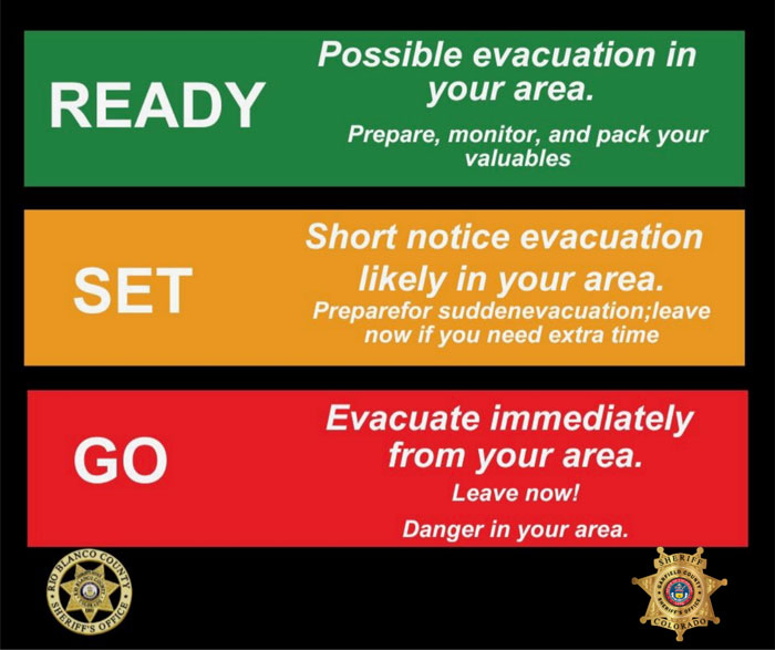
Ready Set Go graphic

As a reminder:

GO = Evacuate immediately from your area. Leave now – danger in your area.

SET = Short notice evacuation likely in your area. Prepare for sudden evacuations. Leave now if you need extra time.

READY = Possible evacuation in your area. Prepare, monitor, and pack your valuables.

Garfield County: REGISTER FOR ALERTS – garco911.com
INCIDENT UPDATES/SUBSCRIBE – garfieldcounty.net
FACEBOOK – facebook.com/garcosheriff
Elk and Lee Fire Information page: https://www.facebook.com/elkleefire

Lee Fire: Zone downgrades for Garfield County

Derby Fire: Community meeting Friday, August 22

Northern Rockies Complex Incident Management Team 3

Please join us for a community meeting Friday, August 22, 2025 at 6:30 pm at the Gypsum Town Hall, 50 Lundgren Blvd, Gypsum, CO. Spanish language translation will be available. We will try again with live streaming.

The Derby Incident Operations Section Chief and Incident Commander, as well as the Eagle County Sheriff, will provide an update on the current situation and operational strategies. Officials will be available for questions after the update.

For more information on the Derby Fire, please visit: https://inciweb.wildfire.gov/incident…/cowrf-derby-fire

Email: 2025.Derby@firenet.gov
Fire Information Line: 970-355-3283 (staffed 8am – 8pm)

Derby Fire: Community meeting Friday, August 22

Derby Fire: Leave evacuated areas for safety

Eagle County Sheriff’s Office, Garfield County Sheriff’s Office, Eagle County Emergency Operations Center

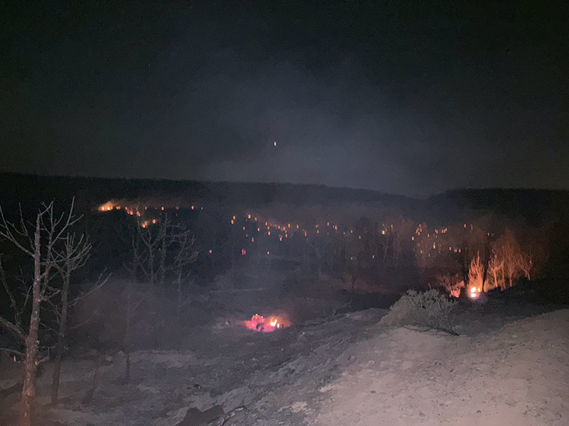
August 21, 10:45 a.m. – The Derby Fire grew to more than 2600 acres in the past two days. Winds are moving in a southward direction today, August 21, and outflow winds pushing downward risk fire spread today.

Eagle County: Zone 266-A along the Colorado River Road has been moved to pre-evacuation status. The Colorado River Road remains closed to non-residents and unapproved traffic. Evacuations remain in place for Sweetwater and Red Dirt Creek.

Leave evacuated areas now for your immediate safety.

Evacuations remain in place for zones 327, 330, 266, 264, and 265, including Sweetwater Road and sections of the Colorado River Road from Sweetwater to Red Dirt Creek both in Eagle and Garfield counties. Click on the map to identify the zones: Genasys Protect

SWEETWATER, SWEETWATER LAKE AND TO WEST END OF CR 150 – Evacuation in place
COLORADO RIVER ROAD – Evacuation in place
DERBY MESA – Pre-evacuation, prepare to leave, monitor updates
Follow directions from authorities.
For evacuation questions, please call the Eagle County Evacuation information line: 970-328-7400.

Evacuated areas are lawfully closed to public access.  

Eagle County’s evacuation center

Gypsum Recreation Center, 52 Lundgren Blvd, Gypsum, is open from 9 a.m. to 5 p.m. 

Services available at the Evacuation Center include: information sharing, resource connection, showers, restroom facilities and light refreshments. It is located near The Salvation Army Canteen that provides meals for evacuees and first responders.The evacuation center is not accepting or in need of any donations at this time. Monetary donations can be made to the Salvation Army. 

Parking at the Eagle Sports Complex for evacuees
The Eagle Sports Complex parking lot is available for evacuees to park and camp, providing easy access to their livestock being sheltered at the fairgrounds.

Move animals to safety

For anyone seeking support for livestock and animal evacuations, please contact Connie Melzer of CSU Extension, 970-471-8043. The Eagle County Fairgrounds are closed to public use at this time. 

For support with smaller animals, dogs and cats, please call the Eagle County Animal Services #970-471-3763.

Smoke impacts

If visibility is less than 5 miles, smoke has reached levels that are unhealthy. Stay indoors and consider creating a clean air space or leaving the area temporarily.

The fire is now managed by the Northern Rockies Complex Incident Management 3 team. 

Derby Fire email
2025.derby@firenet.gov 

Derby Fire phone
For Derby Fire questions, please contact: 970-355-3283.

Derby Fire official information:

FACEBOOK – Derby fire @derbyfire
INCIWEB – Derby Fire
WHITE RIVER NATIONAL FOREST – facebook.com/whiteriverNF @whiteriverNF

_______________

EAGLE COUNTY INFO
REGISTER FOR ALERTS – 911 alerts
INCIDENT UPDATES – EC Emergency or Reachwell app
FACEBOOK – facebook.com/eaglecountyso @eaglecountyso

________________

GARFIELD COUNTY INFO
REGISTER FOR ALERTS – 911 alerts or Reachwell app
INCIDENT UPDATES / SUBSCRIBE – Garfield County emergency
FACEBOOK – facebook.com/garcosheriff @garcosheriff

Allow government alerts on your mobile phone (like Amber alerts) to receive emergency alerts released for geographical areas.

For areas without cell service, consider using a GPS device that allows satellite notifications.


Incendio de Derby: abandone las áreas evacuadas por seguridad

Oficina del Sheriff del Condado de Eagle, Oficina del Sheriff del Condado de Garfield, Centro de Operaciones de Emergencia del Condado de Eagle

21 de agosto, 10:45 a. m. – El incendio Derby se extendió a más de 2600 acres en los últimos dos días. Los vientos se mueven hacia el sur hoy, 21 de agosto, y los vientos de salida que empujan hacia abajo podrían provocar la propagación del incendio.

Condado de Eagle: La zona 266-A a lo largo de Colorado River Road ha sido puesta en estado de preevacuación. Colorado River Road permanece cerrada al tráfico no autorizado y a los no residentes. Se mantienen las evacuaciones en Sweetwater y Red Dirt Creek.

Abandone las áreas evacuadas ahora para su seguridad inmediata .

Se mantienen las evacuaciones en las zonas 327, 330, 266, 264 y 265, incluyendo Sweetwater Road y tramos de Colorado River Road desde Sweetwater hasta Red Dirt Creek, en los condados de Eagle y Garfield. Haga clic en el mapa para identificar las zonas: Genasys Protect

SWEETWATER, SWEETWATER LAKE Y HASTA EL EXTREMO OESTE DE LA CR 150: Evacuación en marcha.
COLORADO RIVER ROAD: Evacuación en marcha.
DERBY MESA: Preevacuación, prepárese para partir, esté atento a las actualizaciones
. Siga las instrucciones de las autoridades.
Para preguntas sobre evacuación, llame a la línea de información de evacuación del Condado de Eagle: 970-328-7400.

Las áreas evacuadas están legalmente cerradas al público.  

Centro de evacuación del condado de Eagle

El Centro de Recreación Gypsum, 52 Lundgren Blvd, Gypsum, está abierto de 9 a. m. a 5 p. m. 

Los servicios disponibles en el Centro de Evacuación incluyen: intercambio de información, conexión con recursos, duchas, baños y refrigerios. Está ubicado cerca de la cantina del Ejército de Salvación, que ofrece comidas a evacuados y personal de primera respuesta. El centro de evacuación no acepta ni necesita donaciones actualmente. Se pueden hacer donaciones monetarias al Ejército de Salvación. 

Estacionamiento en el Complejo Deportivo Eagle para evacuados
El estacionamiento del Complejo Deportivo Eagle está disponible para que los evacuados puedan estacionar y acampar, proporcionando fácil acceso a su ganado que se encuentra refugiado en el recinto ferial.

Trasladar a los animales a un lugar seguro

Si necesita ayuda para la evacuación de ganado y animales, comuníquese con Connie Melzer, de la Extensión de la CSU, al 970-471-8043. El recinto ferial del condado de Eagle está cerrado al público en este momento. 

Para obtener ayuda con animales más pequeños, perros y gatos, llame a los Servicios para Animales del Condado de Eagle al # 970-471-3763.

Impactos del humo

Si la visibilidad es inferior a 8 kilómetros, el humo ha alcanzado niveles insalubres. Permanezca en el interior y considere crear un espacio de aire limpio o abandonar el área temporalmente.

El incendio ahora está siendo controlado por el equipo de Gestión de Incidentes 3 del Complejo Northern Rockies. 

Correo electrónico de Derby Fire
: 2025.derby@firenet.gov 

Teléfono de Derby Fire
Para preguntas sobre Derby Fire , comuníquese al: 970-355-3283.

Información oficial de Derby Fire:

FACEBOOK – Derby Fire @derbyfire INCIWEB – Derby Fire BOSQUE NACIONAL WHITE RIVER – facebook.com/whiteriverNF @whiteriverNF

_______________

INFORMACIÓN DEL CONDADO DE EAGLE
REGÍSTRESE PARA RECIBIR ALERTAS – Alertas del 911 ACTUALIZACIONES DE INCIDENTES – Aplicación EC Emergency o Reachwell FACEBOOK – facebook.com/eaglecountyso @eaglecountyso

________________

INFORMACIÓN DEL CONDADO DE GARFIELD
REGÍSTRESE PARA RECIBIR ALERTAS – Alertas del 911 o aplicación Reachwell ACTUALIZACIONES DE INCIDENTES / SUSCRÍBASE – Emergencia del condado de Garfield FACEBOOK – facebook.com/garcosheriff @garcosheriff

Permita que las alertas gubernamentales en su teléfono móvil (como las alertas Amber) reciban alertas de emergencia publicadas para áreas geográficas.

Para áreas sin servicio celular, considere usar un dispositivo GPS que permita notificaciones satelitales.

Derby Fire: Leave evacuated areas for safety