12.2.25, 8:47 p.m. – I-70 is open at mile marker 90 eastbound, RIFLE.
12.2.25, 7:29 p.m. – I-70 is closed at mile marker 90 eastbound, RIFLE, due to an accident.
REGISTER for emergency alerts at garco911.com
SUBSCRIBE for emails from this feed - click at upper right
VIEW: Inciweb wildfires | CDOT routes | NOAA storms | CAIC avalanches
Garfield County | Accessibility
12.2.25, 8:47 p.m. – I-70 is open at mile marker 90 eastbound, RIFLE.
12.2.25, 7:29 p.m. – I-70 is closed at mile marker 90 eastbound, RIFLE, due to an accident.
12.2.25, 8:56 p.m. – I-70 is open at mile marker 97 westbound, Silt.
12.2.25, 7:27 p.m. – I-70 is closed at mile marker 97 westbound, SILT, due to an accident.
December 2, 2025, 11:28 a.m. – Westbound Interstate 70 is open at mile marker 121, Grizzly Creek.
December 2, 2025, 11:16 a.m. – Westbound Interstate 70 is closed at mile marker 121, Grizzly Creek, due to an accident.
December 2, 2025, 11:15 a.m. – I-70 is now open at mile marker 105, New Castle.
December 2, 2025, 9:27 a.m. – Eastbound Interstate 70 is closed at mile marker 105, just before the New Castle exit, due to an accident. Traffic is being diverted at Silt.
10.16.25, 9:35 am – Hwy 82 is open, both lanes, at mile-marker 13 EB, 2 miles east of Carbondale.
10.16.25, 9:17 am – Hwy 82 has one lane open at mile-marker 13 EB, 2 miles east of Carbondale, due to an accident.
10.16.25, 8:22 am – Hwy 82 is closed at mile-marker 13 EB, 2 miles east of Carbondale, due to an accident.
9.27.25, 12:15 pm – I-70 is open at mile marker 133 westbound, Dotsero.
9.27.25, 10:33 am – I-70 is closed at mile marker 133 westbound, Dotsero, for additional work from last night’s accident. Unknown time to reopening.
9.27.25, 12:40 am – I-70 is open at mile marker 130 westbound, Dotsero.
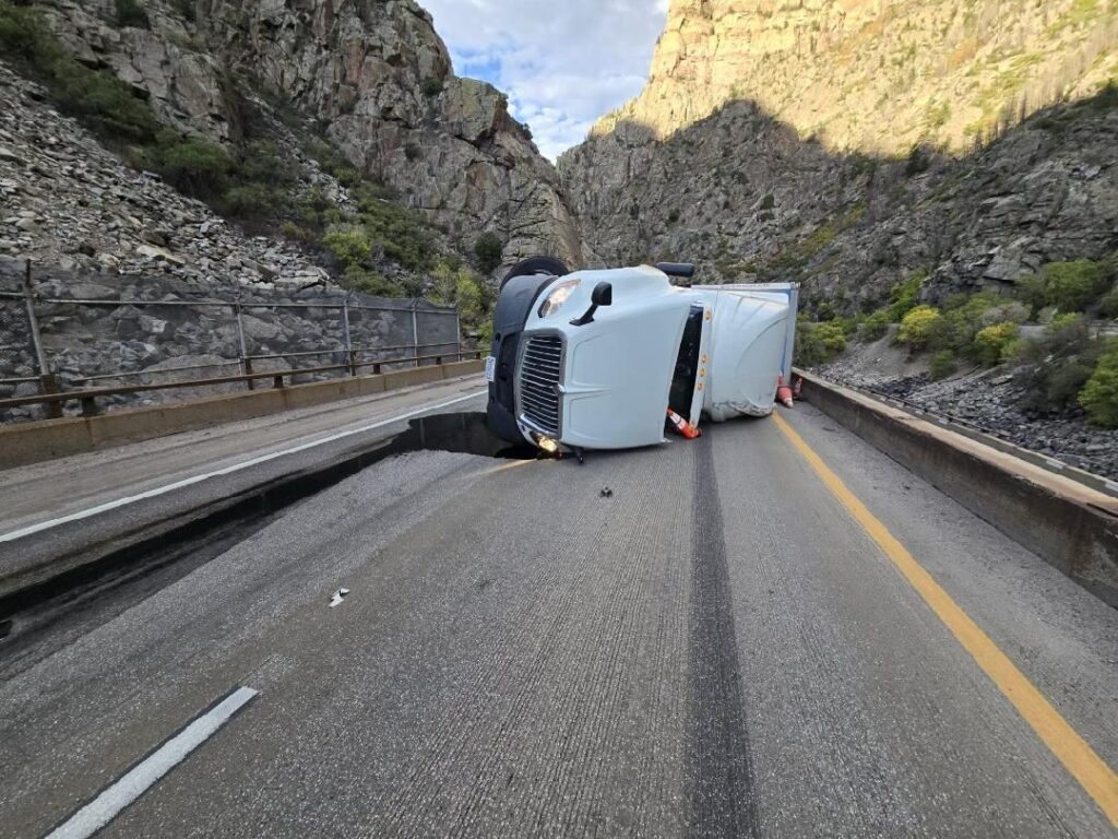
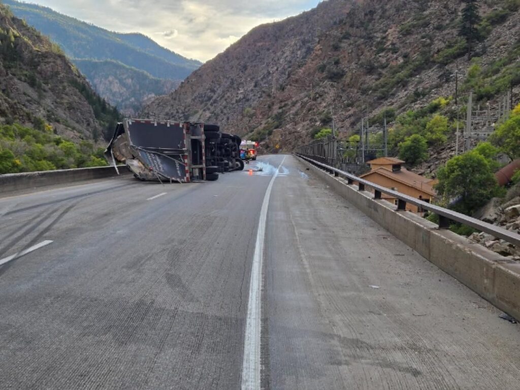
9.26.25, 9:03 pm – Westbound I-70 is closed to through traffic at Wolcott, Exit 157, due to a rolled over CMV crash that took place in Glenwood Canyon at around 6 p.m. this evening. CDOT and its partners worked tirelessly to avoid putting a detour in place — estimated to add four hours of travel time — but unfortunately, I-70 through Glenwood Canyon is an extremely challenging section of road with limited space for operations. There is no estimated time of re-opening.
The detour that is in place directs commuters onto US 6 via exit 157, Wolcott, north on HWY 131 toward Steamboat, west on US 40 towards Craig, south on HWY 13, and back on I-70 near Rifle.
Check COtrip.org or the #COtrip Planner app for more information and road updates.
9.26.25, 6:00 pm – I-70 is closed at mile marker 130 westbound, Dotsero, due to an accident.
9.7.25, 2:42. a.m. – I-70 is open at mile marker 103 westbound, near New Castle.
9.7.25, 12:57 a.m. – I-70 is closed at mile marker 103 westbound, near New Castle, due to an accident.
9.6.25, 7:50 p.m. – I -70 is open at mile marker 116 / Glenwood Springs, eastbound, Glenwood Canyon.
9.6.25, 4:43 p.m. – I-70 is closed at mile marker 116 eastbound, Glenwood Springs, due to an accident in the canyon.