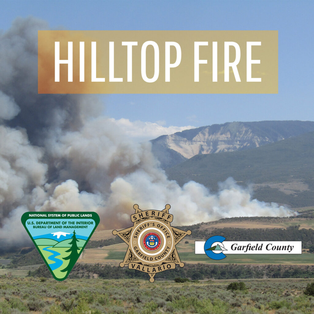
Garfield County Sheriff’s Office
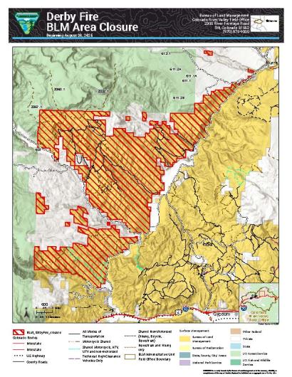
June 23, 2026 – Garfield County, CO, the Garfield County Sheriff’s Office, Bureau of Land Management (BLM) lands, the U.S. Forest Service in Garfield County, and the seven Fire Districts in Garfield County are implementing Stage 2 Fire Restrictions effective at 1 a.m. Friday June 26, 2026. This applies to all of Garfield County.
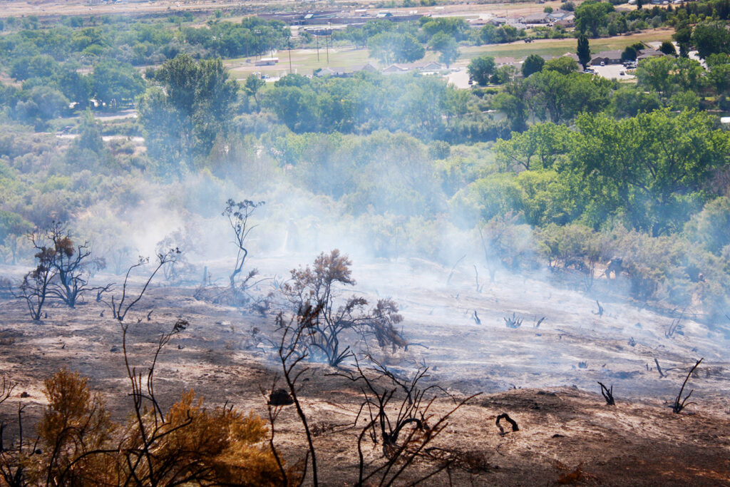
This decision was made with thoughtful consideration. We look at the data as well as the potential for significant wildfires and balance it with the impacts to our community. The current active wildfires in Colorado have already stretched our available resources and effected our ability to respond as necessary.
Fire restrictions are implemented based on specific criteria to including moisture content of vegetation, weather outlooks, human risk factors, and firefighting resource availability.
What Stage 2 Fire Restrictions mean in Garfield County
- A) Use of fireworks – Not permitted
- B) Burn permits (General) – No burn permits will be issued. All previously issued burn permits are cancelled.
- C) Recreational fires- No recreational fires
- D) Cooking fires – Use caution and keep attended. Cooking devices must be clean (including gas cylinder) and in proper working order.
- Gas Grills – No permit required.
- Charcoal and other solid fuel grills and cookers – No permit required in developed areas only.
- In undeveloped areas, a permit from the local fire department may be required.
- E) Smoking – Open smoking allowed in developed areas.
- In undeveloped areas, allowed only in an enclosed vehicle or building.
- F) Welding and spark-emitting cutting (hot work) – Developed area: Use extreme caution and take preventative measures as necessary.
- Undeveloped area: Industrial use only. A permit from the local fire department may be required. Must be in a cleared area at least 10 feet in diameter with a designated lookout. Must have Class A fire extinguishing capabilities readily available.
- G) Operating of internal combustion engine-powered equipment, such as chainsaws, hand-held tools, or generators without a spark-arresting device is prohibited. If described equipment does have a spark arresting device, you must have Class A fire extinguishing capabilities readily available, and round-point shovel (36? length minimum) shall be readily available for use.
- H) Other internal combustion engine-powered equipment, such as tractors and mowers: Operate with extreme caution paying special attention in areas subject to extreme conditions that may be susceptible to ignition (dry weeds and grasses, etc.).
- I) Use of explosives, explosive targets and steel or tracer bullets – not permitted.
- J) Use of firearms – steel jacket/core bullets (armor piercing) and tracer bullets are expressly prohibited. It is the responsibility of each independent range to ensure safe fire conditions at all times the range is in use. This includes: mitigating fuels that may potentially catch fire; monitoring downrange conditions/impacts; maintaining the ability to access and rapidly extinguish fires; notifying the local fire department immediately in the event of a fire of any size. Keeping a usable fire-extinguishing application method on hand is strongly recommended.
- If shooting at an unattended range – including those on public and private property – the responsibility for ensuring safe fire conditions falls on the independent shooter.
By definition:
A “developed area” is an area, whether within city limits or rural, that is groomed, manicured and or watered, where grasses, brush and trees are regularly attended to by landowner. This includes residential and business areas, improved recreational areas, parks and other common areas.
“Undeveloped areas” are lands that are not groomed, manicured, or watered; where grasses, brush and trees have been allowed to grow in a natural environment. This includes green belts that are not landscaped or manicured, open space lands, non-manicured parklands, and other areas where the fire hazard presented by the vegetation is determined by the authority having jurisdiction or designee to be an undue wildland fire hazard.
The mission of the Garfield County Sheriff’s Office is to provide solutions for the people through professional, ethical and compassionate conduct.