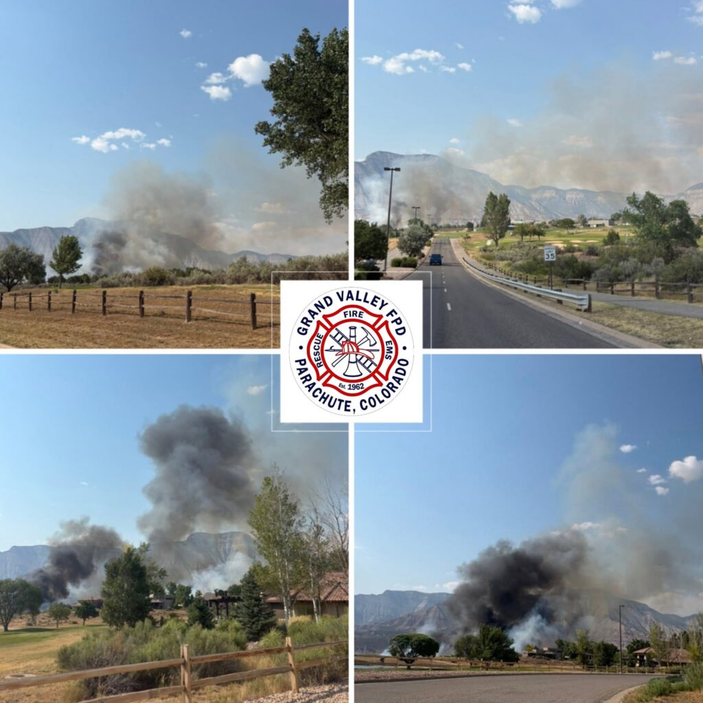
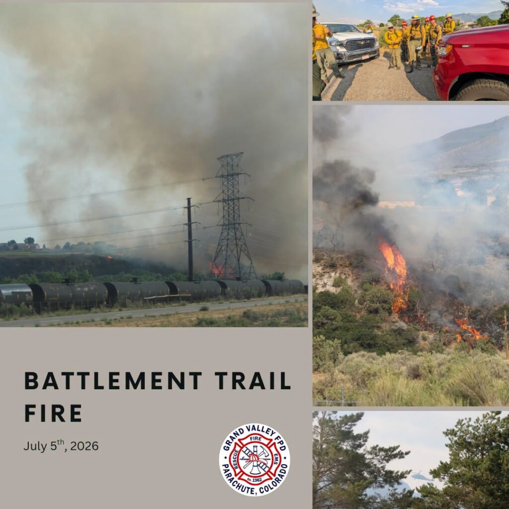
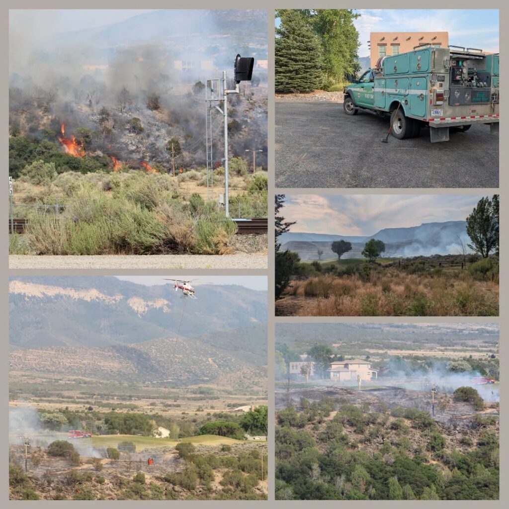
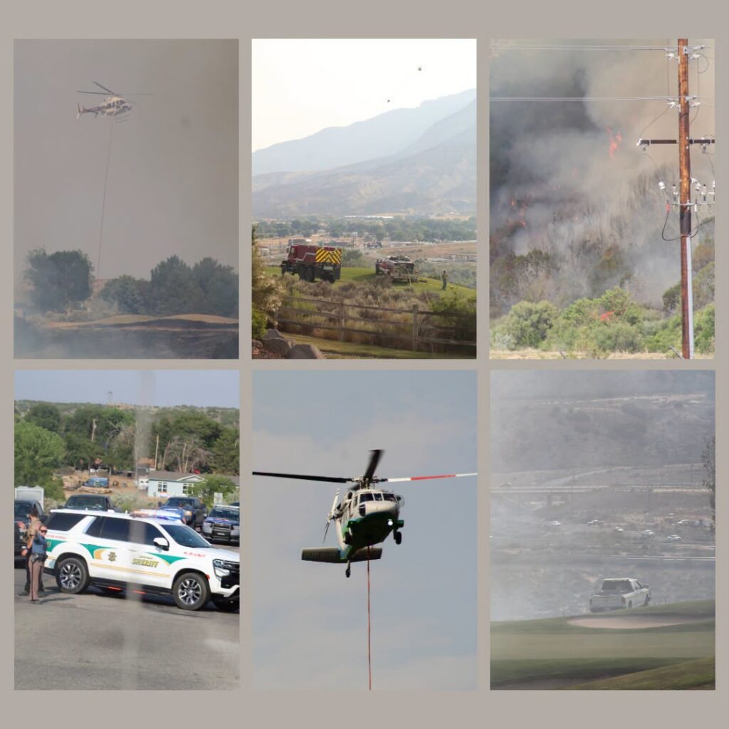
Garfield County Sheriff’s Office
Garfield County is utilizing its Ready, Set, Go evacuation status for the Dry Creek Fire near Rifle. Evacuations are in place around Grass Mesa (Go) and Set status is in place for the area near Hunter Mesa.
Evacuation map
The evacuation map link is https://bit.ly/drycreekfire.
GO
GO – Evacuate immediately from your area. LEAVE NOW! Danger in your area.
GO status is in place east of Grass Mesa, along the ridge line east of Grass Mesa Road, including Gage Road and County Road 319 to the east.
Nobody should access this area at this time.
SET
SET – Short notice evacuation likely in your area. Prepare for sudden evacuation; leave now if you need extra time.
SET status is in place for the area near Hunter Mesa and now Grass Mesa.
The area east of the fire around Hunter Mesa is in SET status. This includes the junction of County Road 315 and Brandon Way to the northeast to a half mile south of County Road 333 and County Road 315 to the southeast. The southern boundary is a half mile north of County Road 322 (Shaeffer). The northern boundary heads straight west at the Brandon Way and County Road 315 junction.
SET status is also now in place for Grass Mesa, inlcuding Grass Mesa Road, south from the intersection with County Road 319, including Sunset Lane, Rodeo Drive, Coyote Trail, Arrowhead Trail, and roads north to Mustang Mesa Trail, including Cedar Breaks Road, Quicksilver Way, and Quick Silver Court.
During an evacuation
Prepare to evacuate quickly and safely in the event of an emergency. Planning and preparation can help you take quick action.
Ready Set Go
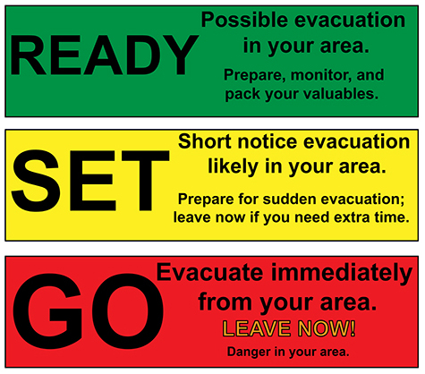
Ready – possible evacuation in your area. Prepare, monitor and pack your valuables.
Set – Short notice evacuation likely in your area. Prepare for sudden evacuation; leave now if you need extra time.
Go – Evacuate immediately from your area. LEAVE NOW! Danger in your area.
Information channels
Garfield County Sheriff’s Office
FACEBOOK – Garfield County Sheriff’s Office #facebook.com/GarcoSheriff
Garfield County Emergency Management
INCIDENT UPDATES/SUBSCRIBE – garfieldcounty.net
Garfield County Emergency Communications Authority
REGISTER FOR ALERTS – garco911.com and Reachwell mobile app
Colorado River Fire Rescue
CRFR website | facebook: #ColoradoRiverFireRescue
______________________________
Oficina del Sheriff del Condado de Garfield
Estado de evacuación por el incendio de Dry Creek
El condado de Garfield ha activado su protocolo de evacuación “Preparados, Listos, ¡Adelante!” para el incendio de Dry Creek cerca de Rifle. Se han ordenado evacuaciones en los alrededores de Grass Mesa (¡Adelante!) y se ha activado el protocolo “Listos, Listos, ¡Adelante!” para la zona cercana a Hunter Mesa.
Mapa de evacuación
El enlace al mapa de evacuación es https://bit.ly/drycreekfire.
FUERA
Evacúa tu zona de inmediato SAL AHORA! Hay peligro en su zona.
Grass Mesa para el incendio de Dry Creek cerca de Rifle
Se ha habilitado la vía pública al este de Grass Mesa, a lo largo de la cresta al este de Grass Mesa Rd, incluyendo Gage Rd y County Road 319 al este.
Nadie debería acceder a esta zona en este momento.
LISTO
Es probable una evacuación con poco aviso en tu zona. Preparate para una evacuación repentina; sal ahora si necesitas tiempo adicional.
Alerta: Es probable que se produzca una evacuación con poca antelación en su zona. Prepárese para una evacuación repentina; salga ahora si necesita más tiempo.
Se ha establecido un estado de alerta para el área cercana a Hunter Mesa y Grass Mesa.
El área al este del incendio, alrededor de Hunter Mesa, se encuentra bajo estado de incendio controlado. Esto incluye desde el cruce de la carretera del condado 315 y Brandon Way al noreste hasta medio kilómetro al sur del cruce de la carretera del condado 333 y la carretera del condado 315 al sureste. El límite sur se ubica medio kilómetro al norte de la carretera del condado 322 (Shaeffer). El límite norte se extiende directamente hacia el oeste en el cruce de Brandon Way y la carretera del condado 315.
También se ha establecido el estado de seguridad para Grass Mesa, incluyendo Grass Mesa Road, al sur de la intersección con County Road 319, incluyendo Sunset Lane, Rodeo Drive, Coyote Trail, Arrowhead Trail y las carreteras al norte hasta Mustang Mesa Trail, incluyendo Cedar Breaks Road, Quicksilver Way y Quick Silver Court.
El límite occidental es la zona Go en Grass Mesa.
Durante una evacuación
Prepárese para evacuar rápida y seguramente en caso de emergencia. La planificación y la preparación pueden ayudarle a actuar con rapidez.
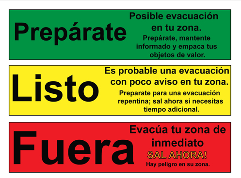
Prepárate: Posible evacuación en tu zona. Prepárate, mantente informado y empaca tus objetos de valor.
Listo: Es probable una evacuación con poco aviso en tu zona. Preparate para una evacuación repentina; sal ahora si necesitas tiempo adicional.
Fuera: Evacúa tu zona de inmediato SAL AHORA! Hay peligro en su zona.
Canales de información
Oficina del Sheriff del Condado de Garfield
FACEBOOK – Oficina del Sheriff del Condado de Garfield # facebook.com/GarcoSheriff
Gestión de Emergencias del Condado de Garfield
ACTUALIZACIONES DE INCIDENTES/SUSCRÍBASE – garfieldcounty.net
Autoridad de Comunicaciones de Emergencia del Condado de Garfield
REGÍSTRESE PARA RECIBIR ALERTAS – garco911.com y la aplicación móvil Reachwell
Rescate de Incendios del Río Colorado
Sitio web de CRFR | facebook: # ColoradoRiverFireRescue