Glenwood Springs Fire Department
Mountain Shadows Fire
9.24.23, 10:26 am – Glenwood Springs, Colorado – The prompt and coordinated efforts of multiple agencies successfully prevented the Mountain Shadows Fire from causing damage to nearby residential structures. As a result, residents were able to safely return to their homes after being evacuated due to the brush fire.
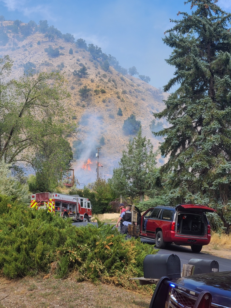
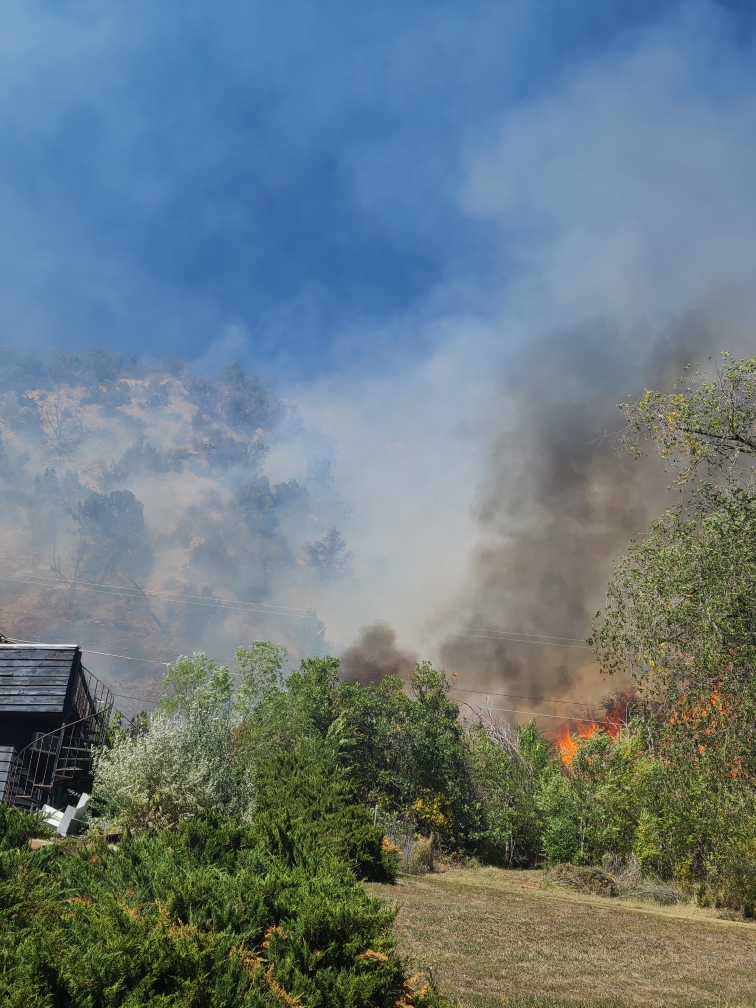
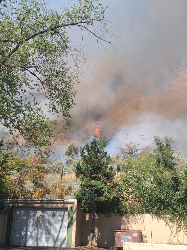
At approximately 1:33 p.m. on Saturday, September 23rd, the Glenwood Springs Fire Department was called to a brush fire in West Glenwood. Upon arrival, firefighters discovered an active blaze covering an acre of land, accompanied by heavy smoke. The fire was being pushed towards the east by strong westerly winds. Firefighters swiftly identified structures at risk and collaborated with the Garfield County Sheriff’s Office to address evacuation concerns, all while actively fighting the fire. Thanks to the efforts of the Garfield County Sheriff, threatened structures were safely evacuated.
Securing the fire line closest to the residential area was a priority for the firefighters. Their successful efforts in doing so allowed for the lifting of evacuation orders before evening.
The current size of the fire is approximately 4. 5 acres. The Glenwood Springs Fire Department monitored the fire throughout the night and will continue mop-up operations today.
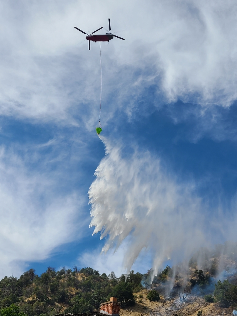
According to Incident Commander Jesse Hood, “Quick action from initial attack and mutual aid resources were paramount in the suppression of this fire. The utilization of air resources gave command insight into fire behavior and helicopter bucket drops cooled hot spots so ground crews could access and extinguish as the terrain was steep.”
In response to the incident, a total of 5 engines, 1 water tender, 1 command vehicle, 2 investigation vehicles, a Chinook helicopter, a multi-mission aircraft, air attack, and two ambulances, along with over 30 firefighters, were deployed from Colorado River Fire Rescue, Carbondale and Rural Fire Protection District, Roaring Fork Fire Authority, and the Upper Colorado Fire Management Unit. Additionally, the Colorado State Patrol, Garfield County Sheriff’s Office, Glenwood Springs Police Department, and Glenwood Electric all responded to this incident. The water supply for the Chinook helicopter was provided by Storm King Ranch. The Glenwood Springs Fire Department is immensely grateful for the response from these partner agencies.
No injuries have been reported at this time.
The cause of the fire is currently under investigation by the Garfield County Fire Investigation Team, in collaboration with the Glenwood Springs Fire Department.
Garfield County Sheriff’s Office
9.23.23, 4:57 pm – Evacuation are lifted and roadblocks open, except no driving onto Mt Shadows Dr. Residents may walk in. Garfield County Sheriff’s Office facebook
Glenwood Springs Fire Department
9.23.23, 4:59 pm – We have been working with crews from Colorado River Fire Rescue, Carbondale & Rural Fire Protection District, and Upper Colorado River Interagency Fire Management Unit on the Mountain Springs Fire in West Glenwood Springs, which is approximately 4.5 acres. Crews are focusing on securing line closest to residential structures. Glenwood Fire facebook
Garfield County Sheriff’s Office
9.23.23, 2:20 pm – Evacuate immediately
Mountain Shadows subdivision and residents north of Donegan Road: Due to the fire, evacuate the area immediately.
All people and small animals should go to Glenwood Springs Mall.
Follow updates Glenwood Springs Fire Department
Brush fire in West Glenwood Springs with structures threatened. Active flames and smoke visible. Please stay away from this area and allow first responders to do their job.
Glenwood Springs Police Dept and Garfield County Sheriff’s Office facebook
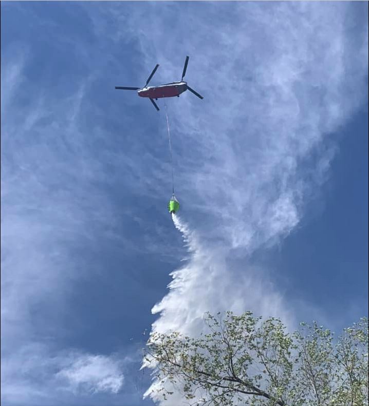
Photo of water drop from GCSO facebook page