Rocky Mountain Area Complex Incident Management Team 3
Casey Cheesbrough, Jay Miller, Ben Sanders Incident Commanders
Derby Fire update document
Derby Fire update document – Spanish
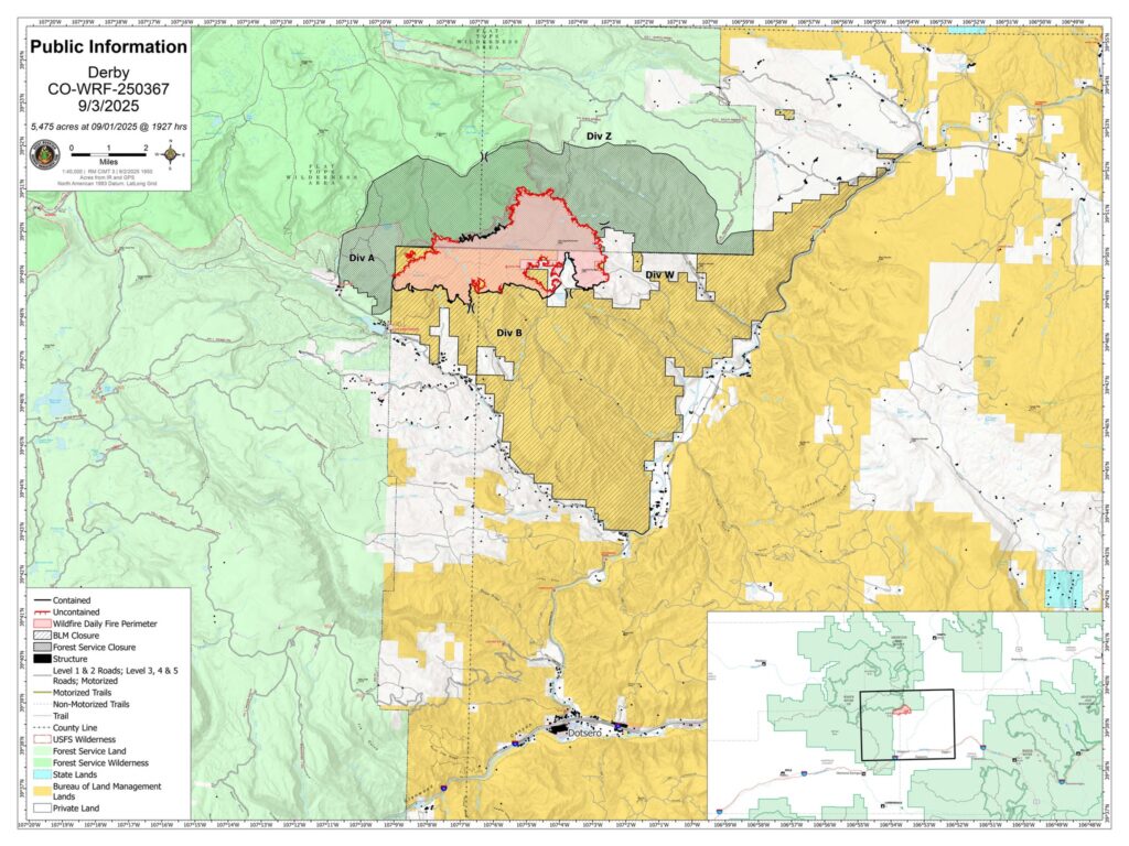
Derby Fire public information map
Derby Fire public information map – Spanish
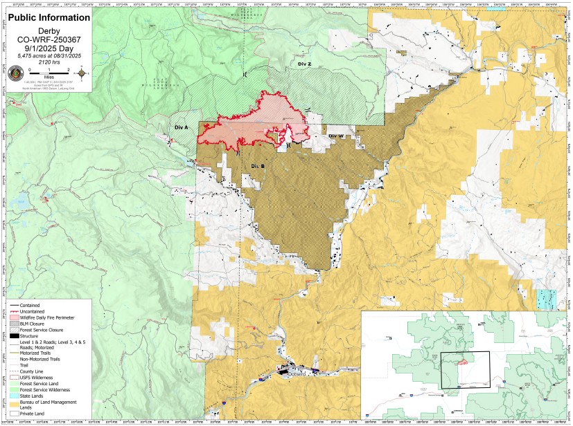
Derby Fire public progression map
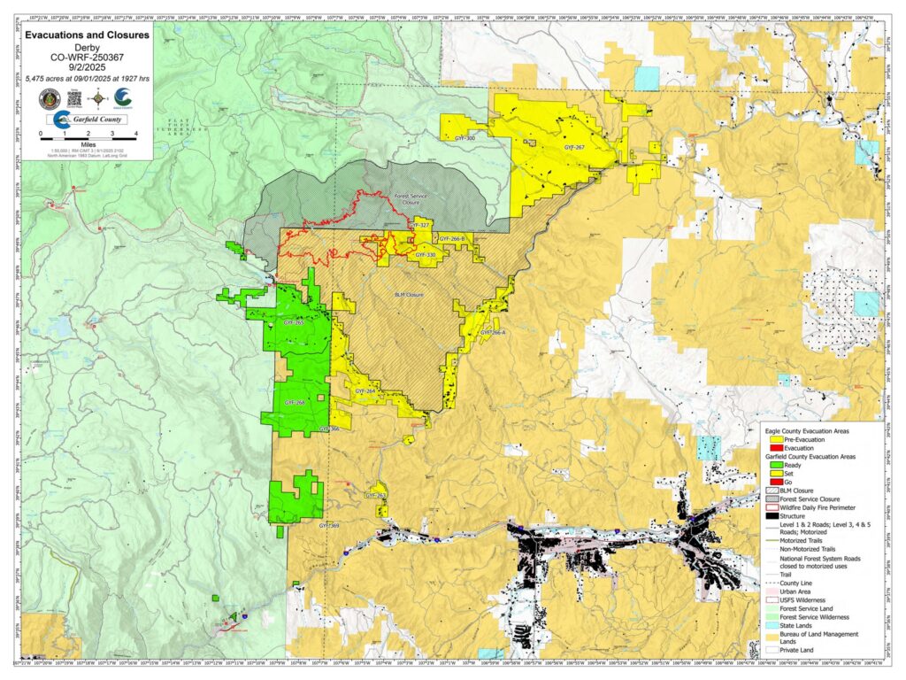
Derby Fire public evacuation and closure map
Fire Information: 970-355-3283
Size: 5,475
Total Personnel: 530
Containment: 41%
Cause: Lightning
Resources: 5 Aircraft | 8 Hand Crews | 20 Engines | 9 Heavy Equipment
Current Situation:
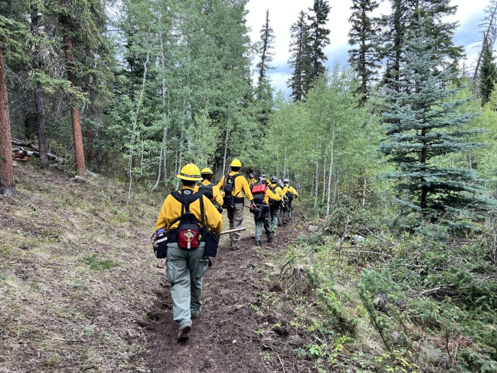
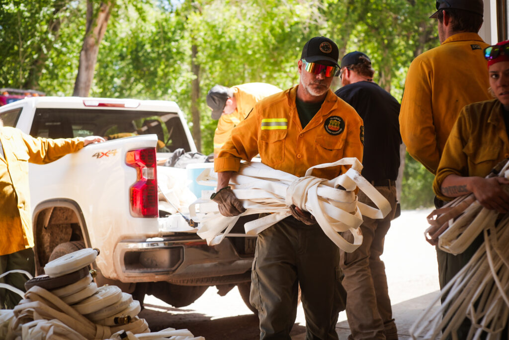
Containment rose to 41% on the Derby Fire. Crews completed handline construction in steep and rugged terrain, on the southwest corner of the fire and are beginning to move north. Support from helicopter water drops in the area helped to mitigate the lingering heat along the southern fire edge. Firefighters are also working to repair impacts of fire suppression actions on the natural environment.
Four separate groups of firefighters and support personnel have been flown into different parts of the fire and will continue their work on Wednesday. A hotshot crew on the north flank of the fire started line construction along the fire’s edge, using Minimum Impact Suppression Tactics (MIST), in the West Fork Sheep Creek drainage of the Flat Tops Wilderness where heat has been detected. These tactics include cold trailing, using bare hands to feel for residual heat along the fire’s edge to reduce the amount of line construction. They will be assisted by aerial assets and anticipate working at this location for the
next few days.
A wildland fire Suppression Module (SMOD) is taking action to extinguish hotspots outside of the western fire perimeter. A SMOD is a smaller firefighting crew that is used for Initial Attack and other specific fire suppression needs. More than 70 firefighters are working on the eastern fire edge. Hand crews are traveling by helicopter to reduce travel time, moving further north, continuing handline construction.
On the southeastern edge of the fire, an unmanned aircraft system identified several heat pockets. Crews plan to focus suppression efforts on those areas Wednesday.
Weather & Fire Behavior:
Dry weather continues across the area. Temperatures will be in the lower 80’s with humidity once again dropping into the mid-teens. However, there will be cloud cover and a slight chance of rain keeping the potential for fire spread minimal.
Evacuations and Closures:
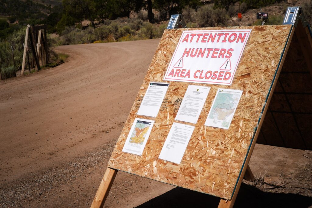
Fire restrictions and closures remain in place for Bureau of Land Management – Colorado River Valley Field Office areas, https://www.blm.gov/ucr-fire-restrictions. Restrictions and closures remain in the White River National Forest. See Critical and Fire Restriction Forest Alerts at https://www.fs.usda.gov/r02/whiteriver/alerts/.
The Colorado River, Sweetwater, and Red Dirt Creek roads have all been reopened, and the Garfield County and Eagle County Sheriff’s Offices have changed the evacuation status for Sweetwater Valley, Sheep Creek and Red Dirt Creek areas to pre-evacuation (READY) status: https://arcg.is/S0u4G and www.ecemergency.org.
A Temporary Flight Restriction (TFR) is in place over the Derby Fire. For more information, visit https://tfr.faa.gov.
Derby Fire Information
Phone: 970-355-3283 (8:00 a.m. to 8:00 p.m.)
Email: 2025.Derby@firenet.gov
Actualización Diaria para el Incendio Derby – el 3 de Septiembre de 2025
Equipo 3 del Manejo de Incidentes Complejos del Área de las Montañas Rocosas
Comandantes del Incidente: Casey Cheesbrough, Jay Miller, Ben Sanders
Información del incendio: 970-355-3283
Acres: 5,475
Personal: 530
Contención: 41%
Causa: Rayos
Recursos: 5 aeronaves | 8 cuadrillas | 20 camiones de bomberos | 9 equipo pesados
Situación Actual:
La contención del incendio Derby aumentó al 41%. Los equipos completaron la construcción de la línea de fuego manual en un terreno escarpado y accidentado, en el extremo suroeste del incendio, y están comenzando a avanzar hacia el norte. El apoyo de helicópteros que lanzaban agua en la zona ayudó a mitigar el calor persistente en el borde sur del incendio. Los bomberos también están trabajando para reparar el impacto de las acciones de extinción en el entorno natural.
Cuatro grupos separados de bomberos y personal de apoyo se han trasladado a diferentes partes del incendio y continuarán su trabajo el miércoles. Un equipo “hotshot” (bomberos expertos) en el flanco norte del incendio comenzó la construcción de la línea a lo largo del borde del incendio, utilizando Tácticas de Supresión de Mínimo Impacto (MIST, por sus siglas en inglés), en la cuenca del arroyo West Fork Sheep de Flat Tops Wilderness, donde se ha detectado calor. Estas tácticas incluyen el uso de rastreo en frío, que significa el uso las manos desnudas para detectar calor residual a lo largo del borde del incendio y así reducir la cantidad de construcción de la línea. Contarán con la asistencia de recursos aéreos y prevén trabajar en este lugar durante los próximos días.
Un Módulo de Supresión de Incendios Forestales (SMOD, por sus siglas en inglés) está tomando medidas para extinguir los focos de calor fuera del perímetro oeste del incendio. Un SMOD es un equipo de extinción de incendios más pequeño que se utiliza para el Ataque Inicial y otras necesidades específicas de extinción. Más de 70 bomberos trabajan en el límite este del incendio. Equipos de bomberos se desplazan en helicóptero para reducir el tiempo de desplazamiento y continúan la construcción de las líneas de extinción.
En el límite sureste del incendio, un sistema de aeronaves no tripuladas (dron) identificó varios focos de calor. Los equipos planean centrar las labores de extinción en esas zonas el miércoles.
Clima y el comportamiento del fuego:
El tiempo seco continúa en la zona. Las temperaturas rondarán los 80°F, con una humedad que volverá a descender a alrededor de 15%. Sin embargo, habrá nubosidad y una ligera probabilidad de lluvia, lo que minimiza la posibilidad de propagación del incendio.
Evacuaciones y cierres:
Las restricciones y cierres por incendios se permanecen vigentes en los terrenos bajo la administración de la Oficina de Administración de Tierras del Valle del Río Colorado: https://www.blm.gov/ucr-fire-restrictions. Las restricciones y cierres por incendios se permanecen vigentes en Bosque Nacional White River. Consulte las alertas forestales críticas y de restricciones por incendios en https://www.fs.usda.gov/r02/whiteriver/alerts/.
Se han reabierto los caminos Colorado River Road, Sweetwater Road y Red Dirt Creek. Los condados Eagle y Garfield han cambiado el estado de evacuación para los residentes de Sweetwater Valley, Sheep Creek, y Red Dirt Creek a “LISTOS”, la etapa 1 del proceso de evacuaciones que significa que “esté preparados”: https://arcg.is/S0u4G o https://sites.google.com/eaglec…/ecemergencyespanol/inicio.
Se ha establecido una Restricción Temporal de Vuelo (TFR) sobre el incendio Derby. Para más información, visite https://tfr.faa.gov.
Información sobre el Incendio Derby
Teléfono: 970-355-3283 (de 8:00 a. m. a 8:00 p. m.)
Correo electrónico: 2025.Derby@firenet.gov
______________________________________________________________________________________
Derby Fire official information
FACEBOOK – Derby fire @derbyfire
INCIWEB – Derby Fire
WHITE RIVER NATIONAL FOREST – facebook.com/whiteriverNF @whiteriverNF
_______________
EAGLE COUNTY INFO
DERBY FIRE: EAGLE COUNTY EVACUATION MAP REGISTER FOR ALERTS – 911 alerts
INCIDENT UPDATES – EC Emergency or Reachwell app
FACEBOOK – facebook.com/eaglecountyso @eaglecountyso
________________
GARFIELD COUNTY INFO
DERBY FIRE: GARFIELD COUNTY INTERACTIVE EVACUATION MAP
REGISTER FOR ALERTS – 911 alerts or Reachwell app
INCIDENT UPDATES / SUBSCRIBE – Garfield County emergency
FACEBOOK – facebook.com/garcosheriff @garcosheriff