Rocky Mountain Complex Incident Management Team 3
Air Operations provided these images of fire impacted areas. These images also illustrate protection efforts of values at risk.
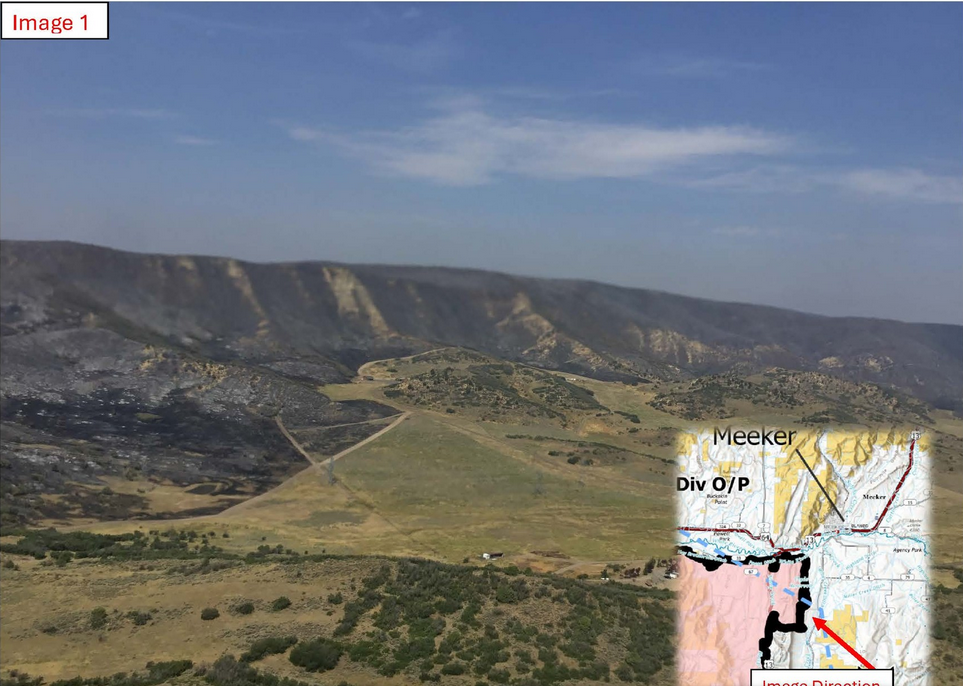
Image 1: Looking west from just south of Meeker, Colorado. The burned area is referred as the Hogback and is where the Lee Fire had crossed Highway 13 on Wednesday August 6, 2025. The image was taken from Air Operations on August 14, 2025.
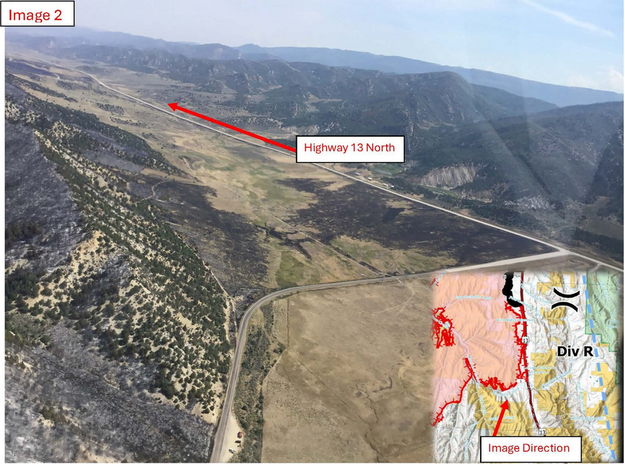
Image 2: This is an image from Air Operations on August 14, 2025, of the intersection of County Road 5 and Highway 13. This is the southeast edge of the fire where strategic firing operations were conducted to improve the road systems as a holding point with the highest probability of success. These firing operations remove fuels to allow firefighters the opportunity to go direct and hold the fire as it approaches and runs out of fuels to burn.
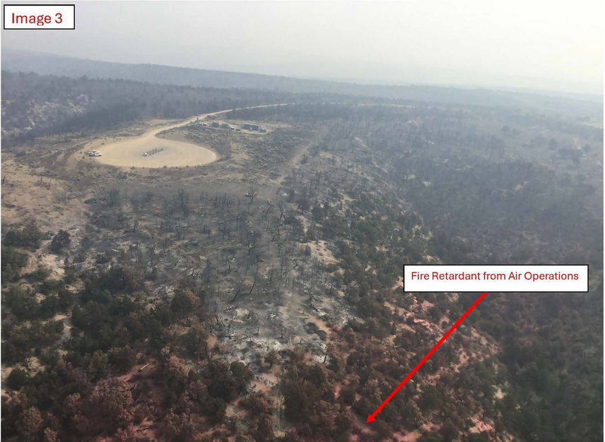
Image 3: This image, taken on August 14, 2025, shows how the Lee Fire burned around the oil and gas infrastructure and minimized the impacts to operations. Some critical values at risk, such as oil and gas infrastructure, have buffer requirements for vegetation for reducing wildfire risk. The lower half of this photo illustrates use of fire retardant during suppression efforts.

Image 4: This image, taken on August 14, 2025, is looking south of Highway 64, just west of the Town of Meeker. On August 6, 2025, when the Lee Fire crossed Highway 13 and progressed towards Meeker, firefighters protected critical values at risk, such as private properties, as seen in this image of the burned area on the northeast edge of the fire.
Rio Blanco County Sheriff’s Office
BLM Colorado Fire
Bureau of Land Management – Colorado
Colorado Division of Fire Prevention and Control
U.S. Forest Service – White River National Forest
Bureau of Land Management Fire
Garfield County Sheriff’s Office – Colorado
Colorado Parks and Wildlife