Northern Rockies Complex Incident Management Team 3
Here is this morning’s update from Northern Rockies Complex Incident Management Team 3
Derby Fire information
Public phone line: (970) 355-3282
Office hours: 8 a.m. to 8 p.m.
2025.derby@firenet.gov
August 20, 2025, 1:03 p.m. –
Northern Rockies Complex Incident Management Team 3, Incident Commander Mike Behrens
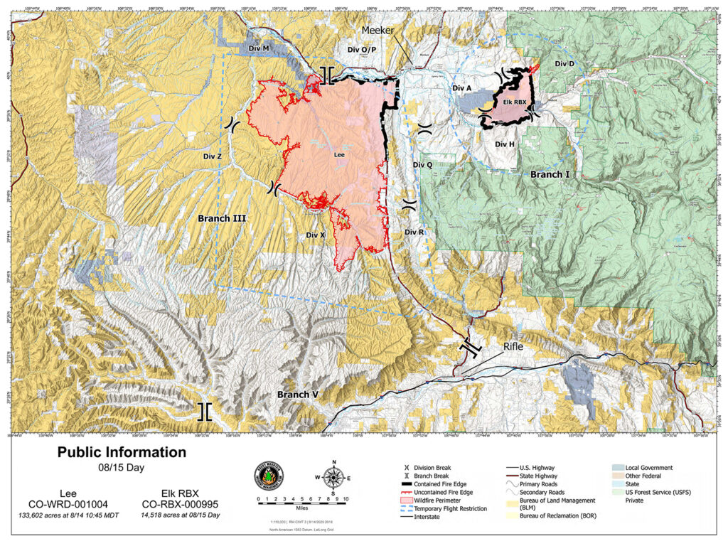
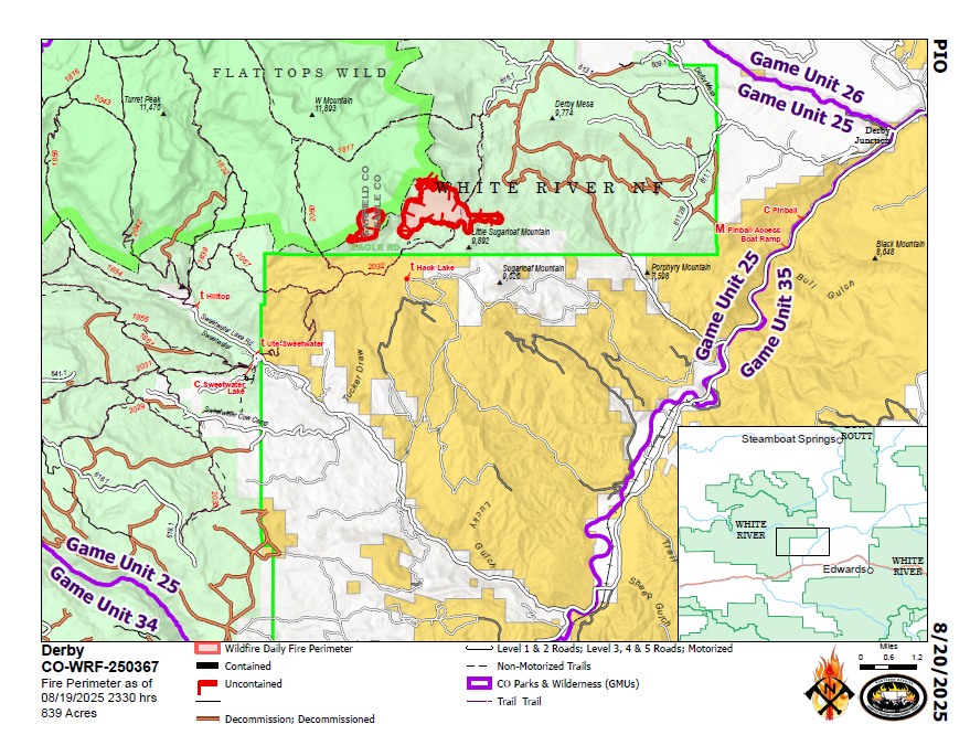
Location: 13 miles west of Dotsero, CO
Start date: 8/16/2025;
Cause: Lightning
Size: Est. 839 acres
Completion/containment: 0%
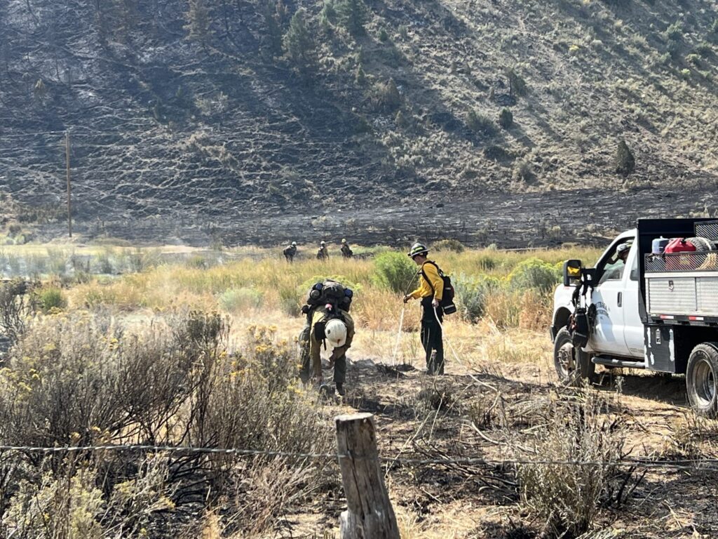
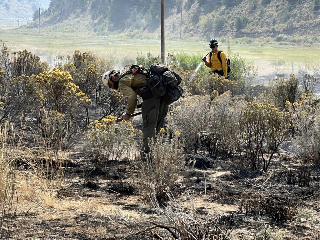
80 est. Total Personnel; 6 Engines; 1 Helicopter; 2 Hand Crews
KEY MESSAGE:
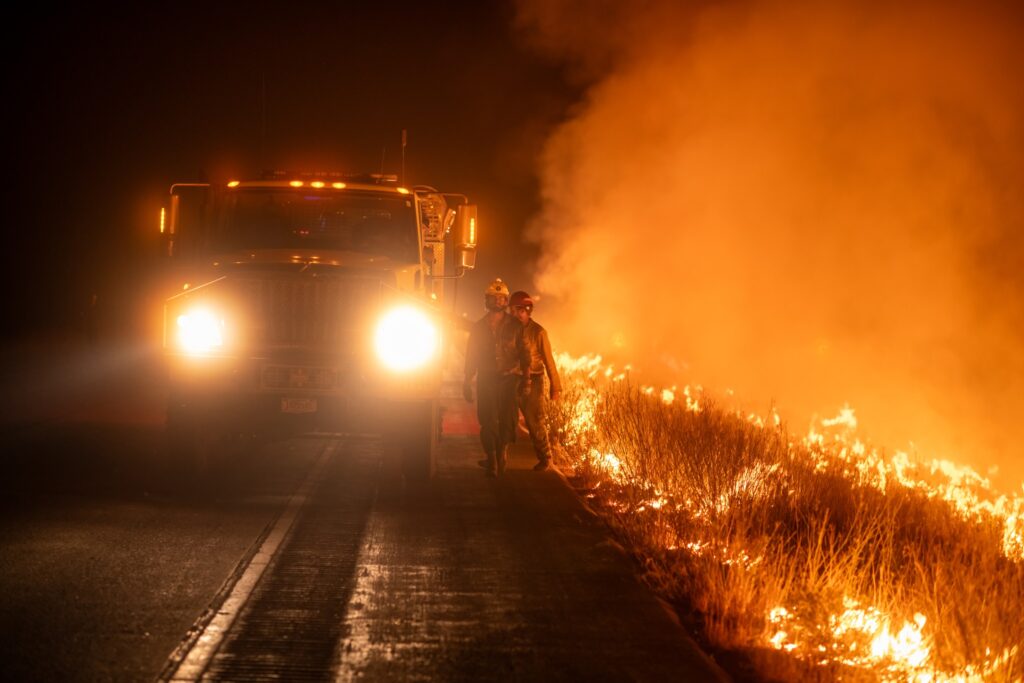
The Derby Fire was ignited by lightning on an extremely steep cliff face in a remote area near the Flat Tops Wilderness on Saturday evening. Initial attack efforts by smokejumpers on Sunday were hindered by rollout of burning material, repeatedly igniting the slope below the main fire.
Protection of life and property are key objectives for managing this fire.
CURRENT STATUS:
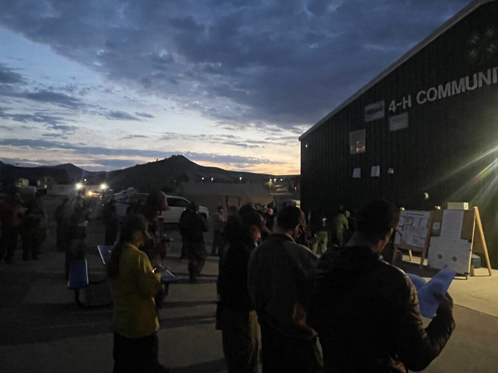
The Complex Incident Management Team managing the Turner Gulch Fire assumed command of the Derby Fire this morning. The Derby Fire saw significant growth overnight. Structure assessment and area reconnaissance will be the main tasks for fire managers today, determining the best strategy to engage the fire with the most likelihood for success, while ensuring for firefighter safety. The remote location makes access very difficult.
WEATHER AND FIRE BEHAVIOR
Several consecutive days of hot and dry weather with very low relative humidities has made fuels across Colorado very receptive. Late today, an incoming monsoonal front may produce erratic outflow winds, increasing rates of spread in the subalpine fir and lodgepole pine forest.
CLOSURES AND SPECIAL MESSAGES
Eagle County has issued an evacuation notice that Residents of Sweetwater Rd and areas of the Colorado River Rd from Sweetwater to Red Dirt Creek must be out of their homes by 12pm noon Wed, 8/20. Derby Mesa Loop remains in pre-evacuation status. Pre-evacuation notice and other information on the Derby Fire is available at www.ecemergency.org. The White River National Forest has issued a public closure for firefighter and public safety in Eagle and Garfield Counties in the vicinity of the fire. The closure is within the Blanco and Eagle-Holy Cross Ranger Districts. The closure order and map are posted at https://www.fs.usda.gov/r02/whiteriver. Specific closure information and maps will also be posted on InciWeb at https://inciweb.wildfire.gov/incident…/cowrf-derby-fire as they are implemented.
Derby Fire Official Information
FACEBOOK – Derby fire @derbyfire
INCIWEB – Derby Fire
WHITE RIVER NATIONAL FOREST – facebook.com/whiteriverNF @whiteriverNF
_______________
EAGLE COUNTY INFO
REGISTER FOR ALERTS – 911 alerts
INCIDENT UPDATES – EC Emergency or Reachwell app
FACEBOOK – facebook.com/eaglecountyso@eaglecountyso
________________
GARFIELD COUNTY INFO
REGISTER FOR ALERTS – 911 alerts or Reachwell app
INCIDENT UPDATES / SUBSCRIBE – Garfield County emergency
FACEBOOK – facebook.com/garcosheriff @garcosheriff
Derby Fire: actualización matutina
Actualización de esta mañana del Equipo de Gestión de Incidentes 3 del Complejo de las Montañas Rocosas del Norte Información sobre el incendio de Derby Teléfono público: (970) 355-3282 Horario de oficina: 8:00 a. m. a 8:00 p. m. 2025.derby@firenet.gov 20 de agosto de 2025, 1:03 p. m. – Equipo de Gestión de Incidentes 3 del Complejo de las Montañas Rocosas del Norte, Comandante del incidente: Mike Behrens Ubicación: 21 kilómetros al oeste de Dotsero, Colorado Fecha de inicio: 16/8/2025 Causa: Rayo Superficie: 839 acres aprox. Finalización/contención: 0 % Personal total estimado: 80 personas; 6 camiones cisterna; 1 helicóptero; 2 cuadrillas de mano
MENSAJE CLAVE:
El incendio Derby se originó el sábado por la noche a causa de un rayo en un acantilado extremadamente empinado en una zona remota cerca de Flat Tops Wilderness. Los esfuerzos iniciales de ataque de los paracaidistas el domingo se vieron obstaculizados por el despliegue de material incendiario, que incendió repetidamente la ladera bajo el incendio principal.
La protección de vidas y propiedades es fundamental para la gestión de este incendio.
ESTADO ACTUAL:
El Equipo de Gestión de Incidentes Complejos, encargado del incendio Turner Gulch, asumió el mando del incendio Derby esta mañana. El incendio Derby experimentó un crecimiento significativo durante la noche. La evaluación de la estructura y el reconocimiento del área serán las principales tareas de los responsables del incendio hoy, determinando la mejor estrategia para combatir el incendio con la mayor probabilidad de éxito, garantizando al mismo tiempo la seguridad de los bomberos. La ubicación remota dificulta mucho el acceso.
CLIMA Y COMPORTAMIENTO DEL INCENDIO
Varios días consecutivos de clima cálido y seco con humedades relativas muy bajas han hecho que los combustibles en todo Colorado sean muy receptivos. Más tarde hoy, un frente monzónico entrante podría producir vientos de salida erráticos, aumentando las tasas de propagación en los bosques de abetos subalpinos y pinos lodgepole.
CIERRES Y MENSAJES ESPECIALES
El Condado de Eagle ha emitido un aviso de evacuación indicando que los residentes de Sweetwater Rd y las áreas de Colorado River Rd, desde Sweetwater hasta Red Dirt Creek, deben abandonar sus hogares antes del mediodía del miércoles 20 de agosto. Derby Mesa Loop permanece en estado de preevacuación. El aviso de preevacuación y otra información sobre el incendio Derby están disponibles en www.ecemergency.org. El Bosque Nacional White River ha emitido un cierre público para la seguridad de los bomberos y el público en los condados de Eagle y Garfield, en las cercanías del incendio. El cierre se aplica a los distritos de guardabosques de Blanco y Eagle-Holy Cross. La orden de cierre y el mapa están publicados en www.fs.usda.gov/r02/whiteriver. También se publicará información específica de cierre y mapas en InciWeb en https://inciweb.wildfire.gov/incident…/cowrf-derby-fire a medida que se implementen.