Eagle County Sheriff’s Office / Garfield County Sheriff’s Office
Eagle/Garfield Counties– Starting Monday, August 25 at 10 a.m., the Eagle County and Garfield County Sheriff’s Offices, in coordination with Derby Fire managers, will begin transitioning Sweetwater Valley and Sheep Creek from full evacuation to pre-evacuation (SET) status. This change will allow residents to return to their properties while remaining prepared to leave if conditions change.
We’re grateful to offer limited access so residents can rest in their homes for now. That said, livestock are not to be returned yet, as fire activity could shift and safety remains our top priority.
“This is not a full repopulation, as the risks are still very high and residents should remain prepared to vacate at any time,” said James Van Beek, Eagle County Sheriff.
To protect both residents and fire crews, travel within the restricted area must remain extremely limited. If travel is essential, the best window is between 10:00 a.m. and 4:00 p.m. when conditions are safest and least disruptive to emergency operations.
We are working closely with the school district to ensure continuity for students. School buses will run at their normal times, with pickup and drop-off occurring at regular locations. This is considered essential travel and will be supported throughout the response.
Please avoid all nonessential movement, as fire activity remains unpredictable and crews need clear access to operate safely.
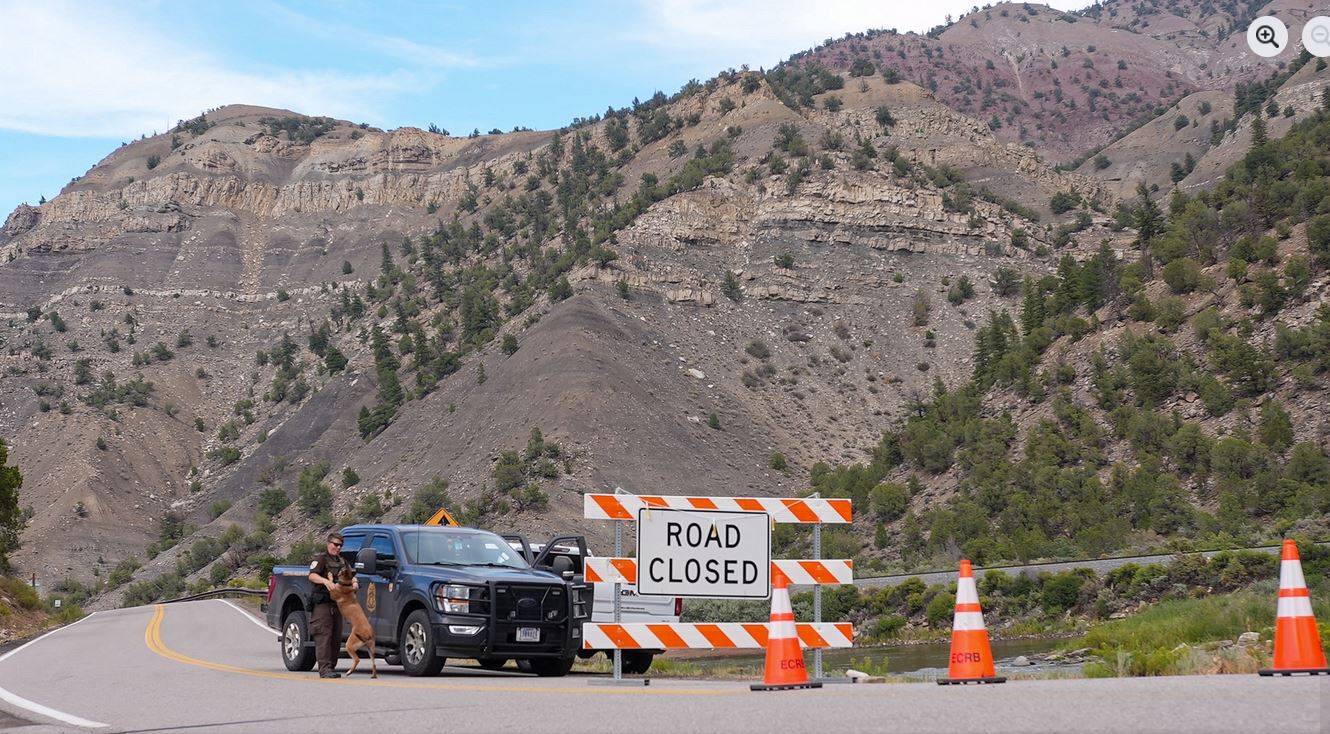
Reentry for residents will require verification of residency or property ownership at the closure points on Colorado River Road. Federal Law Enforcement and Sheriff’s Office personnel will facilitate this process and issue authorized passes accordingly.
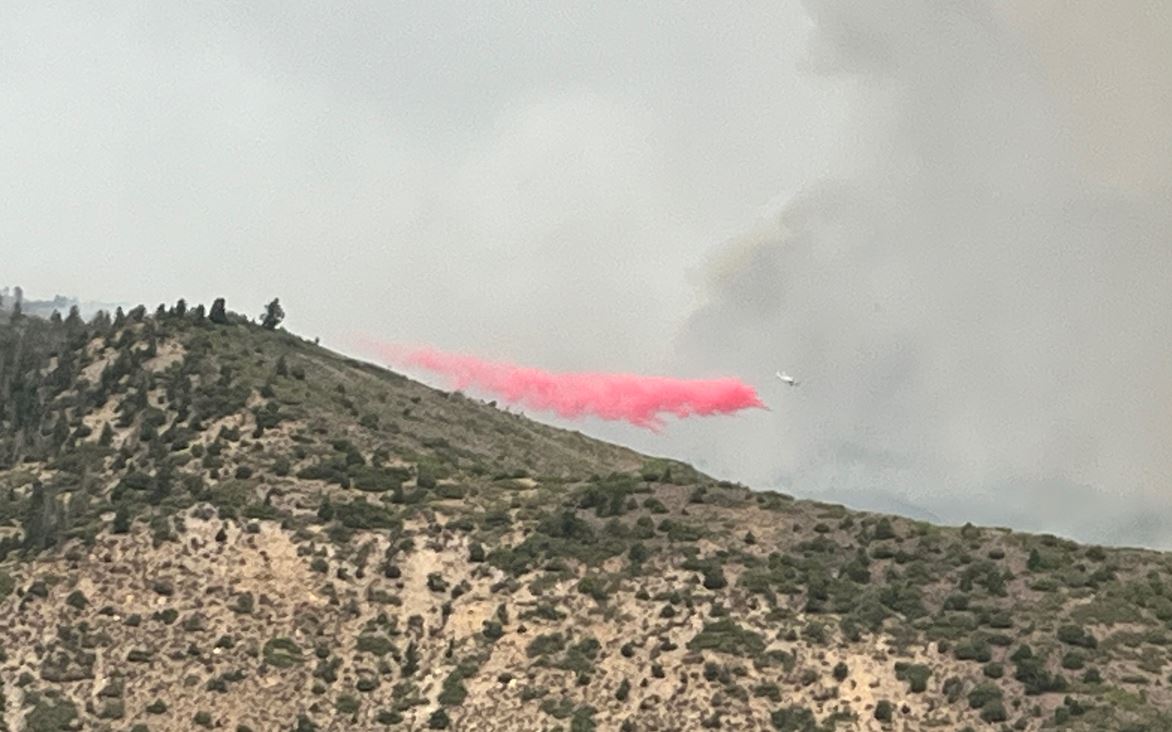
Firefighting and structure protection efforts are actively underway, and residents traveling to and from their properties should be aware that fuel reduction and defensible space work may result in noticeable changes to the landscape. Please do not move or drive over any firefighting or water-handling equipment, as crews may need to use it quickly if fire conditions shift. Always yield to fire personnel and vehicles, and know that teams are working diligently to restore full access and help residents return to their homes permanently.
If you hold a permit issued by the Forest Service or Bureau of Land Management, please coordinate directly with the issuing agency to arrange access to the restricted area. “Thank you for your cooperation. It will allow us to provide this limited access for evacuated residents and still ensure safety for you and firefighting personnel, “ Sheriff Van Beek said.
Derby Fire official information
FACEBOOK – Derby fire @derbyfire
INCIWEB – Derby Fire
WHITE RIVER NATIONAL FOREST – facebook.com/whiteriverNF @whiteriverNF
_______________
EAGLE COUNTY INFO
DERBY FIRE: EAGLE COUNTY EVACUATION MAP
REGISTER FOR ALERTS – 911 alerts
INCIDENT UPDATES – EC Emergency or Reachwell app
FACEBOOK – facebook.com/eaglecountyso @eaglecountyso
________________
GARFIELD COUNTY INFO
DERBY FIRE: GARFIELD COUNTY INTERACTIVE EVACUATION MAP
REGISTER FOR ALERTS – 911 alerts or Reachwell app
INCIDENT UPDATES / SUBSCRIBE – Garfield County emergency
FACEBOOK – facebook.com/garcosheriff @garcosheriff
Incendio de Derby: Los residentes tendrán acceso limitado a Sweetwater Valley y Sheep Creek
Condados de Eagle y Garfield: a partir del lunes 25 de agosto a las 10 a.m., las Oficinas del Sheriff del condado de Eagle y del condado de Garfield, en coordinación con los administradores del incendio Derby, comenzarán a hacer la transición de Sweetwater Valley y Sheep Creek del estado de evacuación total al estado de pre-evacuación (SET). Este cambio permitirá a los residentes regresar a sus propiedades y permanecer preparados para irse si las condiciones cambian.
Agradecemos poder ofrecer acceso limitado para que los residentes puedan descansar en sus hogares por ahora. Dicho esto, el ganado no debe regresar todavía, ya que la actividad del fuego podría cambiar y la seguridad sigue siendo nuestra principal prioridad.
“Esta no es una repoblación total, ya que los riesgos siguen siendo muy altos y los residentes deben estar preparados para desalojar en cualquier momento ”, dijo James Van Beek, sheriff del Condado de Eagle.
Para proteger tanto a los residentes como a los bomberos, el acceso dentro del área restringida debe permanecer extremadamente limitado. Si desplazarse es esencial, el mejor momento para hacerlo es entre las 10:00 a.m. y las 4:00 p.m., cuando las condiciones son más seguras y menos disruptivas para las operaciones de emergencia.
Estamos trabajando en estrecha colaboración con el distrito escolar para garantizar continuidad para los estudiantes. Los autobuses escolares funcionarán en sus horarios habituales y las recogidas y bajadas se realizarán en los lugares habituales. Este se considera un viaje esencial y contará con apoyo durante toda la respuesta.
Evite todo movimiento que no sea esencial, ya que la actividad del incendio sigue siendo impredecible y los equipos necesitan acceso libre para operar de manera segura.
El reingreso de los residentes requerirá verificación de residencia o propiedad en los puntos de cierre en Colorado River Road. El personal de las fuerzas del orden federales y de la Oficina del Sheriff facilitarán este proceso y emitirán pases autorizados en consecuencia.
Los esfuerzos de extinción de incendios y protección de estructuras están en marcha activamente, y los residentes que viajan hacia y desde sus propiedades deben ser conscientes de que la reducción de combustible y el trabajo de espacio defendible pueden resultar en cambios notables en el paisaje. No mueva ni conduzca sobre ningún equipo contra incendios o de manejo de agua, ya que los equipos podrían necesitar usarlo rápidamente si las condiciones del incendio cambian. Ceda siempre el paso al personal de bomberos y a los vehículos, y sepa que los equipos están trabajando diligentemente para restablecer el acceso total y ayudar a los residentes a regresar a sus hogares de forma permanente.
Si tiene un permiso emitido por el Servicio Forestal o la Oficina de Administración de Tierras, coordine directamente con la agencia emisora para organizar el acceso al área restringida.
“Gracias por su cooperación. Eso nos permitirá brindar este acceso limitado a los residentes evacuados y aún así garantizar su seguridad y la del personal de bomberos“, dijo el Sheriff Van Beek.
Información oficial de Derby Fire
FACEBOOK – Derby Fire @derbyfire
INCIWEB – Derby Fire
BOSQUE NACIONAL WHITE RIVER – facebook.com/whiteriverNF @whiteriverNF
_______________
INFORMACIÓN DEL CONDADO DE EAGLE
INCENDIO DE DERBY: MAPA DE EVACUACIÓN DEL CONDADO DE EAGLE
REGÍSTRESE PARA RECIBIR ALERTAS – Alertas del 911 ACTUALIZACIONES DE INCIDENTES – Emergencia EC o aplicación Reachwell FACEBOOK – facebook.com/eaglecountyso @eaglecountyso
________________
INFORMACIÓN DEL CONDADO DE GARFIELD
DERBY FIRE: MAPA DE EVACUACIÓN INTERACTIVO DEL CONDADO DE GARFIELD
REGÍSTRESE PARA RECIBIR ALERTAS: alertas del 911 o aplicación Reachwell
ACTUALIZACIONES DE INCIDENTES / SUSCRÍBASE: emergencia del condado de Garfield
FACEBOOK: facebook.com/garcosheriff @garcosheriff