Rocky Mountain Area Complex Incident Management Team 3
Casey Cheesbrough, Jay Miller, Ben Sanders Incident Commanders
Derby Fire update document
Derby Fire update document – Spanish
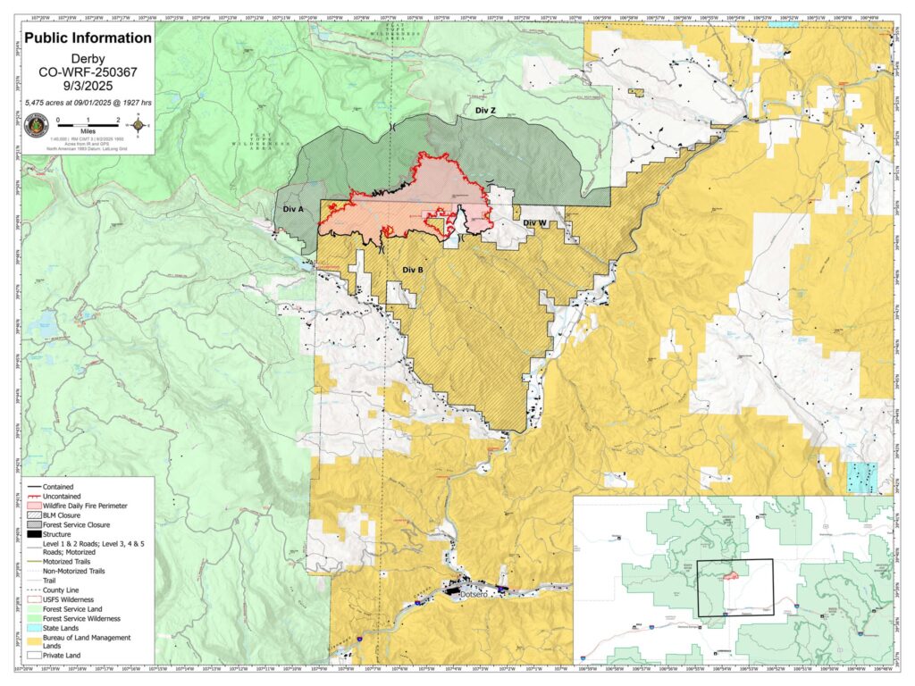
Derby Fire public information map
Derby Fire public information map – Spanish
Size: 5,453
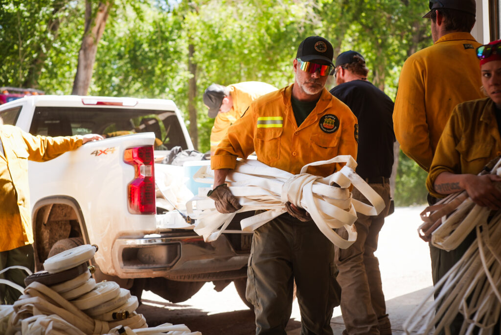
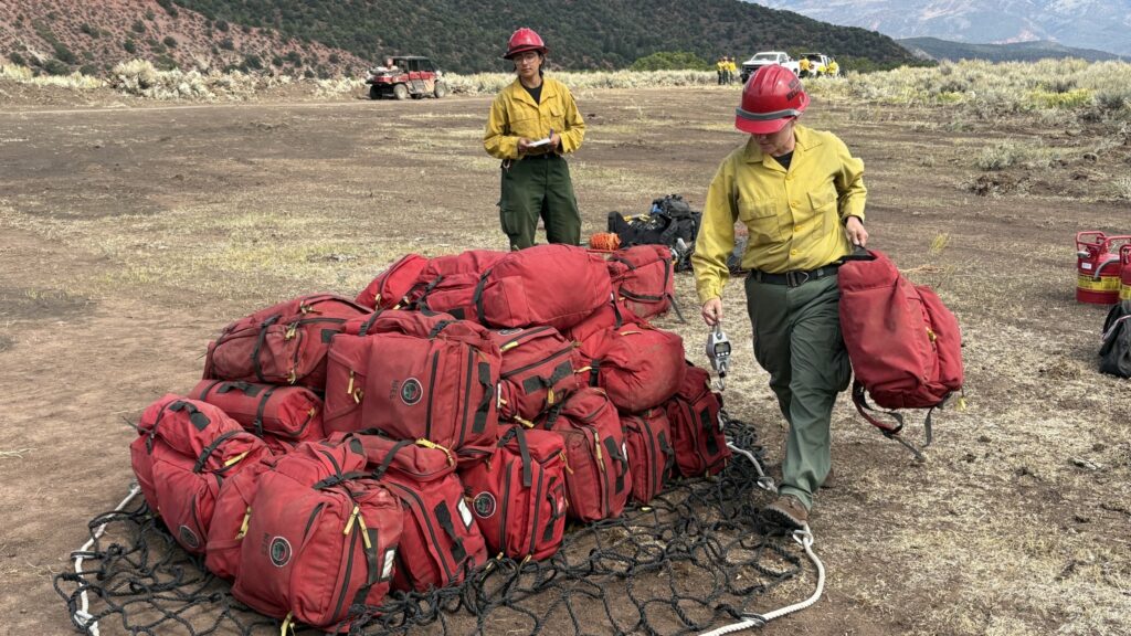
Total Personnel: 470
Containment: 42%
Cause: Lightning
Resources: 4 Aircraft | 7 Hand Crews | 18 Engines | 5 Heavy Equipment
Transition to Type 3 Team:
With a reduction in fire activity and resources assigned, the complexity of the Derby Fire is decreasing. In response, a Type 3 incident management organization will officially take command of the Derby Fire on Saturday at 6:00 a.m. While the management of the fire will transfer to a different team, resources are remaining to perform fire suppression. However, personnel are being released to ensure staffing levels match the operational needs of the incident while maintaining the capability to respond should conditions change.
Current Situation:
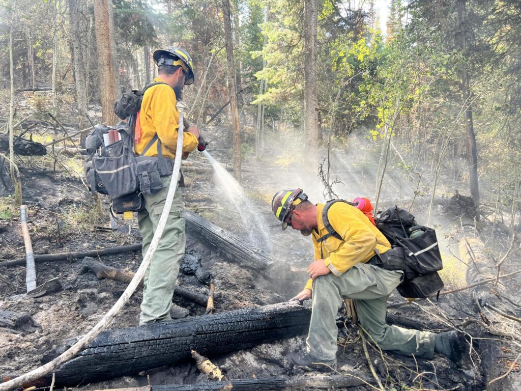
Firefighters are continuing work on the western fire edge. Thursday, hotshots worked with Unmanned Aerial Systems, commonly known as drones, to identify hotspots and extinguish them within the Flat Top Wilderness area.
On the eastern side of the fire, crews are working to reinforce a section of fireline that climbs north through the rugged terrain near the Poison Creek drainage. Air resources assisted in delivering gear and equipment to eliminate the need for firefighters to carry it in, as one crew will utilize a spike camp to continue working in a more remote area. Medical personnel and equipment will remain nearby to support firefighters if necessary.
On the southeast part of the fire, crews have begun suppression repair, in collaboration with a resource advisor (READ). A READ’s role is to advise incident personnel to identify and mitigate impacts of fire suppression activities on natural and cultural resources. Part of the suppression repair is focusing on fireline near historic cabins and a portion of the Ute-Sweetwater Trail.
Suppression repair consists of restoring areas disturbed by fireline construction, staging areas, helipads, and other operational activities to pre-fire conditions. Heavy equipment is used to pull back the removed vegetation over the dozer lines. Replacing vegetation helps prevent soil erosion and makes it easier for the environment to recover.
Weather & Fire Behavior:
A change in weather will bring a heavy cloud cover, scattered showers, and possible thunderstorms throughout the day with a temperature drop to 65 degrees. The potential for fire activity is low.
Evacuations and Closures:
Fire restrictions and closures remain in place for Bureau of Land Management – Colorado River Valley Field Office areas, https://www.blm.gov/ucr-fire-restrictions and the White River National Forest. See Critical and Fire Restriction Forest Alerts at https://www.fs.usda.gov/r02/whiteriver/alerts/. Fire restrictions have dropped to Stage 1.
A Temporary Flight Restriction (TFR) is in place over the Derby Fire. All unauthorized aircraft (including drones) are prohibited from flying near the fire, as they can interfere with authorized air support operations. For more information, visit https://tfr.faa.gov.
Derby Fire Information
Phone: 970-355-3283 (8:00 a.m. to 8:00 p.m.)
Email: 2025.Derby@firenet.gov

Actualización Diaria para el Incendio Derby – el 5 de septiembre de 2025
Equipo 3 del Manejo de Incidentes Complejos del Área de las Montañas Rocosas
Comandantes del Incidente: Casey Cheesbrough, Jay Miller, Ben Sanders
Información del incendio: 970-355-3283
Acres: 5,453
Personal: 470
Contención: 42%
Causa: Rayos
Recursos: 4 aeronaves | 7 cuadrillas | 18 camiones de bomberos | 5 equipo pesados
Transferencia de mando al Equipo Tipo 3:
Con la reducción de la actividad del incendio y la cantidad de recursos asignados al incendio, la complejidad del incendio Derby está disminuyendo. En respuesta, una organización de gestión de incidentes Tipo 3 asumirá oficialmente el mando del incendio Derby el sábado a las 6:00 a.m. Si bien la gestión del incendio se transferirá a otro equipo, se mantienen los recursos para la extinción. Sin embargo, se está liberando personal para garantizar que la dotación se ajuste a las necesidades operativas del incidente, manteniendo la capacidad de respuesta ante posibles cambios en las condiciones.
Situación Actual:
Los bomberos continúan trabajando en el límite oeste del incendio. El jueves, los bomberos trabajaron con sistemas aéreos no tripulados (drones) para identificar los puntos críticos y extinguirlos dentro del área Flat Top Wilderness.
En el lado este del incendio, las cuadrillas trabajan para reforzar una sección de la línea de fuego que asciende hacia el norte a través del terreno accidentado cerca del drenaje de Poison Creek. Los recursos aéreos ayudaron con la entrega de equipo y materiales para eliminar la necesidad de que los bomberos los transportaran, ya que una cuadrilla utilizará un campamento secundario para continuar trabajando en una zona más remota. El personal médico y el equipo permanecerán cerca para apoyar a los bomberos si es necesario.
En la parte sureste del incendio, las cuadrillas han comenzado las reparaciones de extinción, en colaboración con un asesor de recursos (READ, por sus siglas en inglés). La función de un READ es asesorar al personal del incidente para identificar y mitigar el impacto de las actividades de extinción de incendios en los recursos naturales y culturales. Parte de las reparaciones de extinción se centra en la línea de fuego cerca de cabañas históricas y un tramo del Ute-Sweetwater Trail.
La reparación de supresión consiste en restaurar las áreas afectadas por la construcción de cortafuegos, áreas de estacionamiento, helipuertos y otras actividades operativas a las condiciones previas al incendio. Se utiliza equipo pesado para poner la vegetación retirada en las líneas de excavadoras. La reposición de vegetación ayuda a prevenir la erosión del suelo y facilita la recuperación del medio ambiente.
Clima y el comportamiento del fuego:
Un cambio en el clima traerá una densa nubosidad, lluvias dispersas y posibles tormentas eléctricas durante el día, con una baja temperatura de hasta 65°F. El potencial de alta actividad del incendio es bajo.
Evacuaciones y cierres:
Las restricciones y cierres por incendios se permanecen vigentes en los terrenos bajo la administración de la Oficina de Administración de Tierras del Valle del Río Colorado, https://www.blm.gov/ucr-fire-restrictions, y el Bosque Nacional White River. Consulte las alertas forestales críticas y de restricciones por incendios en https://www.fs.usda.gov/r02/whiteriver/alerts/. Las restricciones de incendios han bajado a la Etapa 1.
Se ha establecido una Restricción Temporal de Vuelo (TFR) sobre el incendio Derby. Se prohíbe a todas las aeronaves no autorizadas (incluidos los drones) volar cerca del incendio, ya que pueden interferir con las operaciones de apoyo aéreo autorizadas. Para más información, visite https://tfr.faa.gov.
Información sobre el Incendio Derby
Teléfono: 970-355-3283 (de 8:00 a. m. a 8:00 p. m.)
Correo electrónico: 2025.Derby@firenet.gov
______________________________________________________________________________________
Derby Fire official information
FACEBOOK – Derby fire @derbyfire
INCIWEB – Derby Fire
WHITE RIVER NATIONAL FOREST – facebook.com/whiteriverNF @whiteriverNF
_______________
EAGLE COUNTY INFO
DERBY FIRE: EAGLE COUNTY EVACUATION MAP REGISTER FOR ALERTS – 911 alerts
INCIDENT UPDATES – EC Emergency or Reachwell app
FACEBOOK – facebook.com/eaglecountyso @eaglecountyso
________________
GARFIELD COUNTY INFO
DERBY FIRE: GARFIELD COUNTY INTERACTIVE EVACUATION MAP
REGISTER FOR ALERTS – 911 alerts or Reachwell app
INCIDENT UPDATES / SUBSCRIBE – Garfield County emergency
FACEBOOK – facebook.com/garcosheriff @garcosheriff