Aug. 22, 2025 – An aircraft incident involving a helicopter assigned to the Derby Fire occurred today at 4:10 p.m.
There is an unconfirmed report that the aircraft is in a lake 13 miles northwest of the Eagle County Regional Airport. The pilot was picked up by another incident aircraft and flown to Eagle County Regional Airport. Local emergency medical personnel checked the pilot, who had minor bumps and bruises and desired no further medical attention.
The National Transportation Safety Board has been notified; it is unknown whether they will respond to the incident. A USDA Forest Service investigation team is enroute.
No further information will be released at this time.
August 15, 2025, 6:26 p.m. – Important fire safety update:
The below press release from the U.S. Forest Service – Routt National Forest contains important information for anyone recreating in our area. Parts of Garfield County fall within the Routt National Forest, so please take a moment to read through the details before you head out.
Let’s all do our part to protect our beautiful lands and keep our community safe.
United States Forest Service
Sections of Routt National Forest are in Garfield County
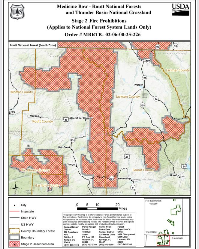
Severe conditions put Routt National Forest in Stage 2 fire restrictions
Campfires are not allowed under these restrictions.
(LARAMIE, Wyo.) August 15, 2025 – Effective immediately, Stage 2 fire restrictions are in place for the Routt National Forest in northwest Colorado.
This includes National Forest System lands located in Garfield, Grand, Jackson, Moffat, Rio Blanco, and Routt counties.
The U.S. Department of Agriculture, Forest Service has communicated with all affected counties, state agencies, and neighboring federal land managers on the timing of the restrictions.
All criteria have been met for the Forest to move into Stage 2 restrictions and the USDA Forest Service is aligned with surrounding land managers regarding this action. Tightened restrictions are necessary due to extreme, dry fuel conditions that are receptive to fire, persistent fire weather patterns, and the danger of human-caused wildfires. Recent weather conditions have resulted in an elevated potential for wildfires. Fire restrictions will help protect public health and safety, as well as natural resources.
The Routt National Forest was last in Stage 2 restrictions in 2020 and has been in Stage 1 restrictions since July 10 of this year.
The following prohibitions are in effect until further notice:
Igniting, building, maintaining, attending, or using a fire, campfire, charcoal barbecue, or grill, except if using a device solely fueled by liquid or gas that can be turned on and off in an area barren or cleared of all flammable materials within three feet of the device.
Smoking, except in an enclosed vehicle or building.
Welding or operating an acetylene or other torch with open flame.
Using an explosive.
This includes but is not limited to fuses, blasting caps, fireworks, rockets, exploding targets, tracers, and incendiary ammunition.
Possessing or using a motor vehicle off NFS roads, except when parking in an area devoid of vegetation within 10 feet of the motor vehicle.
Personal, portable wood or charcoal burning fire pits/rings, often made of stainless steel, are not allowed under these restrictions. Only gas-fueled devices with an on/off switch may be used.
Operating or using any internal or external combustion engine without a spark arresting device that is properly installed, maintained, and in effective working order in accordance with USDA Forest Service Standard 5100-1.
For chainsaw use, it is recommended the operator have a chemical pressurized fire extinguisher (with a minimum 8 oz. capacity and rating of 2A) and a round point shovel with an overall length of at least 35 inches readily available for use.
Violation of the Stage 2 Fire Prohibitions is punishable as a Class B misdemeanor by a fine of not more than $5,000 for individuals and $10,000 for organizations, or by imprisonment for not more than six months, or both. Anyone negligently or willfully starting a wildland fire could also be held responsible for the costs of that fire.
Forest staff will continue to monitor conditions to assess the need for further action, including additional restrictions if weather remains hot and dry and lessening restrictions if a wetter and cooler weather pattern develops.
To report a wildland fire, please call the Northern Colorado Interagency Dispatch Center, (970) 295-6800.
Call your local office for site-specific information.
Hahns Peak/Bears Ears Ranger District, Steamboat Springs, Colo., (970) 870-2299
Parks Ranger District, Walden, Colo., (970) 723-2700
Information on the Medicine Bow-Routt National Forests and Thunder Basin National Grassland can be found on our website or on the Forests’ ‘X’ and Facebook accounts.